

waterfall
Low Force, Teesdale
A set of broad falls on the Tees above Bowlees, crossed by the Wynch Bridge, an early chain suspension footbridge.
11 km · about 20 min drive
England, United Kingdom · Europe
Romaldkirk works well as a base: 10 minutes from Lartington, 24km from B6270 Swaledale.
Romaldkirk is in England, United Kingdom. You drive on the left here. The nearest town is Lartington, about 5 km away.
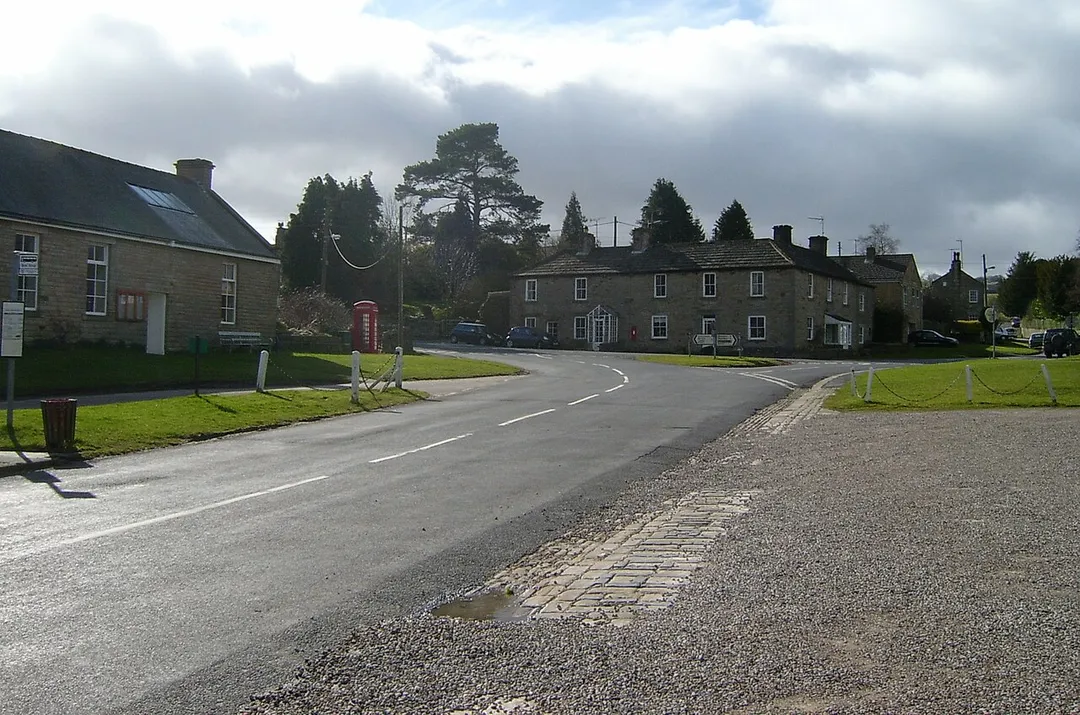
Romaldkirk is a village in Teesdale, in the Pennines of England. The village lies within the historic boundaries of the North Riding of Yorkshire, but has been administered by County Durham since 1974.
It is thought that the name might be derived from St. Rumwold (also spelt Romald or Rumbold), a little-known SaxonRead more
saint who is said to have preached the Gospel after his baptism as an infant; his resting place is recorded as being in Buckingham.
The village was formerly served by Romaldkirk railway station.
Thomas Page, the engineer, grew up in Romaldkirk.
The architects Maxwell Fry and Jane Drew, and famous farmer Hannah Hauxwell are buried near the village church.
The church is a Grade I listed building, containing surviving sections of Anglo-Saxon walls either side of the chancel arch, as well as a late medieval rood stair, a stone tomb effigy of Hugh Fitz Henry (who died on campaign with Edward I in 1305) in chain mail, a 12th-century font, and a pulpit (originally part of a three decker) from the early 18th century.
Compare prices across Booking.com, Airbnb, Expedia, and more. Select your dates to see availability.
Pick your must-haves once: provider links open pre-filtered. Each filter lists which sites it applies to.
Compare before you book!
Prices can vary significantly between platforms. We recommend checking at least 2-3 sites to find the best deal for your stay in Romaldkirk.
Discover famous landmarks, scenic roads, and more near Romaldkirk.
Within an hour or so of Romaldkirk: Low Force, Teesdale (11 km), High Force Waterfall (12 km), High Force (13 km), Tan Hill Inn (18 km).
The nearest famous roads are B6270 Swaledale, A689 Alston to Stanhope (Weardale) and Buttertubs Pass.
Romaldkirk is in England, United Kingdom, about 5 km from Lartington.
Road trip
Add it as a stop and the planner works out the driving, the nights and what's worth seeing on the way.
Start planningSwipe through places to go
Places within a drive of Romaldkirk. Keep the ones you like and add them to your trip.
Essential numbers in United Kingdom
112 also works. NHS non-emergency medical advice: 111. National Highways breakdown assistance on motorways: 0300 123 5000.
Full driving guide for United Kingdom8 notable places within an hour's drive.
waterfall
A set of broad falls on the Tees above Bowlees, crossed by the Wynch Bridge, an early chain suspension footbridge.
11 km · about 20 min drive
waterfall
England's largest waterfall by volume, plunging 21 metres over the Whin Sill escarpment in a cloud of spray in Upper Teesdale.
12 km · about 25 min drive
waterfall
A 21m waterfall where the Tees drops over the Whin Sill dolerite, one of England's most powerful falls.
13 km · about 25 min drive
cafe
Britain's highest pub at 1,732 feet in the Yorkshire Dales, a remote and atmospheric destination for drivers and walkers braving the wild moorland roads.
18 km · about 20 min drive
famous road
The narrow dale road from Richmond to Nateby past Gunnerside and Keld, drystone walls and barns the whole way.
24 km · about 30 min drive
natural wonder
The most northerly and arguably wildest of the Yorkshire Dales, lined with drystone walls, stone field barns and lead-mining remains.
24 km · about 30 min drive
scenic viewpoint
A perfect U-shaped glacial valley in the North Pennines rimmed by dolerite columns, reached by a walk from Dufton.
26 km · about 30 min drive
castle
One of the oldest stone-built Norman fortresses in England, its great keep standing above the River Swale and the market town of Richmond.
28 km · about 30 min drive
April to October
Other places to explore near Romaldkirk.
Your trip starts here
Pick the days, drop in the stops, and share it with whoever's coming.