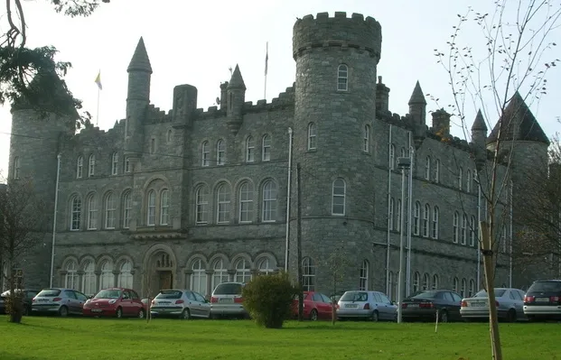


national park
Glenveagh National Park
A remote wilderness of mountains, lakes and a fairytale castle in the heart of the Donegal highlands.
19 km · about 20 min drive
Ulster, Ireland · Europe
Letterkenny works well as a base: 20 minutes from Convoy, 19km from Glenveagh National Park.
Letterkenny is in Ulster, Ireland, with about 19,000 people. You drive on the left here. The nearest town is Convoy, about 11 km away.
Letterkenny (Irish: Leitir Ceanainn Irish pronunciation: [ˈl̠ʲɛtʲəɾʲ ˈcanˠən̠ʲ], meaning "hillside of the O'Cannons"), nicknamed the Cathedral Town, is a large town in County Donegal, Ireland, on the River Swilly in the north-west of the Ulster province. Along with the nearby city of Derry, Letterkenny is a regionalRead more
economic gateway for the north-west of Ireland.
Letterkenny began as a market town at the start of the 17th century, during the Plantation of Ulster. A castle once stood near where the Cathedral of St Eunan and St Columba, County Donegal's only Catholic cathedral, stands today. Letterkenny Castle, built in 1625, was located south of Mt Southwell on Castle Street. County Donegal's largest third-level institution, Atlantic Technological University (ATU) Letterkenny, is located in the town, as are St Eunan's College, Highland Radio, and a Hindu temple. Letterkenny was also the original home of Oatfield Sweet Factory, a confectionery manufacturer; the factory closed and was demolished in 2014. In 1798, Theobald Wolfe Tone was arrested at Laird's Hotel in the town. In 2015, Letterkenny was judged as the tidiest town in Ireland.
Compare prices across Booking.com, Airbnb, Expedia, and more. Select your dates to see availability.
Pick your must-haves once: provider links open pre-filtered. Each filter lists which sites it applies to.
Compare before you book!
Prices can vary significantly between platforms. We recommend checking at least 2-3 sites to find the best deal for your stay in Letterkenny.
Discover famous landmarks, scenic roads, and more near Letterkenny.
Within an hour or so of Letterkenny: Glenveagh National Park (19 km), Poisoned Glen (25 km), Mount Errigal (26 km), Derry City Walls (27 km).
The nearest famous roads are Mamore Gap, Glengesh Pass and Gleniff Horseshoe.
Letterkenny is in Ulster, Ireland, about 11 km from Convoy.
Road trip
Add it as a stop and the planner works out the driving, the nights and what's worth seeing on the way.
Start planningSwipe through places to go
Places within a drive of Letterkenny. Keep the ones you like and add them to your trip.
8 notable places within an hour's drive.
national park
A remote wilderness of mountains, lakes and a fairytale castle in the heart of the Donegal highlands.
19 km · about 20 min drive
scenic viewpoint
A steep-sided glen below Errigal at Dunlewey, entered past a roofless Victorian church.
25 km · about 30 min drive
scenic viewpoint
Donegal's highest peak, a pale quartzite cone above the R251 in the Derryveagh Mountains, climbed in about three hours return.
26 km · about 30 min drive
landmark
The only completely intact walled city in Ireland, a 1.5km 17th-century rampart circling historic Derry.
27 km · about 30 min drive
mountain pass
Steep, narrow pass climbing to 260m through the Urris Hills of Inishowen, with a holy well and grotto at the summit and a plunging descent to the Atlantic at Urris. Part of the Inishowen 100 drive; low gears essential.
35 km · about 40 min drive
scenic viewpoint
A quartzite headland north of Dunfanaghy circled by a narrow loop road, with 180m sea cliffs and nesting seabirds.
35 km · about 40 min drive
landmark
One of the world's most photographed lighthouses, perched on a rugged Donegal headland between Atlantic and lough.
37 km · about 40 min drive
beach
A wild Inishowen beach backed by some of Europe's highest dunes, named for the finger-like rocks offshore.
48 km · about 55 min drive
April to October
Other places to explore near Letterkenny.
Your trip starts here
Pick the days, drop in the stops, and share it with whoever's coming.