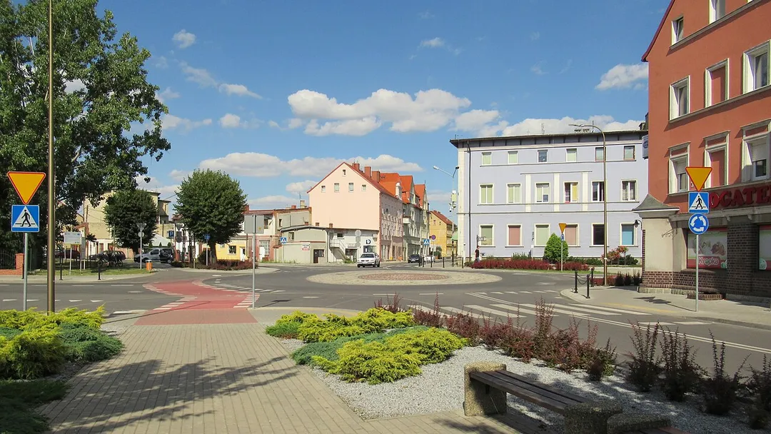
Żarów is worth a stop: 10 minutes from Jaworzyna Śląska, 45km from Adršpach-Teplice Rocks.
Żarów is in Lower Silesia, Poland, with about 6,700 people. You drive on the right here. The nearest town is Jaworzyna Śląska, about 5 km away.
Żarów [ˈʐaruf] (German: Saarau) is a town in Świdnica County, Lower Silesian Voivodeship, in south-western Poland. It is the seat of the administrative district (gmina) called Gmina Żarów.
As of 2020, the town has a population of 12,335. 53.9% of the population is classified as urban, while 46.1% is classified asRead more rural.
In 2016, town limits were expanded by including a part of the village of Mrowiny.
Within an hour or so of Żarów: Church of Peace, Świdnica (11 km), Ksiaz Castle (18 km), Osówka Underground City (31 km), Wrocław Bronze Dwarfs (42 km).
Are there any good drives near Żarów?
The nearest famous roads are Road of a Hundred Bends and Cervenohorske Sedlo.
Where is Żarów?
Żarów is in Lower Silesia, Poland, about 5 km from Jaworzyna Śląska.
Road trip
Drive to Żarów
Add it as a stop and the planner works out the driving, the nights and what's worth seeing on the way.
Europe's largest timber-framed church, raised in 1656–57 by Silesian Lutherans who were forbidden stone, nails or a tower: the wattle-and-daub interior holds 7,500 people under painted galleries. UNESCO-listed.
11 km · about 20 min drive
castle
Ksiaz Castle
Lower Silesia's largest castle, perched dramatically on a rock above a gorge, riddled with WWII tunnels.
18 km · about 20 min drive
museum
Osówka Underground City
The largest visitable complex of Nazi Germany's Project Riese: 3.1 km of tunnels bored into the Owl Mountains in 1943–45 for a purpose still debated. Partly flooded sections are toured by boat.
31 km · about 35 min drive
landmark
Wrocław Bronze Dwarfs
Over 300 whimsical bronze dwarf figurines scattered throughout the city streets, each with a unique character and story.
42 km · about 50 min drive
landmark
Wrocław Market Square
One of the largest and most beautiful medieval market squares in Europe, with colourful townhouses and the famous bronze dwarf statues.
42 km · about 50 min drive
landmark
Wroclaw Market Square
A colourful Silesian square framed by a Gothic town hall, with hundreds of bronze dwarfs hidden around the city.
42 km · about 50 min drive
landmark
Wrocław Centennial Hall
A UNESCO-listed pioneering reinforced-concrete structure from 1913 surrounded by a stunning multimedia fountain complex.
45 km · about 50 min drive
natural wonder
Adršpach-Teplice Rocks
A mesmerizing labyrinth of towering sandstone rock formations sculpted by millions of years of erosion into surreal shapes.
45 km · about 50 min drive
Driving roads near Żarów
52 kmSzczeliniec WielkiThe highest summit of the Table Mountains (919 m): a sandstone plateau of eroded rock labyrinths, chasms and terraces reached by a historic stone stairway from Karłów, with views into Czechia on clear days.
53 kmRoad of a Hundred BendsRoute 387 between Radkow and Kudowa-Zdroj corkscrews through the surreal rock labyrinths of the Table Mountains, packing dozens of hairpins into a forested drive beloved by Polish motorists.
58 kmSnezkaCzechia's highest peak in the Krkonose, reached by chairlift and ridge trails with views into Poland.
58 kmSniezkaHighest peak of the Karkonosze range at 1603 metres on the Polish-Czech border, topped by a distinctive disc-shaped meteorological observatory.