
North AmericaUnited StatesConnecticut
Wethersfield
Connecticut, United States · North America
About Wethersfield
Wethersfield sits on the route: 5 minutes from Glastonbury.
Wethersfield is in Connecticut, United States, with about 27,000 people. You drive on the right here. The nearest town is Glastonbury, about 4 km away.
Wethersfield ( WEH-thers-feeld) is a town located in Hartford County, Connecticut, United States. It is located immediately south of Hartford along the Connecticut River. The town is part of the Capitol Planning Region. The population was 27,298 at the time of the 2020 census.
Many records from colonial times spellRead more
the name "Weathersfield" and "Wythersfield", while Native Americans called it Pyquag. "Watertown" is a variant name.
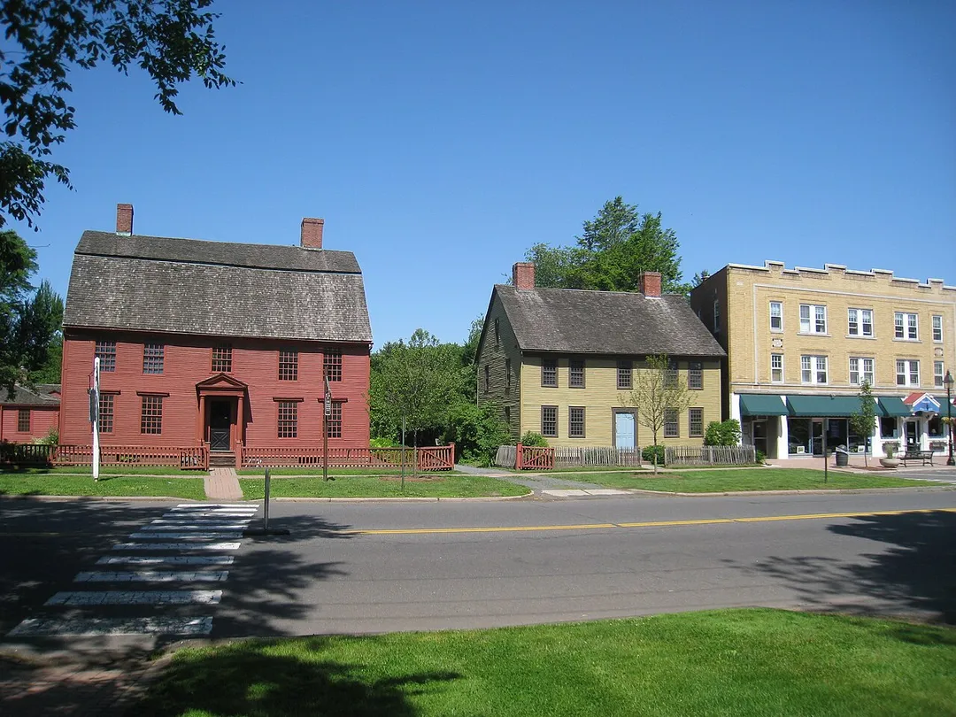
The neighborhood known as Old Wethersfield is the state's largest historic district, spanning 2 sq mi (5.2 km2) and containing 1,100 buildings, dating to the 17th, 18th and 19th centuries. The town is primarily served by Interstate 91.
Where to Stay in Wethersfield
Compare prices across Booking.com, Airbnb, Expedia, and more. Select your dates to see availability.
Filter presets
Pick your must-haves once: provider links open pre-filtered. Each filter lists which sites it applies to.
Compare before you book!
Prices can vary significantly between platforms. We recommend checking at least 2-3 sites to find the best deal for your stay in Wethersfield.
Explore the Area
Discover famous landmarks, scenic roads, and more near Wethersfield.
Loading map...
Frequently Asked Questions
Are there any good drives near Wethersfield?
The nearest famous roads are Ocean Drive (Newport) and Mohawk Trail (Route 2).
Where is Wethersfield?
Wethersfield is in Connecticut, United States, about 4 km from Glastonbury.
Road trip
Drive to Wethersfield
Add it as a stop and the planner works out the driving, the nights and what's worth seeing on the way.
Start planningWhat's nearby?
Swipe through places to go
Places within a drive of Wethersfield. Keep the ones you like and add them to your trip.
Explore now
Quick Information
- Population
- 26,668
- Continent
- North America
- Country
- United States
- Region
- Connecticut
- Timezone
- America/New_York
- Coordinates
- 41.7143, -72.6526
Emergency & Services
Essential numbers in United States
AAA roadside assistance: 1-800-222-4357. Right turn on red is legal in most states unless signed otherwise.
Full driving guide for United StatesTags
Nearby Destinations
Other places to explore near Wethersfield.
Plan a trip around Wethersfield
Your trip starts here
Plan a road trip from Wethersfield.
Pick the days, drop in the stops, and share it with whoever's coming.