PYRTPlan Your Road Trips
Create TripCommunityMerchandise
PYRTPlan Your Road Trips
Create TripCommunityMerchandise
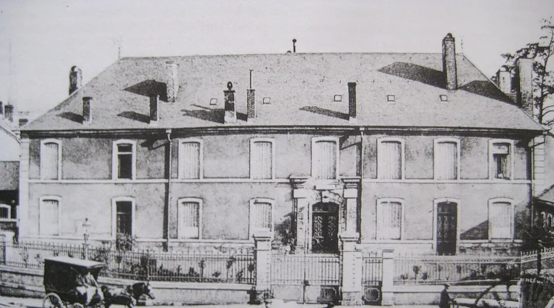
DescriptionChateau Villerupt.jpg

chateau Villerupt


Date

6 August 2011


Source

collection personnelle


Author

Aimelaime


Permission(Reusing this file)


Public domainPublic domainfalsefalse


I, the copyright holder of this work, release this work into the public domain. This applies worldwide.In some countries this may not be legally possible; if so:I grant anyone the right to use this work for any purpose, without any conditions, unless such conditions are required by law.
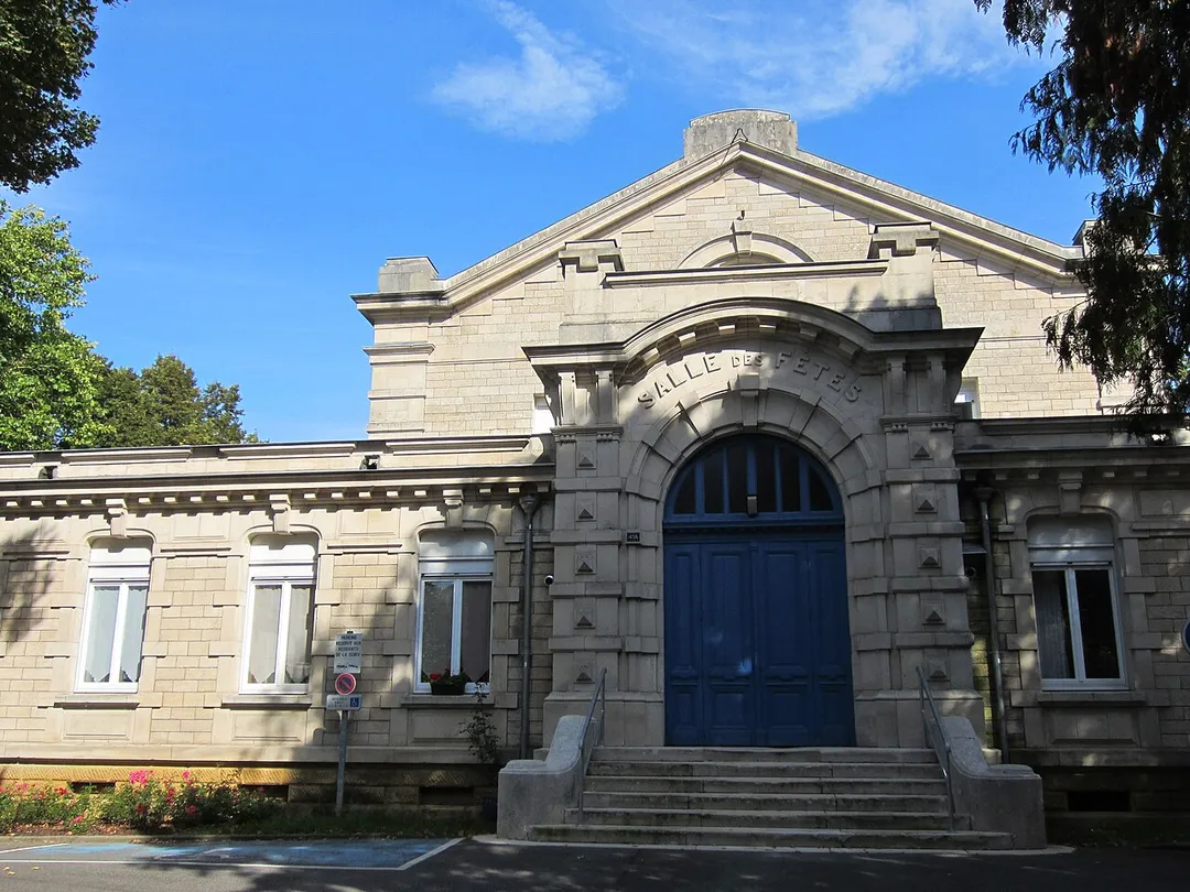
DescriptionAncienne salle fetes Villerupt.JPG

ancienne salle fetes Villerupt


Date

16 September 2011


Source

mon appareil photo


Author

Aimelaime


Permission(Reusing this file)


Public domainPublic domainfalsefalse


I, the copyright holder of this work, release this work into the public domain. This applies worldwide.In some countries this may not be legally possible; if so:I grant anyone the right to use this work for any purpose, without any conditions, unless such conditions are required by law.
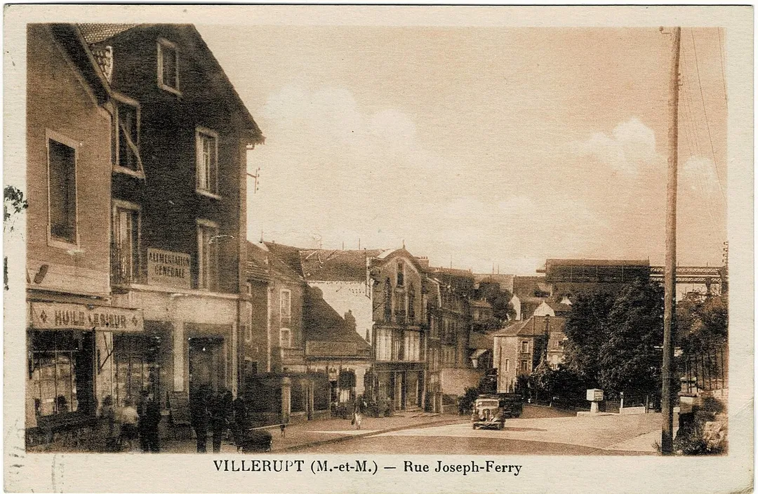
Carte postale de la rue Joseph-Ferry à Villerupt (Meurthe-et-Moselle, France)
Photo by Aimelaime at French Wikipedia
Destinations
Home›Destinations›Villerupt
EuropeFranceGrand Est

Villerupt

Grand Est, France · Europe

About Villerupt

Villerupt works well as a base: 5 minutes from Crusnes, 21km from Notre-Dame Cathedral, Luxembourg.

Villerupt is in Grand Est, France, with about 9,800 people. You drive on the right here. The nearest town is Crusnes, about 4 km away.

Villerupt (pronounced [vilʁy]; Luxembourgish: Weller [ˈvælɐ] ) is a commune in the Meurthe-et-Moselle department in the Grand Est region in Northeastern France. It is located on the departmental border with Moselle, not far from the France–Luxembourg border. A festival takes place in the commune each year in

Read more October–November.

Read more on Wikipedia

Where to Stay in Villerupt

Compare prices across Booking.com, Airbnb, Expedia, and more. Select your dates to see availability.

Filter presets

Pick your must-haves once: provider links open pre-filtered. Each filter lists which sites it applies to.

Booking.comExpediaTripAdvisorHotels.comAgodaAirbnb

Compare before you book!

Prices can vary significantly between platforms. We recommend checking at least 2-3 sites to find the best deal for your stay in Villerupt.

Explore the Area

Discover famous landmarks, scenic roads, and more near Villerupt.

Loading map...
Open in Google Maps

Frequently Asked Questions

What is there to see near Villerupt?

Within an hour or so of Villerupt: Minett Park Fond-de-Gras (9 km), Notre-Dame Cathedral, Luxembourg (21 km), Luxembourg City Old Town (22 km), Bock Casemates (22 km).

Are there any good drives near Villerupt?

The nearest famous roads are Route du Vin, Voie Sacrée and Baraque de Fraiture.

Where is Villerupt?

Villerupt is in Grand Est, France, about 4 km from Crusnes.

Road trip

Drive to Villerupt

Add it as a stop and the planner works out the driving, the nights and what's worth seeing on the way.

Start planning

What's nearby?

Swipe through places to go

Places within a drive of Villerupt. Keep the ones you like and add them to your trip.

Explore now

Quick Information

Population
9,763
Continent
Europe
Country
France
Region
Grand Est
Timezone
Europe/Paris
Coordinates
49.4671, 5.9320

Emergency & Services

Essential numbers in France

Police
17
Ambulance
15
Fire
18
All emergencies
112
Driving side
right

Carrying a warning triangle and hi-vis vest in your vehicle is mandatory. Motorway emergency phones connect to official breakdown services only.

Full driving guide for France

Tags

EuropeFranceGrand EstTown

Worth the detour from Villerupt

8 notable places within an hour's drive.

museum

Minett Park Fond-de-Gras

Open-air industrial heritage park in Luxembourg's red-earth iron country, where the 1900 steam train and the Minièresbunn mine railway still run through ore tunnels to the preserved mining village of Lasauvage (season May-September).

9 km · about 15 min drive

cathedral

Notre-Dame Cathedral, Luxembourg

Late Gothic cathedral in Luxembourg City with Renaissance detailing and the crypt tombs of the grand ducal family.

21 km · about 25 min drive

landmark

Luxembourg City Old Town

A dramatic fortress capital perched on cliffs above gorges, its UNESCO ramparts and casemates carved into the rock.

22 km · about 25 min drive

landmark

Bock Casemates

A honeycomb of cannon tunnels bored through the Bock promontory, the cradle of Luxembourg City's clifftop fortress.

22 km · about 25 min drive

bridge

Grand Duchess Charlotte Bridge

Luxembourg City's striking 'Red Bridge', a scarlet steel span soaring 74 m above the Alzette valley to link the old town with the Kirchberg European quarter.

22 km · about 25 min drive

scenic viewpoint

Chemin de la Corniche

Rampart walkway along Luxembourg City's old walls, described as Europe's most beautiful balcony, overlooking the Grund quarter.

22 km · about 25 min drive

landmark

Rodemack

Fortified Lorraine village dubbed the 'Little Carcassonne', minutes from the Luxembourg border, with 700 m of intact medieval ramparts, a massive gate tower and flower-lined lanes.

22 km · about 25 min drive

landmark

Luxembourg American Cemetery and Memorial

American military cemetery at Hamm holding over 5,000 graves including General Patton's, with visitor parking off the access road.

24 km · about 30 min drive

Driving roads near Villerupt

  • 22 kmGrand Duchess Charlotte BridgeLuxembourg City's striking 'Red Bridge', a scarlet steel span soaring 74 m above the Alzette valley to link the old town with the Kirchberg European quarter.
  • 22 kmChemin de la CornicheRampart walkway along Luxembourg City's old walls, described as Europe's most beautiful balcony, overlooking the Grund quarter.
  • 33 kmRoute du VinWine road running about 42 kilometres along the Moselle from Schengen to Wasserbillig, linking terraced vineyards and riverside villages.
  • 44 kmLuxembourg Moselle ValleyTerraced Riesling vineyards line the gentle Moselle, a string of wine villages on a slow scenic river drive.
  • 45 kmSaarschleifeFrom the Cloef viewpoint and treetop walk, the Saar River carves a spectacular horseshoe through forested hills.
  • 68 kmVoie SacréeThe 'Sacred Way' from Bar-le-Duc to Verdun, the lifeline road that supplied the 1916 battle with a truck every 14 seconds. Milestones topped with poilu helmets line the route through Souilly.
Driving in France

Drives on
the right
Petrol
~€1.85/litre
Motorway tolls
~€10.00/100km

When to drive here

April to October

Nearby Destinations

Other places to explore near Villerupt.

Esch-sur-Alzette

🇱🇺 Luxembourg

5 km awayPop. 36,625

Differdange

🇱🇺 Luxembourg

7 km awayPop. 5,296

Schifflange

🇱🇺 Luxembourg

7 km awayPop. 8,155

Kayl

🇱🇺 Luxembourg

8 km awayPop. 4,396

Pétange

🇱🇺 Luxembourg

11 km awayPop. 7,187

Rodange

🇱🇺 Luxembourg

11 km awayPop. 7,774

Dudelange

🇱🇺 Luxembourg

11 km awayPop. 18,013

Plan a trip around Villerupt

France road trip planner

Your trip starts here

Plan a road trip from Villerupt.

Pick the days, drop in the stops, and share it with whoever's coming.

Start planning
PYRT

The ultimate road trip planning platform. Discover 150,000+ destinations worldwide, plan scenic routes, and create unforgettable adventures.

Inspiration

  • Discover Trips
  • Travel Guides
  • Community

The Product

  • Calendar Planner
  • Integrations
  • How It Works
  • Collaboration Mode
  • Get the App
  • Merchandise: PYRT Supply Co.
  • Become a Creator
  • Trip Marketplace

Plan Your Trip

  • Road Trip Planner
  • Famous Routes
  • Drive Times & Distances
  • Planners by Country
  • Best Road Trip Planner App
  • Discover Road Trips
  • Events
  • Travel Guides
  • How It Works
  • My Trips
  • Community Groups

Company

  • Terms of Service
  • Privacy Policy
  • About PYRT
  • Support
  • Contact Us
  • Sign In
  • Create Account

© 2026 Plan Your Road Trips. All rights reserved.

•[email protected]
Data sources:GeoNames (CC BY 4.0)•Wikimedia Commons (CC BY-SA)•Mapbox•Photography: George Lawrence