
PYRTPlan Your Road Trips
Create TripCommunityMerchandise
PYRTPlan Your Road Trips
Create TripCommunityMerchandise
Chromitite with serpentine from the Precambrian of Zimbabwe. (6.5 centimeters across at its widest)
LLIs are large layered igneous intrusions.  Famous examples include Montana’s Stillwater Complex, South Africa’s Bushveld Complex, the Muskox in Canada, the Dufek in Antarctica, Greenland's Skaergaard Complex, and southern Africa’s Great Dike of Rhodesia.  LLIs consist of thick successions of ultramafic intrusive igneous rocks displaying small-scale to large-scale layering.  The layering in LLIs is the result of crystal settling during cooling of the original magma.  Repeated injections of magma is thought to be necessary in order to get layering throughout the extremely thick sections of rock.  LLIs typically have economic concentrations of important metals (e.g., chromium, platinum).
The rock shown here is a chromium ore from the 2.57-2.58 billion year old Great Dike of Rhodesia.  Many mines exploit the Great Dike - this sample is from the Caesar Mine in the northern part of Southern Rhodesia (= Zimbabwe).  The black component is the mineral chromite (FeCr2O4).  The whitish portions are serpentine (Mg3Si2O5(OH)4), which is metamorphosed olivine.  Chromite-dominated, crystalline-textured, intrusive igneous rocks are called chromitites.

Locality: unrecorded chromitite seam & unrecorded level in the Caesar Mine, ~12 km south of Mutorashanga Pass, Mvurwi Range, Makonde District, Mashonaland West Province, northern part of Southern Rhodesia/Zimbabwe, southern Africa
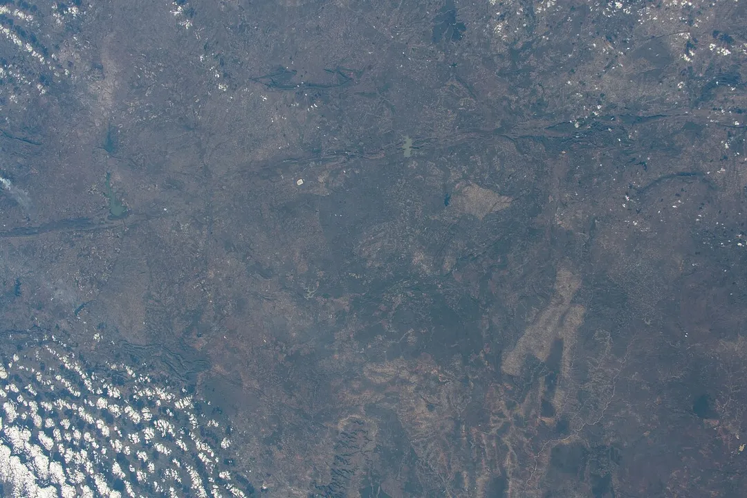
View of Zimbabwe taken during ISS Expedition 67. Harare, Chitungwiza, Manyame River, Lake Chivero
Taal-Net Students on a march against drug abuse in Nov 2024 at Mvurwi
Photo by James St. John
Destinations
Home›Destinations›Mvurwi
AfricaZimbabweMashonaland Central

Mvurwi

Mashonaland Central, Zimbabwe · Africa

About Mvurwi

Mvurwi sits on the route: 45 minutes from Concession.

Mvurwi is in Mashonaland Central, Zimbabwe, with about 16,000 people. The nearest town is Concession, about 40 km away.

Mvurwi, originally known as Umvukwesi, is a town in Mashonaland Central province in Zimbabwe. Some of Mvurwi's schools include Holy Rosary Primary and Secondary School, Mvurwi Primary and High School and Umvukwesi Primary School which is one of the town's most elite learning facilities and produces noteworthy

Read more results. Previously, it fell within the breadbasket region (from Banket - Shamva) where much of foodstuffs and the golden leaf were being produced. Majority of Mvurwians are small scale farmers who rely on the agro-based economy. The industry sector has to be improved in future, currently it has got Delta Beverage brewing company and Mashonaland Tobacco Sales to mention a few. Chiote/ Pembi Falls and Galiva are dams surrounding the borders of the town. It is still developing in terms of infrastructure. It has other government offices such as R.G and major referral hospitals. It was accorded town status styled as Mvurwi Town Council, on 22 February 2010, and is a dynamic, growing urban authority in Mashonaland Central Province. Previously, a service centre under Mazowe RDC, the Town has transformed into a critical agricultural and trading hub, and a diverse population of +/- 16000. It is surrounded by farms and is conducive for farming that is essential for food production of the country. Currently, the area is developing rapidly with locations such as Kurai, Kurai Extension, Mbizi, Suoguru among others. Through Devolution of resources by the government, saw it impetus to built the Tobacco Markerts in the area to serve the community at large ths improving the socio-economic activities.

Read more on Wikipedia

Where to Stay in Mvurwi

Compare prices across Booking.com, Airbnb, Expedia, and more. Select your dates to see availability.

Filter presets

Pick your must-haves once: provider links open pre-filtered. Each filter lists which sites it applies to.

Booking.comExpediaTripAdvisorHotels.comAgodaAirbnb

Compare before you book!

Prices can vary significantly between platforms. We recommend checking at least 2-3 sites to find the best deal for your stay in Mvurwi.

Explore the Area

Discover famous landmarks, scenic roads, and more near Mvurwi.

Loading map...
Open in Google Maps

Frequently Asked Questions

Where is Mvurwi?

Mvurwi is in Mashonaland Central, Zimbabwe, about 40 km from Concession.

Road trip

Drive to Mvurwi

Add it as a stop and the planner works out the driving, the nights and what's worth seeing on the way.

Start planning

What's nearby?

Swipe through places to go

Places within a drive of Mvurwi. Keep the ones you like and add them to your trip.

Explore now

Quick Information

Population
15,646
Continent
Africa
Country
Zimbabwe
Region
Mashonaland Central
Timezone
Africa/Harare
Coordinates
-17.0333, 30.8500

Tags

AfricaZimbabweMashonaland CentralTown

When to drive here

Year-round

Tropical latitude: plan around the wet season rather than temperature.

Nearby Destinations

Other places to explore near Mvurwi.

Bindura

🇿🇼 Zimbabwe

59 km awayPop. 50,400

Banket

🇿🇼 Zimbabwe

62 km awayPop. 9,845

Harare Western Suburbs

🇿🇼 Zimbabwe

90 km awayPop. 15,556

Harare

🇿🇼 Zimbabwe

91 km awayPop. 1,542,813

Mutoko

🇿🇼 Zimbabwe

152 km awayPop. 12,336

Luangwa

🇿🇲 Zambia

164 km awayPop. 9,187

Kadoma

🇿🇼 Zimbabwe

175 km awayPop. 117,381

Your trip starts here

Plan a road trip from Mvurwi.

Pick the days, drop in the stops, and share it with whoever's coming.

Start planning
PYRT

The ultimate road trip planning platform. Discover 150,000+ destinations worldwide, plan scenic routes, and create unforgettable adventures.

Inspiration

  • Discover Trips
  • Travel Guides
  • Community

The Product

  • Calendar Planner
  • Integrations
  • How It Works
  • Collaboration Mode
  • Get the App
  • Merchandise: PYRT Supply Co.
  • Become a Creator
  • Trip Marketplace

Plan Your Trip

  • Road Trip Planner
  • Famous Routes
  • Drive Times & Distances
  • Planners by Country
  • Best Road Trip Planner App
  • Discover Road Trips
  • Events
  • Travel Guides
  • How It Works
  • My Trips
  • Community Groups

Company

  • Terms of Service
  • Privacy Policy
  • About PYRT
  • Support
  • Contact Us
  • Sign In
  • Create Account

© 2026 Plan Your Road Trips. All rights reserved.

•[email protected]
Data sources:GeoNames (CC BY 4.0)•Wikimedia Commons (CC BY-SA)•Mapbox•Photography: George Lawrence