
museum
Museum of Pop Culture (MoPOP)
Frank Gehry-designed museum celebrating contemporary popular culture through music, sci-fi, fantasy, and video game exhibits.
36 km · about 40 min drive
Washington, United States · North America
Mukilteo sits on the route: 15 minutes from Picnic Point, 57km from Snoqualmie Falls.
Mukilteo is in Washington, United States, with about 21,000 people. You drive on the right here. The nearest town is Picnic Point, about 7 km away.
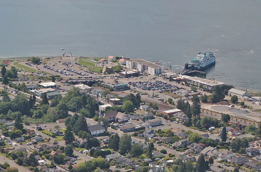
Mukilteo Lighthouse Park encompasses the lighthouse at the west end of the city of Mukilteo, Washington, and 12 acres (0.049 km2) south of it. The property is west and south of the Washington State Ferries terminal with ferry service to Clinton, Whidbey Island, and is bordered on the south and east by the BNSF RailwayRead more
(formerly the Burlington Northern Railroad and Great Northern Railway (U.S.)) mainline. Whidbey Island lies across a narrow portion of Possession Sound and is easily visible from the shore.
This park was formerly known as Mukilteo State Park. The lighthouse was deeded to the City of Mukilteo in 2001, and Washington State Parks deeded the parklands to the City in 2003.
In 2004, the City adopted a Lighthouse Park Master Plan to make physical site improvements in four phases. Phases I and II have been completed, adding amenities and parking.
The artwork by Joe Gobin and James Madison, Tulalip Tribal carvers, indicates the significance of this site to many tribes, especially the Tulalip Tribes of Snohomish County, who lived at this location for over 1,000 years until European-American occupation in the mid-nineteenth century. The 1855 Point Elliott Treaty was signed in the area and three tribes were forced to re-settle at Tulalip Bay across Port Gardner Bay.
Lighthouse Park is also significant as Captain George Vancouver's naturalist landed a small craft on the shoreline on May 31, 1792. Vancouver named the area Rose Point, a name today reflected in that of the nearby community of Rosehill.
Mukilteo Lighthouse Park has about 1,500 feet (460 m) of sandy beach and includes a public boat launch, a lighthouse and a shoreline walkway. It is one of the most easily accessed shorelines in urban Snohomish County, especially for those needing ADA access.
Compare prices across Booking.com, Airbnb, Expedia, and more. Select your dates to see availability.
Pick your must-haves once: provider links open pre-filtered. Each filter lists which sites it applies to.
Compare before you book!
Prices can vary significantly between platforms. We recommend checking at least 2-3 sites to find the best deal for your stay in Mukilteo.
Discover famous landmarks, scenic roads, and more near Mukilteo.
Within an hour or so of Mukilteo: Museum of Pop Culture (MoPOP) (36 km), Space Needle (36 km), Snoqualmie Falls (57 km).
The nearest famous roads are Chuckanut Drive (WA-11), Chinook Pass and North Cascades Highway (WA-20).
Mukilteo is in Washington, United States, about 7 km from Picnic Point.
Road trip
Add it as a stop and the planner works out the driving, the nights and what's worth seeing on the way.
Start planningSwipe through places to go
Places within a drive of Mukilteo. Keep the ones you like and add them to your trip.
Essential numbers in United States
AAA roadside assistance: 1-800-222-4357. Right turn on red is legal in most states unless signed otherwise.
Full driving guide for United States3 notable places within an hour's drive.
museum
Frank Gehry-designed museum celebrating contemporary popular culture through music, sci-fi, fantasy, and video game exhibits.
36 km · about 40 min drive
landmark
Futuristic observation tower built for the 1962 World's Fair, an iconic symbol of Seattle's skyline.
36 km · about 40 min drive
waterfall
A spectacular 82-meter waterfall east of Seattle, sacred to the Snoqualmie people and featured in Twin Peaks.
57 km · about 65 min drive
Other places to explore near Mukilteo.
Your trip starts here
Pick the days, drop in the stops, and share it with whoever's coming.