PYRTPlan Your Road Trips
Create TripCommunityMerchandise
PYRTPlan Your Road Trips
Create TripCommunityMerchandise
Cattle grazing in the open near a small stream on the Santa Margarita cattle ranch in San Diego County, 1900
Photograph of a small herd of cattle (less than 50 head) grazing in the open near a small stream on the Santa Margarita cattle ranch in San Diego County, 1900. A copse of oak trees is visible behind the cattle, which stand at center. The narrow, shallow stream is pictured to the right of center running from the distance under the dipping trees to the left foreground.
Call number: CHS-2358
Filename: CHS-2358
Coverage date: 1900
Part of collection: California Historical Society Collection, 1860-1960
Format: glass plate negatives
Type: images
Part of subcollection: Title Insurance and Trust, and C.C. Pierce Photography Collection, 1860-1960
Repository name: USC Libraries Special Collections
Accession number: 2358
Microfiche number: 1-78-14
Archival file: chs_Volume69/CHS-2358.tiff
Repository address: Doheny Memorial Library, Los Angeles, CA 90089-0189
Geographic subject (country): USA
Format (aacr2): 2 photographs : glass photonegative, photoprint, b&w ; 21 x 26 cm.
Rights: Digitally reproduced by the USC Digital Library; From the California Historical Society Collection at the University of Southern California
Subject (adlf): agricultural sites
Project: USC
Repository email: specol@usc.edu
Contributing entity: California Historical Society
Date created: 1900
Publisher (of the digital version): University of Southern California. Libraries
Format (aat): photographic prints; photographs
Geographic subject (state): California
Subject (file heading): Agriculture -- Ranching -- General
Legacy record ID: chs-m9636; USC-1-1-1-9775
Access conditions: Send requests to address or e-mail given. Phone (213) 821-2366; fax (213) 740-2343.
Geographic subject (county): San Diego
Subject (lcsh): Cattle; Ranches
Subject: Santa Margarita Ranch
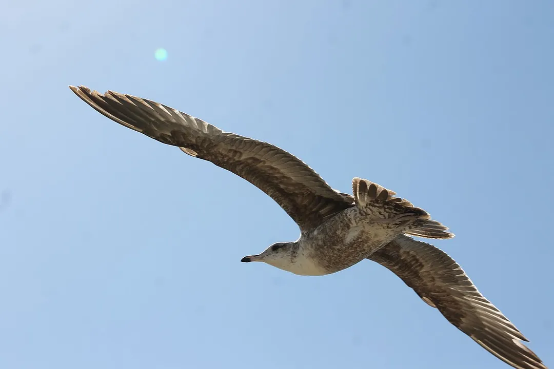
A Seagull over Las Flores Viewpoint in California.
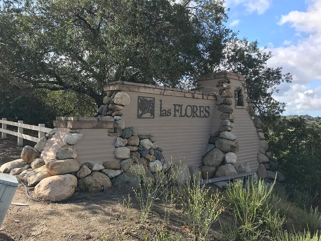
Image of the entrance sign into Las Flores, California from Oso Parkway in Mission Viejo.
Photo by Unknown authorUnknown author
Destinations
Home›Destinations›Las Flores
North AmericaUnited StatesCalifornia

Las Flores

California, United States · North America

About Las Flores

Las Flores is worth a stop: 10 minutes from Coto De Caza, 36km from Disney California Adventure Park.

Las Flores is in California, United States, with about 6,000 people. You drive on the right here. The nearest town is Coto De Caza, about 4 km away.

Las Flores (Spanish for "The Flowers") is an unincorporated community and census-designated place (CDP) in Orange County, California, located adjacent to the City of Rancho Santa Margarita, California. The population was 5,995 at the 2020 census, up from 5,971 at the 2010 census. Las Flores does not have its own ZIP

Read more Code and is served by the same ZIP Code as adjacent Rancho Santa Margarita, 92688. The Rancho Santa Margarita dog/skate park is located in the CDP and is served by the Orange County Sheriff's Dept. and Orange County Fire Authority. Although Las Flores lies in the land grant of Rancho Mission Viejo, it is named after the land grant about twenty-five miles (40 km) south Rancho Santa Margarita y Las Flores.

Read more on Wikipedia

Where to Stay in Las Flores

Compare prices across Booking.com, Airbnb, Expedia, and more. Select your dates to see availability.

Filter presets

Pick your must-haves once: provider links open pre-filtered. Each filter lists which sites it applies to.

Booking.comExpediaTripAdvisorHotels.comAgodaAirbnb

Compare before you book!

Prices can vary significantly between platforms. We recommend checking at least 2-3 sites to find the best deal for your stay in Las Flores.

Explore the Area

Discover famous landmarks, scenic roads, and more near Las Flores.

Loading map...
Open in Google Maps

Frequently Asked Questions

What is there to see near Las Flores?

Within an hour or so of Las Flores: Moto Republic (27 km), Disney California Adventure Park (36 km), Cars Land (Disney California Adventure) (36 km), Disneyland Park (37 km).

Are there any good drives near Las Flores?

The nearest famous roads are Route 66 - Santa Monica End and Mulholland Drive.

Where is Las Flores?

Las Flores is in California, United States, about 4 km from Coto De Caza.

Road trip

Drive to Las Flores

Add it as a stop and the planner works out the driving, the nights and what's worth seeing on the way.

Start planning

What's nearby?

Swipe through places to go

Places within a drive of Las Flores. Keep the ones you like and add them to your trip.

Explore now

Quick Information

Population
5,971
Continent
North America
Country
United States
Region
California
Timezone
America/Los_Angeles
Coordinates
33.5881, -117.6267

Emergency & Services

Essential numbers in United States

Police
911
Ambulance
911
Fire
911
Driving side
right

AAA roadside assistance: 1-800-222-4357. Right turn on red is legal in most states unless signed otherwise.

Full driving guide for United States

Tags

North AmericaUnited StatesCaliforniaTown

Worth the detour from Las Flores

8 notable places within an hour's drive.

cafe

Moto Republic

A shared motorcycle workshop and social hub in Costa Mesa where riders wrench on their bikes and share the community stoke.

27 km · about 30 min drive

landmark

Disney California Adventure Park

Anaheim Disney park celebrating California's culture, history, and natural beauty with Pixar and Marvel lands.

36 km · about 40 min drive

landmark

Cars Land (Disney California Adventure)

Disney's immersive recreation of Radiator Springs from Pixar's Cars films with the thrilling Radiator Springs Racers ride.

36 km · about 40 min drive

landmark

Disneyland Park

Walt Disney's original theme park opened in 1955, the happiest place on earth in Anaheim, California.

37 km · about 40 min drive

landmark

Knott's Berry Farm

America's first theme park in Buena Park, California, known for its Old West Ghost Town and thrilling coasters.

45 km · about 50 min drive

landmark

Aquarium of the Pacific

Long Beach aquarium showcasing the diverse marine life of the Pacific Ocean from Southern California to the tropics.

56 km · about 65 min drive

museum

Wally Parks NHRA Motorsports Museum

Drag racing's shrine at the Pomona Fairplex, steps from the historic strip where the NHRA season starts and ends, packed with top fuel dragsters, hot rods and land-speed cars.

56 km · about 65 min drive

racetrack

In-N-Out Burger Pomona Dragstrip

The oldest continuously operating drag strip in the world, opened 1951 on the Los Angeles County Fairplex, and the traditional season opener and finale of the NHRA calendar.

58 km · about 65 min drive

Nearby Destinations

Other places to explore near Las Flores.

Ladera Ranch

🇺🇸 United States

2 km awayPop. 22,980

Coto De Caza

🇺🇸 United States

4 km awayPop. 14,866

Mission Viejo

🇺🇸 United States

4 km awayPop. 97,156

Rancho Santa Margarita

🇺🇸 United States

6 km awayPop. 49,324

Laguna Hills

🇺🇸 United States

8 km awayPop. 31,748

Lake Forest

🇺🇸 United States

9 km awayPop. 82,492

Laguna Woods

🇺🇸 United States

9 km awayPop. 16,406

Aliso Viejo

🇺🇸 United States

10 km awayPop. 50,195

Plan a trip around Las Flores

North America road trip planner

Your trip starts here

Plan a road trip from Las Flores.

Pick the days, drop in the stops, and share it with whoever's coming.

Start planning
PYRT

The ultimate road trip planning platform. Discover 150,000+ destinations worldwide, plan scenic routes, and create unforgettable adventures.

Inspiration

  • Discover Trips
  • Travel Guides
  • Community

The Product

  • Calendar Planner
  • Integrations
  • How It Works
  • Collaboration Mode
  • Get the App
  • Merchandise: PYRT Supply Co.
  • Become a Creator
  • Trip Marketplace

Plan Your Trip

  • Road Trip Planner
  • Famous Routes
  • Drive Times & Distances
  • Planners by Country
  • Best Road Trip Planner App
  • Discover Road Trips
  • Events
  • Travel Guides
  • How It Works
  • My Trips
  • Community Groups

Company

  • Terms of Service
  • Privacy Policy
  • About PYRT
  • Support
  • Contact Us
  • Sign In
  • Create Account

© 2026 Plan Your Road Trips. All rights reserved.

•[email protected]
Data sources:GeoNames (CC BY 4.0)•Wikimedia Commons (CC BY-SA)•Mapbox•Photography: George Lawrence