PYRTPlan Your Road Trips
Create TripCommunityMerchandise
PYRTPlan Your Road Trips
Create TripCommunityMerchandise
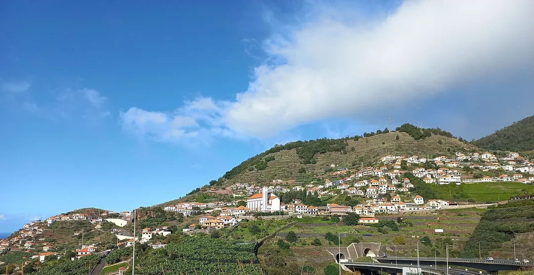
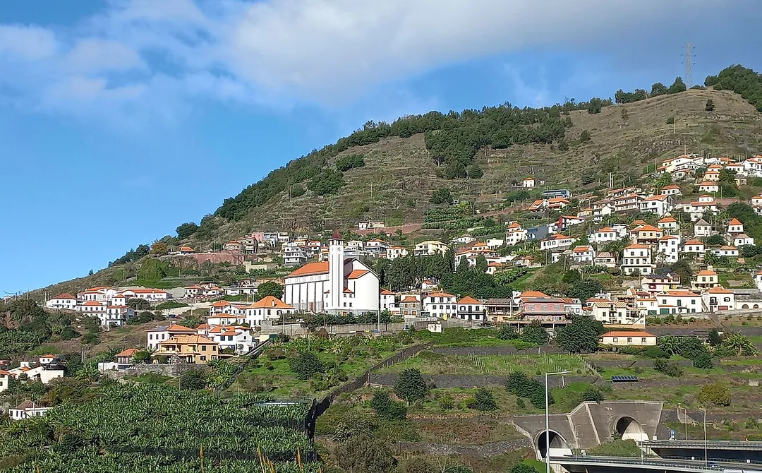
Campanário - Quinta Grande, Madeira
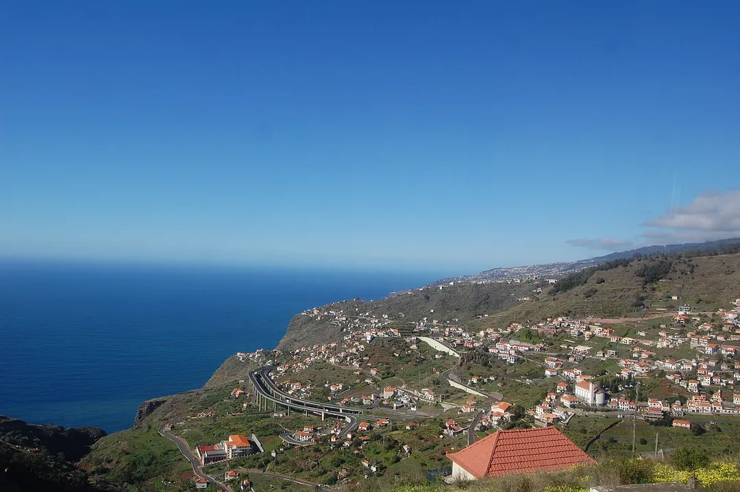
View from de Via Rapida (VR1) at Campanário in Madeira, Portugal
Photo by Mark Woodbury
Destinations
Home›Destinations›Campanário
EuropePortugalMadeira

Campanário

Madeira, Portugal · Europe

About Campanário

Campanário works well as a base: 10 minutes from Câmara de Lobos, 9km from ER-101 and ER-105 Madeira mountain roads.

Campanário is in Madeira, Portugal, with about 4,000 people. You drive on the right here. The nearest town is Câmara de Lobos, about 6 km away.

Where to Stay in Campanário

Compare prices across Booking.com, Airbnb, Expedia, and more. Select your dates to see availability.

Filter presets

Pick your must-haves once: provider links open pre-filtered. Each filter lists which sites it applies to.

Booking.comExpediaTripAdvisorHotels.comAgodaAirbnb

Compare before you book!

Prices can vary significantly between platforms. We recommend checking at least 2-3 sites to find the best deal for your stay in Campanário.

Explore the Area

Discover famous landmarks, scenic roads, and more near Campanário.

Loading map...
Open in Google Maps

Frequently Asked Questions

What is there to see near Campanário?

Within an hour or so of Campanário: Cabo Girao (3 km), ER-101 and ER-105 Madeira mountain roads (9 km), Levada Walks (11 km), Funchal Old Town (12 km).

Are there any good drives near Campanário?

The nearest famous roads are ER-101 and ER-105 Madeira mountain roads.

Where is Campanário?

Campanário is in Madeira, Portugal, about 6 km from Câmara de Lobos.

Road trip

Drive to Campanário

Add it as a stop and the planner works out the driving, the nights and what's worth seeing on the way.

Start planning

What's nearby?

Swipe through places to go

Places within a drive of Campanário. Keep the ones you like and add them to your trip.

Explore now

Quick Information

Population
3,987
Continent
Europe
Country
Portugal
Region
Madeira
Timezone
Atlantic/Madeira
Coordinates
32.6658, -17.0358

Emergency & Services

Essential numbers in Portugal

Police
112
Ambulance
112
Fire
112
Driving side
right
Full driving guide for Portugal

Tags

EuropePortugalMadeiraTown

Worth the detour from Campanário

8 notable places within an hour's drive.

scenic viewpoint

Cabo Girao

One of the highest sea cliffs in Europe at 580 meters, with a glass-floored skywalk platform offering vertiginous ocean views.

3 km · about 5 min drive

famous road

ER-101 and ER-105 Madeira mountain roads

Madeira's old cliff and mountain roads with tunnels, tight hairpins and drops to the Atlantic; the Encumeada pass links north and south.

9 km · about 15 min drive

natural wonder

Levada Walks

A unique network of irrigation channel paths winding through Madeira's laurel forests, offering spectacular walking through lush endemic vegetation.

11 km · about 20 min drive

landmark

Funchal Old Town

Madeira's lively capital quarter of painted doors, cable-car, market and seafront promenade.

12 km · about 25 min drive

scenic viewpoint

Pico do Arieiro

Madeira's third-highest peak at 1,818 meters, offering a surreal above-the-clouds sunrise experience and a thrilling ridge walk to Pico Ruivo.

13 km · about 25 min drive

waterfall

25 Fontes

A levada hike ending at a green pool fed by dozens of cascading springs deep in Madeira's forest.

13 km · about 25 min drive

beach

Seixal

A north-coast village with a black-sand beach and waterfalls tumbling onto the coastal road.

18 km · about 20 min drive

national park

Fanal Forest

A misty plateau of ancient gnarled laurel trees, eerily beautiful when fog rolls through the Laurisilva.

19 km · about 20 min drive

Driving roads near Campanário

  • Right hereCabo GiraoOne of the highest sea cliffs in Europe at 580 meters, with a glass-floored skywalk platform offering vertiginous ocean views.
  • Right hereER-101 and ER-105 Madeira mountain roadsMadeira's old cliff and mountain roads with tunnels, tight hairpins and drops to the Atlantic; the Encumeada pass links north and south.
  • Right herePico do ArieiroMadeira's third-highest peak at 1,818 meters, offering a surreal above-the-clouds sunrise experience and a thrilling ridge walk to Pico Ruivo.
  • 33 kmPonta de São LourençoMadeira's arid eastern tip, a hiking trail along ochre volcanic cliffs surrounded by deep blue sea.

Driving in Portugal

Drives on
the right
Petrol
~€1.78/litre
Motorway tolls
~€9.00/100km

When to drive here

April to October

Nearby Destinations

Other places to explore near Campanário.

Ribeira Brava

🇵🇹 Portugal

3 km awayPop. 5,932

Estreito de Câmara de Lobos

🇵🇹 Portugal

3 km awayPop. 9,348

Câmara de Lobos

🇵🇹 Portugal

6 km awayPop. 32,209

Curral das Freiras

🇵🇹 Portugal

9 km awayPop. 1,673

São Martinho

🇵🇹 Portugal

9 km awayPop. 26,482

Santo António

🇵🇹 Portugal

9 km awayPop. 25,940

Funchal

🇵🇹 Portugal

10 km awayPop. 105,795

São Roque

🇵🇹 Portugal

11 km awayPop. 9,385

Plan a trip around Campanário

Portugal road trip planner

Your trip starts here

Plan a road trip from Campanário.

Pick the days, drop in the stops, and share it with whoever's coming.

Start planning
PYRT

The ultimate road trip planning platform. Discover 150,000+ destinations worldwide, plan scenic routes, and create unforgettable adventures.

Inspiration

  • Discover Trips
  • Travel Guides
  • Community

The Product

  • Calendar Planner
  • Integrations
  • How It Works
  • Collaboration Mode
  • Get the App
  • Merchandise: PYRT Supply Co.
  • Become a Creator
  • Trip Marketplace

Plan Your Trip

  • Road Trip Planner
  • Famous Routes
  • Drive Times & Distances
  • Planners by Country
  • Best Road Trip Planner App
  • Discover Road Trips
  • Events
  • Travel Guides
  • How It Works
  • My Trips
  • Community Groups

Company

  • Terms of Service
  • Privacy Policy
  • About PYRT
  • Support
  • Contact Us
  • Sign In
  • Create Account

© 2026 Plan Your Road Trips. All rights reserved.

•[email protected]
Data sources:GeoNames (CC BY 4.0)•Wikimedia Commons (CC BY-SA)•Mapbox•Photography: George Lawrence