The United States practically invented the road trip. With nearly 4.2 million miles of paved roads spanning every conceivable landscape, from sun-scorched deserts to misty mountain passes, the country offers a depth and variety of driving experiences that few nations can match. These eight iconic routes have defined American road trip culture for generations, and each one remains as compelling today as when the first adventurers set out to explore them.
1. Route 66: Chicago to Santa Monica
Route 66 is more than a road; it's a cultural artefact. Established in 1926 as one of the original highways in the US Highway System, "The Mother Road" ran 2,448 miles from Chicago, Illinois to Santa Monica, California, passing through eight states and three time zones. Although it was officially decommissioned in 1985 after being bypassed by the Interstate Highway System, large sections remain driveable, and the route has become a pilgrimage for road trip enthusiasts from around the world.
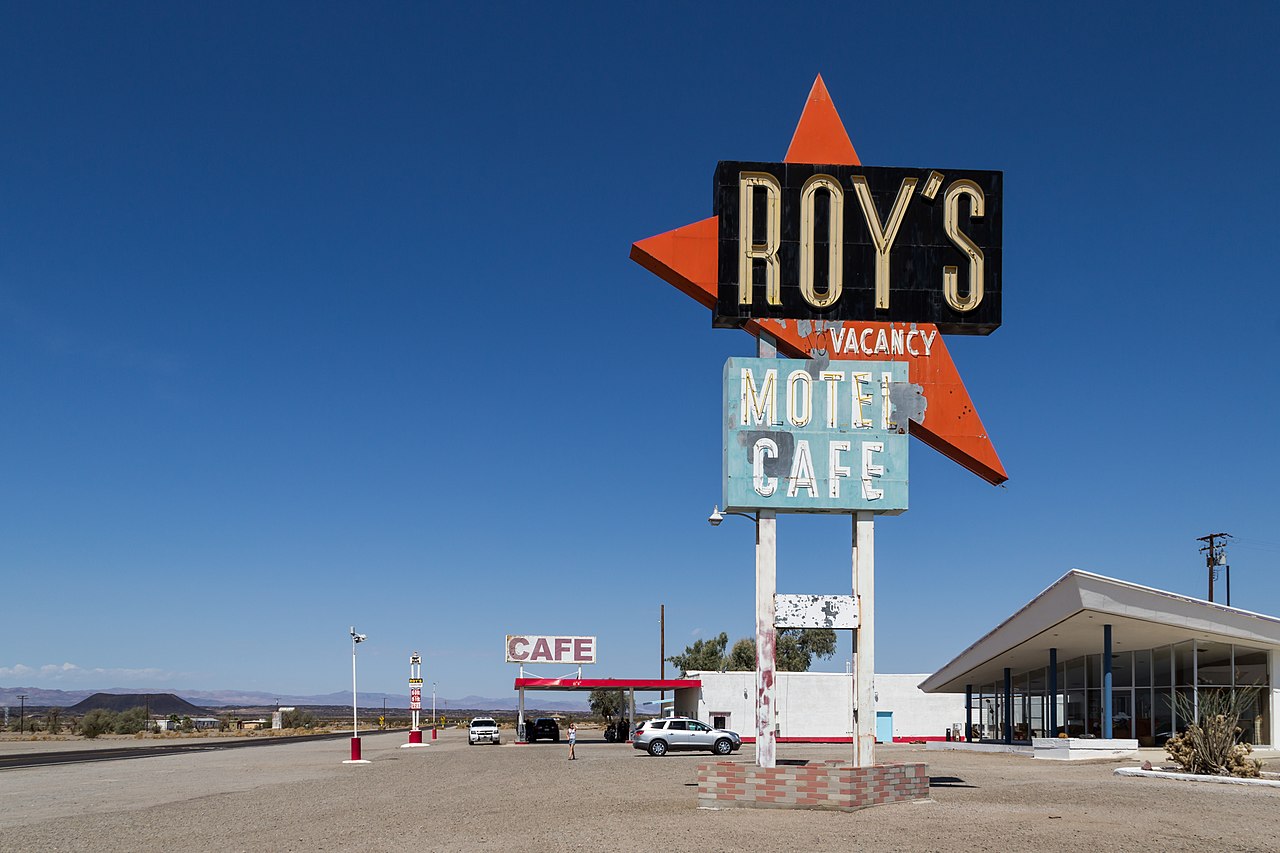
The magic of Route 66 lies in its Americana: neon-lit diners, vintage motels with hand-painted signs, quirky roadside attractions, and small towns that time seems to have gently passed by. The Cadillac Ranch near Amarillo (ten Cadillacs buried nose-first in a field), the Blue Whale of Catoosa in Oklahoma, and the Wigwam Motel in Holbrook, Arizona, where you sleep in concrete tepees, are just a few of the hundreds of landmarks that line the route.
Route 66 by state
- Illinois - Chicago to St. Louis, through the cornfields and small towns of the Midwest
- Missouri - The Ozark Mountains, Meramec Caverns, and the Gateway Arch in St. Louis
- Kansas - A brief 13-mile stretch through the southeastern corner of the state
- Oklahoma - The longest remaining driveable stretch of original Route 66, rich in Native American heritage
- Texas - The Panhandle, Cadillac Ranch, and the midpoint marker in Adrian
- New Mexico - Santa Fe, Albuquerque's Old Town, and the stunning high desert landscape
- Arizona - Petrified Forest, Meteor Crater, and the approach to the Grand Canyon
- California - The Mojave Desert, the San Bernardino Mountains, and the final stretch to the Pacific
Pro tip: Allow at least two weeks for the full Route 66 experience. The EZ66 Guide by Jerry McClanahan is the definitive turn-by-turn guide and is essential for navigating sections where the original road has been rerouted, overlaid by interstates, or simply crumbled back into the desert.
Plan this trip starting from Chicago to map out every stop along The Mother Road.
2. Pacific Coast Highway, California
California State Route 1, commonly known as the Pacific Coast Highway (PCH), is arguably the most beautiful coastal drive in North America. The most celebrated section runs 123 miles from Monterey to Morro Bay, passing through Big Sur, where the Santa Lucia Mountains plunge directly into the Pacific Ocean and the road is carved into cliffs hundreds of feet above the waves.
The Bixby Creek Bridge, a 714-foot concrete arch bridge completed in 1932, is the most photographed structure on the route and has appeared in countless films, television shows, and car adverts. McWay Falls, where an 80-foot waterfall drops directly onto a pristine beach, is another unforgettable sight.
But Big Sur is just one section. The full PCH experience runs from Dana Point in Orange County north to Leggett in Mendocino County, covering approximately 655 miles. The stretch through Malibu, Santa Barbara, San Luis Obispo, and the Mendocino coast each has its own distinct character and charm.
Begin your PCH adventure in Los Angeles and head north for the most dramatic direction of travel. Plan this trip to build your perfect California coast itinerary.
3. Blue Ridge Parkway, Virginia to North Carolina
The Blue Ridge Parkway runs 469 miles along the crest of the Blue Ridge Mountains from Shenandoah National Park in Virginia to the Great Smoky Mountains National Park in North Carolina. Designed as a scenic leisure drive with a maximum speed limit of 45 mph, it is the most visited unit of the National Park System, attracting over 14 million visitors annually.
The parkway was built between 1935 and 1987, making it one of the longest-running public works projects in American history. Every mile is engineered for beauty: there are no commercial vehicles, no billboards, and no traffic lights. The road follows the ridge line, providing constant panoramic views of the Appalachian Mountains, with over 200 overlooks inviting you to stop and absorb the scenery.
Seasonal highlights
- Spring (April-May) - Wildflowers, dogwood blossoms, and rhododendron blooms at lower elevations
- Summer (June-August) - Lush green canopy, temperatures 10-15 degrees cooler than the valleys below, and clear mountain views
- Autumn (October) - The parkway's most spectacular season, with peak fall foliage typically mid-October; the entire mountain range turns gold, crimson, and amber
- Winter (December-February) - Sections may be closed due to ice and snow, but open stretches offer solitude and dramatic bare-tree views
Pro tip: The Linn Cove Viaduct near milepost 304 is one of the most complex concrete bridges ever built, curving around the side of Grandfather Mountain. Stop at the visitor centre underneath to appreciate the engineering. For fall colour reports, check the National Park Service website, which publishes weekly foliage updates from September through November.
4. Going-to-the-Sun Road, Montana
Going-to-the-Sun Road in Glacier National Park is a 50-mile mountain road that crosses the Continental Divide at Logan Pass (6,646 feet). Completed in 1932 after over a decade of construction, it is considered one of the most difficult roads ever built in North America and was designated a National Historic Landmark and a National Civil Engineering Landmark.
The road climbs from the shores of Lake McDonald through dense cedar forests, past waterfalls cascading directly onto the roadway, to the treeline and above, where mountain goats graze on alpine meadows and the full grandeur of the Rocky Mountains unfolds in every direction. The section known as "The Wall," where the road is carved into a sheer cliff face with a thousand-foot drop below, is utterly breathtaking.
Vehicle restrictions apply: no vehicles longer than 21 feet or wider than 8 feet are permitted on the middle section. Timed entry reservations are required during peak summer months (typically late May through early September), so plan ahead.
5. Overseas Highway, Florida Keys
The Overseas Highway (US Route 1) runs 113 miles from Florida City to Key West, crossing 42 bridges over open ocean to connect the Florida Keys. The Seven Mile Bridge, one of the longest bridges in the world when it was completed in 1982, is the centrepiece, offering a drive across open water with nothing but turquoise sea and sky in every direction.
The route follows the path of Henry Flagler's Overseas Railroad, completed in 1912 and destroyed by the Labor Day Hurricane of 1935. Remnants of the original railroad bridges are visible alongside the modern road, their weathered concrete arches adding a poignant historical dimension to the drive.
Key stops along the way
- Key Largo - John Pennekamp Coral Reef State Park, the first undersea park in the US
- Islamorada - The "Sport Fishing Capital of the World," with tarpon, bonefish, and permit in the flats
- Marathon - The Turtle Hospital, a rehabilitation centre for injured sea turtles
- Bahia Honda Key - Consistently rated one of the best beaches in the United States
- Key West - Ernest Hemingway's home, Duval Street, and the Southernmost Point marker
6. Trail Ridge Road, Colorado
Trail Ridge Road (US Route 34) traverses Rocky Mountain National Park for 48 miles between Estes Park and Grand Lake, reaching a maximum elevation of 12,183 feet, making it the highest continuous paved road in the United States. For 11 miles, the road runs above the treeline through genuine alpine tundra, an ecosystem more commonly associated with the Arctic than the American West.
The views from the Alpine Visitor Centre at 11,796 feet are staggering: peaks stretching to the horizon in every direction, with elk herds grazing in the valleys below. The road typically opens for the season in late May and closes in October, depending on snowfall. Even in summer, temperatures at the summit can be 30 degrees cooler than at the base, and afternoon thunderstorms are common.
7. The Great River Road, Minnesota to Louisiana
The Great River Road follows the Mississippi River for approximately 3,000 miles from its source at Lake Itasca, Minnesota to the Gulf of Mexico near Venice, Louisiana, passing through 10 states along the way. It is the longest and oldest scenic byway in the United States, tracing the river that has shaped American history, culture, music, and literature more than any other natural feature.
The route passes through river towns that read like a roll call of American cultural history: La Crosse, Wisconsin; Dubuque, Iowa; Hannibal, Missouri (Mark Twain's hometown); Memphis, Tennessee (Beale Street, Sun Studio, and Graceland); and Nashville, accessible via a short detour east. The final stretch through Louisiana's Cajun country to New Orleans is a feast for the senses.
Pro tip: The Great River Road is marked by distinctive green pilot wheel signs in all 10 states. The route frequently crosses the river and can be driven on either bank; the western bank generally has more scenic views in the upper river, while the eastern bank is stronger in the lower Mississippi. Allow at least two weeks for the full route, though a month is better.
Plan this trip to include Nashville as part of a Great River Road adventure.
8. Hana Highway, Maui, Hawaii
The Hana Highway (Hawaii Route 360) runs 64 miles from Kahului to the remote town of Hana on Maui's eastern shore, featuring 620 curves and 59 bridges (most of them single-lane). The road winds through lush tropical rainforest, past waterfalls tumbling into pools surrounded by wild ginger and bamboo, and along cliff edges with views over the blue Pacific to the neighbouring island of Hawaii (the Big Island).
The journey is famously slow, not because of the distance, but because the narrow road demands careful driving and the scenery demands constant stops. Allow at least three hours each way without stops, though most people take far longer. The black sand beach at Wai'anapanapa State Park, the bamboo forest at the Pipiwai Trail, and the Seven Sacred Pools at Ohe'o Gulch are just a few of the highlights.
Hana Highway driving tips
- Start early (before 7 AM) to avoid traffic, as the single-lane bridges create bottlenecks
- Yield to oncoming traffic on single-lane bridges; the vehicle closest to the bridge goes first
- Pull over at designated pullouts to let faster traffic pass
- Fill up your tank in Kahului; there is limited fuel in Hana
- Some rental companies prohibit driving the unpaved road past Hana; check your rental agreement
What Makes American Road Trips Special
There are practical reasons why the United States is the world's premier road trip destination. Fuel is relatively cheap by international standards. The Interstate Highway System makes long-distance travel efficient. Motels, diners, and roadside attractions are woven into the landscape. But the real reason is more emotional than practical: the sheer scale and variety of the American landscape means that every road trip becomes a journey through multiple worlds.
You can drive from the jazz clubs of New Orleans to the silent vastness of the Mojave Desert, from the autumn splendour of the Appalachians to the tropical warmth of the Florida Keys, and every mile teaches you something new about this extraordinary country.
Frequently Asked Questions
How long does it take to drive Route 66 from start to finish?
The drive from Chicago to Santa Monica covers approximately 2,400 miles and takes a minimum of five days if you're in a hurry, but most Route 66 enthusiasts recommend two to three weeks to do the trip justice. This allows time to explore the quirky roadside attractions, eat at legendary diners, visit national parks and monuments near the route (Petrified Forest, Grand Canyon, Painted Desert), and simply soak in the atmosphere of the small towns along the way. The route is not always clearly marked, so having a dedicated guidebook or GPS route is essential.
What is the best time of year for a US road trip?
It depends entirely on the route. The Blue Ridge Parkway is best in mid-October for fall foliage. Going-to-the-Sun Road and Trail Ridge Road are only fully open from June to September. The Pacific Coast Highway and Route 66 are best in spring (April-May) or autumn (September-October) when weather is pleasant and crowds are thinner. The Overseas Highway and Hana Highway are year-round destinations, though Florida's Keys are most popular from December to April (dry season) and Maui is best from April to October. As a general rule, the shoulder seasons of May and September offer the best combination of weather, access, and manageable crowds across most of the country.
Should I rent a car or use my own vehicle for an American road trip?
If you're a domestic traveller with a reliable vehicle, using your own car is usually more economical for trips under two weeks, especially if you factor in rental fees, insurance, and one-way drop-off charges (which can be substantial for coast-to-coast trips). International visitors will need to rent, and major agencies at airports offer the best rates when booked in advance. For classic road trip experiences like Route 66, consider renting a convertible or a classic car from specialist agencies. For mountain roads like Going-to-the-Sun or Trail Ridge, any standard car with good brakes will suffice. Ensure your insurance covers all states you plan to visit, and carry physical copies of your rental agreement and insurance documents.