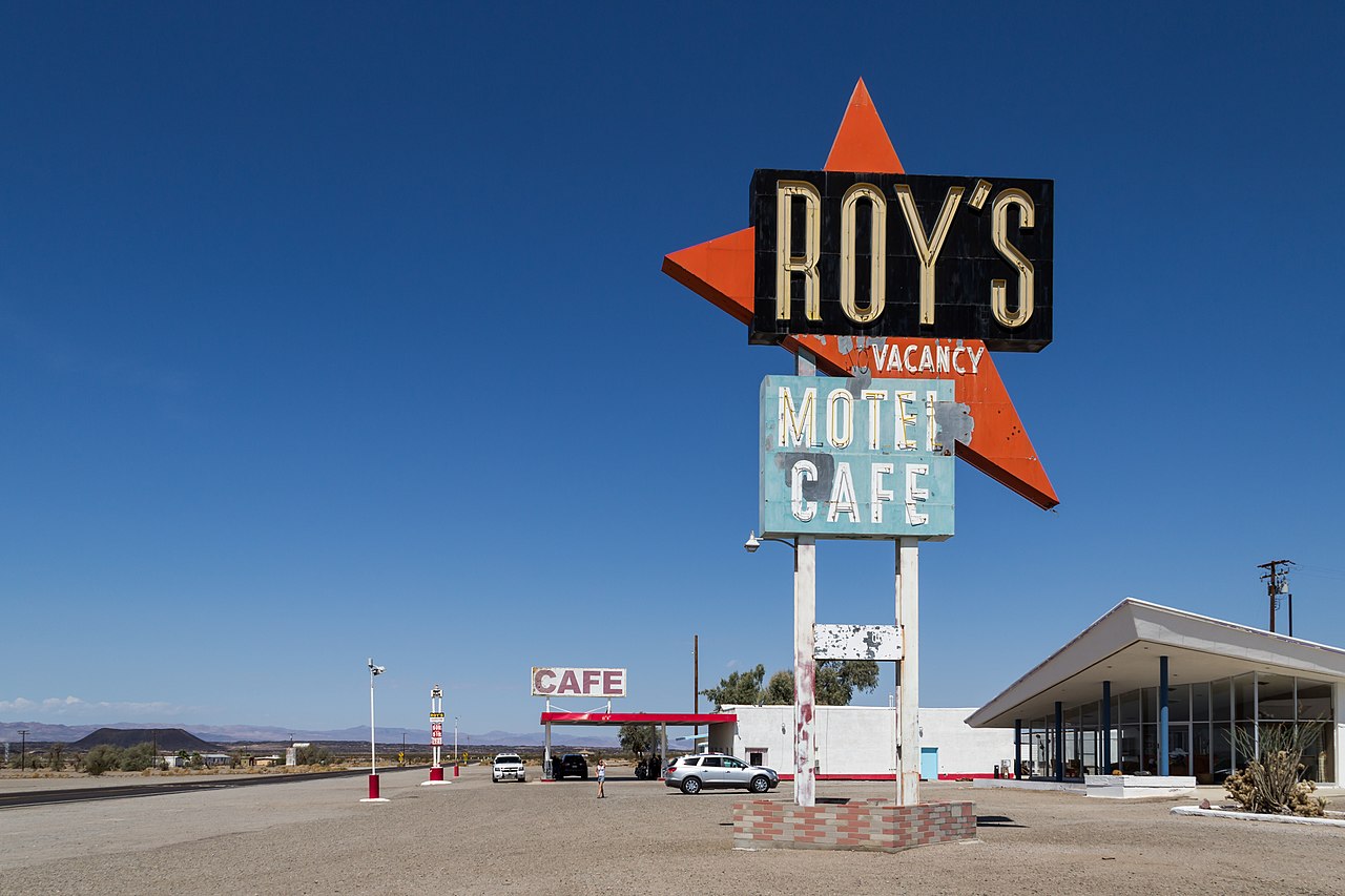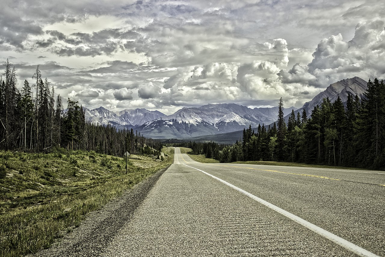
Canada is a country built for road trips. The second-largest nation on Earth stretches across six time zones, from the Atlantic fishing villages of Newfoundland to the Pacific rainforests of British Columbia, with the Rocky Mountains, the Great Lakes, the prairies, and the boreal wilderness of the Canadian Shield in between. The distances are immense, the landscapes are varied beyond any reasonable expectation, and the roads, from engineered mountain highways to lonely two-lane blacktop crossing the tundra, are among the most spectacular on the planet.
Here are ten Canadian road trips that showcase the country's extraordinary range, from quick weekend drives to epic multi-week journeys.
1. Icefields Parkway, Alberta
Distance: 232 km | Driving time: 3 hours (without stops) | Best for: Mountain scenery, glaciers, wildlife
The Icefields Parkway (Highway 93 North) between Lake Louise and Jasper is widely regarded as one of the most beautiful drives in the world, and it earns that reputation within the first ten minutes. The road follows the Continental Divide through the heart of the Canadian Rockies, passing beneath peaks exceeding 3,000 metres, alongside glaciers that flow to within metres of the road, and past lakes whose turquoise colour, caused by glacial rock flour suspended in the water, looks digitally enhanced but is entirely real.
The Columbia Icefield, roughly halfway along the route, is the largest ice field in the Rocky Mountains, covering 325 square kilometres. The Athabasca Glacier, which descends from the icefield to within walking distance of the road, has retreated 1.5 km in the last 125 years, a visible and sobering reminder of climate change. Stop at the Glacier Skywalk, a glass-floored platform cantilevered 280 metres above the Sunwapta Valley, for a perspective on the landscape that is literally breathtaking.
Icefields Parkway highlights
- Peyto Lake: The most photographed lake on the Parkway, with a distinctive fox-head shape and intense turquoise colour. A short walk from the car park leads to a viewpoint.
- Mistaya Canyon: A short walk to a narrow limestone gorge where the Mistaya River has carved sinuous curves in the rock.
- Columbia Icefield: Take the Ice Explorer tour onto the Athabasca Glacier, or simply walk to the toe of the glacier from the car park (free).
- Sunwapta Falls: A powerful waterfall where the Sunwapta River drops into a narrow gorge. The lower falls are less visited and more impressive.
- Athabasca Falls: Near Jasper, the Athabasca River forces through a narrow gorge with tremendous power.
Pro tip: Drive the Icefields Parkway in both directions if your itinerary allows. The views are completely different in each direction because the mountains present different faces. If you can only drive it once, go north to south (Jasper to Lake Louise) for the best light in the afternoon, when the turquoise lakes are most vivid.
2. Sea-to-Sky Highway, British Columbia
Distance: 130 km | Driving time: 1.5 hours | Best for: Ocean-to-mountain scenery, outdoor recreation
The Sea-to-Sky Highway (Highway 99) from Vancouver to Whistler is one of the most dramatic short drives in North America. The road climbs from sea level at Horseshoe Bay, where ferries depart for Vancouver Island, along the edge of Howe Sound, a deep fjord flanked by mountains that rise to over 2,000 metres directly from the water. The engineering is impressive: the road was substantially rebuilt for the 2010 Winter Olympics and now flows beautifully along the fjord's edge.
Shannon Falls, the third-highest waterfall in British Columbia at 335 metres, is visible from the highway and accessible via a short walk from the car park. A few kilometres further, the Sea-to-Sky Gondola lifts you 885 metres above sea level for views that encompass the fjord, the mountains, and on clear days, Vancouver Island. The road continues through Squamish (the outdoor recreation capital of Canada, with rock climbing on the Stawamus Chief, a 700-metre granite monolith) to Whistler, consistently rated one of the top ski resorts in North America.
Plan this trip from Vancouver to map out the Sea-to-Sky Highway and beyond.
3. Cabot Trail, Nova Scotia
Distance: 298 km loop | Driving time: 5-6 hours (without stops) | Best for: Coastal scenery, Celtic culture, whale watching
The Cabot Trail loops around the northern tip of Cape Breton Island, and it is the finest driving route in eastern Canada. The road climbs and falls along the coast through Cape Breton Highlands National Park, a landscape of deep river canyons, boreal plateau, and sheer coastal cliffs that have earned comparisons to Scotland's Highlands, which is fitting given that many Cape Breton communities were settled by Scottish Gaelic speakers in the 18th and 19th centuries. Gaelic is still spoken by some residents, and the Celtic musical tradition is thriving in the pubs and community halls along the trail.
The most spectacular section runs along the western coast between Cheticamp and Pleasant Bay, where the road climbs to 455 metres above the Gulf of St Lawrence with panoramic views over an ocean that, in late summer and autumn, is patrolled by humpback, minke, and pilot whales. The Skyline Trail, a 7.5 km return hike from a trailhead on this section, delivers the signature Cabot Trail view: the road ribboning along the coast far below, with the setting sun turning the Gulf to gold.
Cabot Trail essentials
- Direction: Drive clockwise for the most dramatic coastal views on the seaward side.
- Duration: Allow at least two full days, ideally three. Rushing the Cabot Trail wastes it.
- Whale watching: Boat tours depart from Pleasant Bay and Cheticamp from June to October. Humpback whales are the main attraction.
- Music: Attend a ceilidh (traditional Celtic music session) in Mabou or Judique. The Red Shoe Pub in Mabou, run by the Rankin Family, is legendary.
- Autumn colour: The Cabot Trail in October is one of the great autumn colour drives in the world, with the maple and birch forests turning vivid red and gold against the blue ocean.
Pro tip: Book the Skyline Trail sunset hike. Parks Canada sometimes offers guided evening walks timed for sunset, and the experience of watching the sun drop into the Gulf of St Lawrence from 300 metres above the ocean is one of the most memorable moments in Canadian travel. Even without a guided walk, time your own hike to arrive at the headland viewpoint for the golden hour.
4. Trans-Canada Highway: Calgary to Vancouver
Distance: 1,060 km | Driving time: 10-12 hours (without stops) | Best for: Mountain passes, national parks, variety of landscapes
The Trans-Canada Highway (Highway 1) between Calgary and Vancouver crosses the Rocky Mountains, the Selkirk Mountains, and the Cascade Range, passing through four national parks and delivering a cross-section of western Canada's landscapes: prairies giving way to foothills, foothills to towering Rockies, then interior plateau, more mountain ranges, and finally the lush Pacific coast.
The highlights are concentrated in the mountain sections. Banff National Park, Canada's first national park, centres on the stunning town of Banff with Lake Louise and Moraine Lake nearby. Yoho National Park, just over the BC border, contains Emerald Lake and Takakkaw Falls (373 metres). Glacier National Park (the Canadian one, not Montana's) features Rogers Pass, where the highway crosses the Selkirk Mountains through avalanche country, with snow sheds protecting the road in winter.
Recommended stops
- Banff: Hot springs, Lake Louise, Moraine Lake, and the Banff Springs Hotel, a castle-like railway hotel from 1888.
- Lake Louise: The most famous lake in Canada. Visit before 8am in summer to avoid the crowds and see the glacier-fed turquoise water in morning light.
- Golden: A base for whitewater rafting on the Kicking Horse River and access to Kicking Horse Mountain Resort.
- Revelstoke: An underrated mountain town with excellent skiing, a railway museum, and the Giant Cedars Boardwalk in Mount Revelstoke National Park.
- Kamloops to Vancouver: The highway follows the Fraser Canyon, where the river has carved a dramatic gorge. Stop at Hell's Gate, where 200 million gallons of water per minute force through a 34-metre-wide channel.
5. Route 138, Quebec: The Whale Route
Distance: 390 km (Baie-Saint-Paul to Tadoussac and beyond) | Driving time: 5-6 hours | Best for: Whale watching, French-Canadian culture, dramatic landscapes
Route 138 follows the north shore of the St Lawrence River from Montreal through Quebec City and onward to the Charlevoix region and the whale-watching capital of Canada, Tadoussac. The Charlevoix section, from Baie-Saint-Paul to La Malbaie, is the highlight: the road winds along the shore of the progressively widening St Lawrence (which is already 20 km wide at this point and feels more like a sea) beneath mountains that rise to over 1,000 metres.
Tadoussac sits at the confluence of the Saguenay and St Lawrence rivers, where cold, nutrient-rich water from the Saguenay Fjord meets the St Lawrence, creating a feeding ground for whales that has been attracting marine mammals for millennia. Thirteen species of whale visit these waters, including blue whales (the largest animals ever to have lived), humpbacks, minke whales, belugas, and fin whales. Whale-watching boat tours depart from Tadoussac and Baie-Sainte-Catherine daily from May to October.
Pro tip: For the best chance of seeing blue whales, visit in August or September and take a zodiac tour from Tadoussac rather than a larger boat. The zodiacs sit at water level, putting you eye-to-eye with surfacing whales. Dress very warmly, the river is cold even in summer, and spray from the zodiac soaks everything.
6. Pacific Rim Highway, Vancouver Island
Distance: 200 km (Nanaimo to Tofino) | Driving time: 3 hours | Best for: Rainforest, surfing, wild Pacific beaches
Highway 4 crosses Vancouver Island from the Strait of Georgia to the Pacific Ocean, passing through Cathedral Grove, a stand of 800-year-old Douglas fir trees up to 76 metres tall, before reaching the wild west coast at Tofino and Ucluelet. This is temperate rainforest country: moss-draped trees, rainfall measured in metres rather than millimetres, and a Pacific coastline of long sandy beaches pounded by surf rolling in from Japan.
Tofino has evolved from a remote fishing and logging village into Canada's premier surf town. Long Beach, a 16 km stretch of sand in Pacific Rim National Park Reserve, is the main surfing beach, with consistent waves year-round. In winter, storm-watching season brings massive Pacific swells and horizontal rain, and Tofino's hotels have built storm-watching into a luxury experience, with hot tubs facing the ocean and packages that celebrate the dramatic weather rather than apologising for it.
7. Dempster Highway, Yukon to Northwest Territories
Distance: 736 km (Dawson City to Inuvik) | Driving time: 10-12 hours | Best for: Extreme wilderness, Arctic landscape, adventure
The Dempster Highway is Canada's most adventurous road trip. This gravel highway runs from Dawson City in the Yukon to Inuvik in the Northwest Territories, crossing the Arctic Circle, two mountain ranges, and two river crossings served by free government ferries (in summer) or ice bridges (in winter). There are no services for stretches of 370 km. This is genuine wilderness driving where preparation and self-sufficiency are essential.
The rewards match the challenge. The Tombstone Territorial Park at the southern end features jagged granite peaks rising from tundra that turns vivid red and gold in late August. The Eagle Plains Hotel, the only services for 370 km, sits in the middle of the caribou migration route. And the drive above the Arctic Circle, through a landscape of permafrost tundra and endless sky, delivers a sense of remoteness that few roads on Earth can match.
8. Viking Trail, Newfoundland
Distance: 489 km (Deer Lake to St. Anthony) | Driving time: 5.5 hours | Best for: UNESCO sites, Viking history, icebergs
Route 430 up Newfoundland's Great Northern Peninsula passes two UNESCO World Heritage Sites and some of the most dramatic coastal scenery in Atlantic Canada. Gros Morne National Park, at the southern end, features the Tablelands, a flat-topped mountain of exposed mantle rock (peridotite) that was pushed up from the Earth's interior by tectonic forces 485 million years ago. It looks like Mars and is one of the few places on Earth where you can walk on the planet's mantle.
At the northern end, L'Anse aux Meadows is the only confirmed Norse settlement in North America, where Leif Erikson and his crew established a base around 1000 AD, nearly 500 years before Columbus. The reconstructed sod buildings and the visitor centre bring this extraordinary history to life. In late spring and early summer, icebergs from Greenland drift past the coast, and the sight of a 10,000-year-old iceberg floating past a 1,000-year-old Viking settlement is quintessentially Newfoundland.
9. Okanagan Valley, British Columbia
Distance: 200 km (Vernon to Osoyoos) | Driving time: 2.5 hours | Best for: Wine country, lake swimming, fruit orchards
The Okanagan Valley is Canada's answer to Napa, a sun-drenched valley of vineyards, orchards, and lake-filled landscapes that produces some of the country's finest wines. Highway 97 runs the length of the valley from Vernon to Osoyoos through a landscape that shifts from green, forested north to near-desert conditions in the south, where Osoyoos is officially Canada's only desert and the hottest spot in the country.
Over 200 wineries line the valley, with concentrations around Kelowna, Penticton, and Oliver-Osoyoos. The wines, particularly Pinot Noir, Riesling, and the unique Icewine (made from grapes frozen on the vine), have won international recognition. Between tastings, Okanagan Lake offers swimming, paddleboarding, and beach time at temperatures that regularly exceed 30 degrees Celsius in July and August.
10. Fundy Trail, New Brunswick
Distance: 190 km (Moncton to St. Andrews) | Driving time: 3 hours | Best for: Extreme tides, coastal geology, covered bridges
The Bay of Fundy has the highest tides in the world: the difference between high and low tide can exceed 16 metres, equivalent to a four-storey building. This extraordinary tidal range creates unique landscapes and experiences. At Hopewell Rocks, low tide reveals the famous "flowerpot rocks," towering sandstone pillars topped with trees that are submerged to their treeline at high tide. You can walk on the ocean floor at low tide, then kayak over the same spot six hours later.
The Fundy Trail Parkway, a scenic highway along the coast, offers access to pristine beaches, waterfalls, and dramatic sea cliffs. The coast between St Martins (with its sea caves accessible at low tide) and Alma (the gateway to Fundy National Park) is a geological wonderland shaped by the relentless daily tidal cycle.
Pro tip: Check the tide tables for Hopewell Rocks before visiting and arrive two to three hours before low tide. This gives you time to walk the ocean floor among the flowerpot rocks as the water retreats. Return to the viewing platform for high tide six hours later to see the same rocks half-submerged, a visceral demonstration of the Bay of Fundy's extraordinary tidal power.
Frequently Asked Questions
What is the best road trip in Canada for first-time visitors?
The Icefields Parkway from Lake Louise to Jasper is the single most spectacular day drive in Canada. Fly into Calgary, spend a day in Banff, drive the Parkway to Jasper, and return via a different route. If you have two weeks, the Calgary to Vancouver Trans-Canada route covers the greatest variety of landscapes and includes the Icefields Parkway as a detour. For eastern Canada, the Cabot Trail in October is unbeatable for autumn colour and Celtic culture.
When is the best time for a Canadian road trip?
June to September is the primary season for most routes. The Icefields Parkway and mountain routes are best from mid-June (when snow has cleared) to mid-September. The Cabot Trail peaks in October for autumn colours. The Dempster Highway is accessible from June to mid-October (summer ferries) and mid-December to mid-April (ice bridges). Quebec's Route 138 is best from late June to September for whale watching. BC's Pacific Rim Highway is a year-round destination, with surfing and storm-watching making winter genuinely appealing.
Do I need a special vehicle for Canadian road trips?
For the Dempster Highway, a high-clearance vehicle with two full-size spare tyres is recommended due to the gravel surface and remoteness. For all other routes on this list, any standard rental car is fine. The Trans-Canada Highway, Icefields Parkway, Sea-to-Sky Highway, and Cabot Trail are all fully paved and well-maintained. Winter driving in mountain areas requires winter tyres (mandatory in BC from October to April on most highways) and confidence driving in snow. All-wheel drive is helpful in winter but not essential with proper tyres.