cathedral
St Patrick's Cathedral
Ireland's largest cathedral and national cathedral of the Church of Ireland, once led by Jonathan Swift.
3 km · about 5 min drive

Leinster, Ireland · Europe
Ringsend works well as a base: 22km from Powerscourt Waterfall.
Ringsend is a town located in Leinster, Ireland. With a population of 8,202, it is an important destination in Europe.
On a road trip, Ringsend sits in Ireland, where you drive on the left. It's in the Europe/Dublin time zone. Below you'll find where to stay, things to do nearby, and everything you need to add Ringsend to your route.
Ringsend (Irish: An Rinn) is a southside inner suburb of Dublin, Ireland. It is located on the south bank of the River Liffey and east of the River Dodder, about two kilometres east of the city centre. It is the southern terminus of the East Link Toll Bridge. Areas included in Ringsend are the south side of the DublinRead more
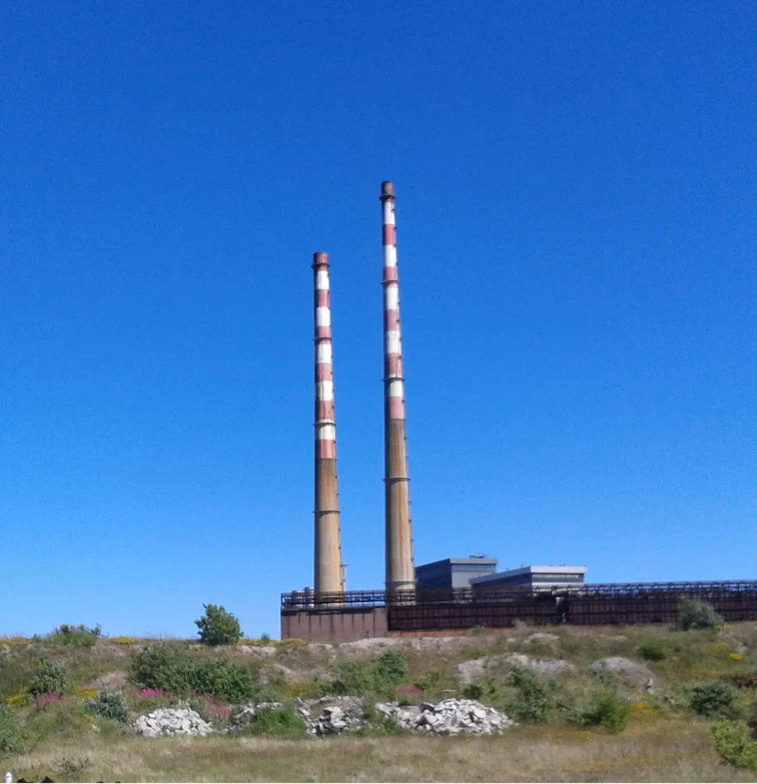
Docklands, and at the west end is the area of South Lotts and part of the Grand Canal Dock area. Neighbouring areas include Irishtown, Sandymount and the Beggars Bush part of Ballsbridge to the south, and the city centre to the west. A key feature of the area is the chimneys of Poolbeg power station.
Formerly the point where ships arriving from across the Irish Sea would dock, Ringsend went into decline in the 19th and 20th centuries, when the shipping moved to other locations, although there is still some container shipping.
Compare prices across Booking.com, Airbnb, Expedia, and more. Select your dates to see availability.
Pick your must-haves once: provider links open pre-filtered. Each filter lists which sites it applies to.
Compare before you book!
Prices can vary significantly between platforms. We recommend checking at least 2-3 sites to find the best deal for your stay in Ringsend.
Discover famous landmarks, scenic roads, and more near Ringsend.
Ringsend offers many attractions including tourist sites, museums, parks, and local restaurants. Explore famous landmarks, scenic roads, and natural wonders on our interactive map and plan your visit.
Plan your road trip to Ringsend with Plan Your Road Trips! Add Ringsend as a destination, and we'll help you find the best route and discover more amazing places along the way.
Ringsend is located in Leinster, Ireland, Europe. The coordinates are 53.3419 latitude, -6.2264 longitude.
Ringsend has a population of approximately 8,202 people, making it a town in Ireland.
Add to your itinerary
Start planning your road trip with Ringsend as a destination. Create a custom route and discover more amazing places along the way.
Start Road TripDiscover destinations like Tinder
Swipe through stunning destinations near Ringsend. Save your favourites and add them to your trip.
8 notable places within an hour's drive.
cathedral
Ireland's largest cathedral and national cathedral of the Church of Ireland, once led by Jonathan Swift.
3 km · about 5 min drive
landmark
Ireland's largest zoo in Phoenix Park, one of the oldest zoos in Europe, home to over 400 animals.
5 km · about 10 min drive
scenic viewpoint
A looped cliff path around Howth Head with views to Ireland's Eye and the Wicklow mountains, easily reached from Dublin.
11 km · about 20 min drive
waterfall
Ireland's highest waterfall at 121 metres, cascading down a rock face in the beautiful Powerscourt Estate in the Wicklow Mountains.
22 km · about 25 min drive
mountain pass
A high crossroads pass over the Wicklow Mountains amid blanket bog, with the famous Military Road running through.
23 km · about 25 min drive
scenic viewpoint
A dark lake with a pale sand beach at one end, viewed from the R759 above; used as the Viking village in the series Vikings.
26 km · about 30 min drive
waterfall
A waterfall spilling off the plateau beside the Military Road in the Wicklow Mountains, with parking right at the top.
32 km · about 35 min drive
mountain pass
High mountain pass on the R756 across the Wicklow Mountains between Hollywood and Glendalough, following the medieval pilgrims' route of St Kevin's Road through wild granite moorland.
35 km · about 40 min drive
7 named roads, passes and coastal drives within 150km.
April to October
Other places to explore near Ringsend.
Create your perfect itinerary with our calendar-based planner. Add stops, discover attractions along the way, and share your trip with friends.
Start Planning