

natural wonder
Ennerdale Water
The most remote Lake District lake, with no public road along it, at the heart of the Wild Ennerdale rewilding project.
9 km · about 15 min drive
England, United Kingdom · Europe
Cleator Moor works well as a base: 10 minutes from Egremont, 9km from Ennerdale Water.
Cleator Moor is a town located in England, United Kingdom. With a population of 6,936, it is an important destination in Europe.
On a road trip, Cleator Moor sits in United Kingdom, where you drive on the left. It's in the Europe/London time zone. Below you'll find where to stay, things to do nearby, and everything you need to add Cleator Moor to your route.
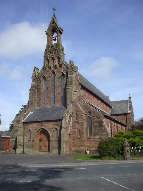
Cleator Moor is a town and civil parish in the Cumberland district of Cumbria, England. The parish was historically called Cleator. During the Industrial Revolution in the 19th century, the new settlement of Cleator Moor was built on the moorland to the north of Cleator village, based around mining and the ironRead more
industry. There was a significant influx of Irish immigrants in the latter half of the 19th century, leading to the colloquial title of Little Ireland. Cleator Moor grew to become the main settlement in the parish, which was formally renamed Cleator Moor in 1934. Cleator village remains part of the parish, and is now classed as part of the built up area of Cleator Moor by the Office for National Statistics.
The town stands below Dent Fell, and is on the 190 miles (310 km) Coast to Coast Walk that spans Northern England.
Compare prices across Booking.com, Airbnb, Expedia, and more. Select your dates to see availability.
Pick your must-haves once: provider links open pre-filtered. Each filter lists which sites it applies to.
Compare before you book!
Prices can vary significantly between platforms. We recommend checking at least 2-3 sites to find the best deal for your stay in Cleator Moor.
Discover famous landmarks, scenic roads, and more near Cleator Moor.
Cleator Moor offers many attractions including tourist sites, museums, parks, and local restaurants. Explore famous landmarks, scenic roads, and natural wonders on our interactive map and plan your visit.
Plan your road trip to Cleator Moor with Plan Your Road Trips! Add Cleator Moor as a destination, and we'll help you find the best route and discover more amazing places along the way.
Cleator Moor is located in England, United Kingdom, Europe. The coordinates are 54.5214 latitude, -3.5159 longitude.
Cleator Moor has a population of approximately 6,936 people, making it a town in United Kingdom.
Add to your itinerary
Start planning your road trip with Cleator Moor as a destination. Create a custom route and discover more amazing places along the way.
Start Road TripDiscover destinations like Tinder
Swipe through stunning destinations near Cleator Moor. Save your favourites and add them to your trip.
Essential numbers in United Kingdom
112 also works. NHS non-emergency medical advice: 111. National Highways breakdown assistance on motorways: 0300 123 5000.
Full driving guide for United Kingdom8 notable places within an hour's drive.
natural wonder
The most remote Lake District lake, with no public road along it, at the heart of the Wild Ennerdale rewilding project.
9 km · about 15 min drive
natural wonder
The smallest and most tranquil of the western lakes, uniquely draining inland towards Crummock Water rather than out to sea.
12 km · about 25 min drive
waterfall
The Lake District's highest waterfall at 52m, hidden in a mossy ravine above Crummock Water.
13 km · about 25 min drive
natural wonder
Buttermere's larger neighbour, with Scale Force - the Lake District's highest waterfall - hidden in a ravine on its western shore.
14 km · about 25 min drive
natural wonder
Tranquil lake surrounded by dramatic fells including Haystacks and Fleetwith Pike, offering one of the finest circular walks in the Lake District.
16 km · about 30 min drive
famous road
A single-track climb from Braithwaite to Buttermere over 333m, with a roadside waterfall at the summit and views down to Crummock Water.
16 km · about 20 min drive
scenic viewpoint
England's deepest lake, ringed by towering screes, voted Britain's favourite view and reached by a single dramatic dead-end road.
17 km · about 20 min drive
mountain pass
A quiet, narrow pass through Newlands Valley with the Moss Force waterfall tumbling beside the road.
17 km · about 20 min drive
9 named roads, passes and coastal drives within 60km.
April to October
Other places to explore near Cleator Moor.
Create your perfect itinerary with our calendar-based planner. Add stops, discover attractions along the way, and share your trip with friends.
Start Planning