natural wonder
Lake Windermere
England's largest natural lake, stretching over 10 miles through the heart of the Lake District with stunning mountain backdrops.
2 km · about 5 min drive
England, United Kingdom · Europe
Windermere works well as a base: 10 minutes from Staveley, 2km from Lake Windermere.
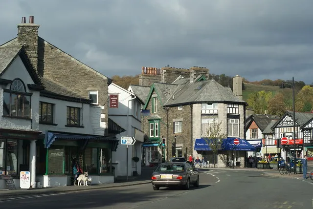
Windermere is a town located in England, United Kingdom. With a population of 7,765, it is an important destination in Europe.
On a road trip, Windermere sits in United Kingdom, where you drive on the left. It's in the Europe/London time zone. Below you'll find where to stay, things to do nearby, and everything you need to add Windermere to your route.
Windermere and Bowness, formerly just Windermere, is a civil parish in the Westmorland and Furness district, in the ceremonial county of Cumbria, England. It includes the towns of Windermere and Bowness-on-Windermere, the village of Troutbeck Bridge, the hamlet of Storrs and the areas of Ferney Green and Heathwaite.Read more
In 2021 the parish had a population of 7,676. The parish borders Cartmel Fell, Claife, Colton, Crook, Hugill, Kentmere, Lakes, Satterthwaite and Staveley-in-Cartmel. There are 82 listed buildings in Windermere and Bowness. Windermere and Bowness Town Council's meetings take place at Langstone House.
Compare prices across Booking.com, Airbnb, Expedia, and more. Select your dates to see availability.
Pick your must-haves once: provider links open pre-filtered. Each filter lists which sites it applies to.
Compare before you book!
Prices can vary significantly between platforms. We recommend checking at least 2-3 sites to find the best deal for your stay in Windermere.
Discover famous landmarks, scenic roads, and more near Windermere.
Windermere offers many attractions including tourist sites, museums, parks, and local restaurants. Explore famous landmarks, scenic roads, and natural wonders on our interactive map and plan your visit.
Plan your road trip to Windermere with Plan Your Road Trips! Add Windermere as a destination, and we'll help you find the best route and discover more amazing places along the way.
Windermere is located in England, United Kingdom, Europe. The coordinates are 54.3809 latitude, -2.9071 longitude.
Windermere has a population of approximately 7,765 people, making it a town in United Kingdom.
Add to your itinerary
Start planning your road trip with Windermere as a destination. Create a custom route and discover more amazing places along the way.
Start Road TripDiscover destinations like Tinder
Swipe through stunning destinations near Windermere. Save your favourites and add them to your trip.
Essential numbers in United Kingdom
112 also works. NHS non-emergency medical advice: 111. National Highways breakdown assistance on motorways: 0300 123 5000.
Full driving guide for United Kingdom8 notable places within an hour's drive.
natural wonder
England's largest natural lake, stretching over 10 miles through the heart of the Lake District with stunning mountain backdrops.
2 km · about 5 min drive
landmark
The busiest lakeside town in the National Park, the departure point for Windermere steamers and home to the World of Beatrix Potter.
2 km · about 5 min drive
film location
Beatrix Potter's farmhouse in the Lake District, used in Miss Potter and the source of her illustrated landscapes.
6 km · about 10 min drive
natural wonder
A small, fertile lake between Windermere and Coniston, near Beatrix Potter's Hill Top farm at Near Sawrey.
6 km · about 10 min drive
waterfall
A 21 m waterfall reached by a short woodland walk from the centre of Ambleside, once powering the town's mills.
6 km · about 10 min drive
landmark
A stone-built town at the head of Windermere, known for the tiny Bridge House straddling Stock Ghyll and as a walkers' base.
6 km · about 10 min drive
mountain pass
The Lake District's highest motor road, topped by an ancient inn and sweeping views over Brothers Water.
9 km · about 20 min drive
famous road
The Lake District's highest pass road at 454m; the 'Struggle' from Ambleside is a 1-in-4 climb to the Kirkstone Pass Inn.
9 km · about 15 min drive
15 named roads, passes and coastal drives within 60km.
April to October
Other places to explore near Windermere.
Create your perfect itinerary with our calendar-based planner. Add stops, discover attractions along the way, and share your trip with friends.
Start Planning