museum
National Museum of Military History Diekirch
Luxembourg's foremost Battle of the Bulge museum, packed with tanks, vehicles and life-size winter dioramas of the 1944-45 Ardennes fighting around Diekirch.
15 km · about 30 min drive
Mersch, Luxembourg · Europe
Boevange-sur-Attert works well as a base: 5 minutes from Vichten, 17km from Upper Sûre Lake.
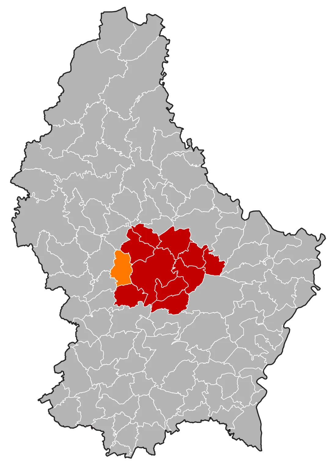
Boevange-sur-Attert is a town located in Mersch, Luxembourg. With a population of 576, it is an important destination in Europe.
On a road trip, Boevange-sur-Attert sits in Luxembourg, where you drive on the right. It's in the Europe/Luxembourg time zone. Below you'll find where to stay, things to do nearby, and everything you need to add Boevange-sur-Attert to your route.
Useldange (French pronunciation: [yzɛldɑ̃ʒ]; Luxembourgish: Useldeng [ˈuzəldeŋ] ; German: Useldingen [ˈuːzl̩ˌdɪŋən]) is a commune and small town in western Luxembourg, in the canton of Redange.
As of 2025, the town of Useldange, which lies in the east of the commune, has a population of 1,122. Other towns within theRead more
commune include Everlange, Rippweiler, and Schandel.
Useldange Castle is a medieval castle, which, while now being mainly in ruin, also comprises the current town hall. It is located in the centre of the village, right opposite to the town's church building. The site can be visited throughout the year with special arrangements for poorly sighted visitors. It is also the location for the annual medieval festival in Luxembourg.
Compare prices across Booking.com, Airbnb, Expedia, and more. Select your dates to see availability.
Pick your must-haves once: provider links open pre-filtered. Each filter lists which sites it applies to.
Compare before you book!
Prices can vary significantly between platforms. We recommend checking at least 2-3 sites to find the best deal for your stay in Boevange-sur-Attert.
Discover famous landmarks, scenic roads, and more near Boevange-sur-Attert.
Boevange-sur-Attert offers many attractions including tourist sites, museums, parks, and local restaurants. Explore famous landmarks, scenic roads, and natural wonders on our interactive map and plan your visit.
Plan your road trip to Boevange-sur-Attert with Plan Your Road Trips! Add Boevange-sur-Attert as a destination, and we'll help you find the best route and discover more amazing places along the way.
Boevange-sur-Attert is located in Mersch, Luxembourg, Europe. The coordinates are 49.7726 latitude, 6.0153 longitude.
Boevange-sur-Attert has a population of approximately 576 people, making it a town in Luxembourg.
Add to your itinerary
Start planning your road trip with Boevange-sur-Attert as a destination. Create a custom route and discover more amazing places along the way.
Start Road TripDiscover destinations like Tinder
Swipe through stunning destinations near Boevange-sur-Attert. Save your favourites and add them to your trip.
8 notable places within an hour's drive.
museum
Luxembourg's foremost Battle of the Bulge museum, packed with tanks, vehicles and life-size winter dioramas of the 1944-45 Ardennes fighting around Diekirch.
15 km · about 30 min drive
castle
Extensive medieval castle ruins on a rocky spur 150 metres above the Sûre river, with a car park and panoramic Ardennes views.
15 km · about 30 min drive
castle
Twin ruined castles of rival noble lines perched on a sandstone crag 150 m above the half-timbered town of Larochette, midway between Luxembourg City and the Mullerthal, with the restored Gothic 'Créhange House' to explore.
15 km · about 25 min drive
landmark
A tiny medieval village wrapped almost entirely by a hairpin loop of the Sûre beneath a ruined hilltop tower.
16 km · about 20 min drive
natural wonder
Luxembourg's largest reservoir in the Ardennes, ringed by wooded roads with viewpoints, swimming areas and boat hire at Insenborn.
17 km · about 20 min drive
bridge
Luxembourg City's striking 'Red Bridge', a scarlet steel span soaring 74 m above the Alzette valley to link the old town with the Kirchberg European quarter.
19 km · about 20 min drive
landmark
A dramatic fortress capital perched on cliffs above gorges, its UNESCO ramparts and casemates carved into the rock.
20 km · about 25 min drive
landmark
A honeycomb of cannon tunnels bored through the Bock promontory, the cradle of Luxembourg City's clifftop fortress.
20 km · about 25 min drive
April to October
Other places to explore near Boevange-sur-Attert.
Create your perfect itinerary with our calendar-based planner. Add stops, discover attractions along the way, and share your trip with friends.
Start Planning