ancient ruins
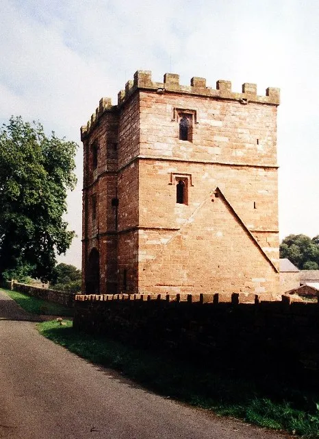
Birdoswald Roman Fort
A Hadrian's Wall fort above the Irthing gorge, with the longest continuous stretch of surviving wall alongside it.
19 km · about 20 min drive
England, United Kingdom · Europe
Wetheral works well as a base: 15 minutes from Carlisle, 24km from Hartside Pass (A686).
Wetheral is a town located in England, United Kingdom. With a population of 1,605, it is an important destination in Europe.
On a road trip, Wetheral sits in United Kingdom, where you drive on the left. It's in the Europe/London time zone. Below you'll find where to stay, things to do nearby, and everything you need to add Wetheral to your route.
Wetheral is a village, civil parish and electoral ward in the historic county of Cumberland but now in the ceremonial county of Cumbria, England. At the 2001 census, the population of the Wetheral Ward was 4,039, The civil parish of Wetheral is slightly larger, with a population of 6,293 at the 2021 census.
WetheralRead more
stands high on a bank overlooking a gorge in the River Eden. Parts of the riverbank here are surrounded by ancient woodlands, including Wetheral Woods, owned by the National Trust. Formerly a small ferryboat operated to the village of Great Corby on the opposite bank, and an iron ring can still be found attached to the rocks on the Great Corby side of the river where the ferry would tie up.
The place-name 'Wetheral' is first attested in the Register of Wetheral Priory circa 1100 AD, where it appears as Wetherhala. The name means 'the haugh (area of flat land by a river) where wethers (castrated male sheep) were kept'.
The Newcastle to Carlisle Railway has a station here at the west end of Corby Bridge (popularly known as 'Wetheral Viaduct') over the Eden which acts also as a footbridge connecting with Great Corby. The station was closed during the Beeching cuts in 1967, but was reopened in 1981. In 1836 one of the very earliest railway accidents happened close to Wetheral station.
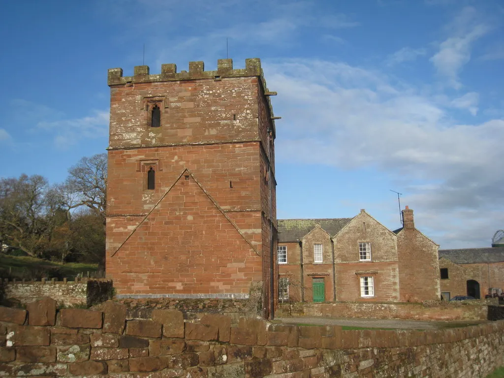
In the Middle Ages there was a priory at Wetheral. All that is left now is the gatehouse, which is in the care of English Heritage, and some low ruined walls behind the farm buildings that now occupy the site.
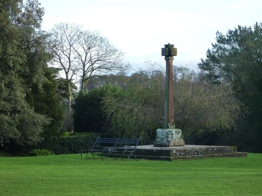
At the historic core of the village lies the village green, in one corner of which stands Wetheral Cross. The steps were the base of a maypole erected in the centre of the green at the expense of Henry Howard in 1814. For some reason, in 1838 to 1844, the steps were moved to the current location and the cross added. It is not a market cross as Wetheral was not a market town. The head of the cross appears much older than the shaft and this may possibly be on the site of a medieval cross. The green is surrounded by large period houses in different styles, and the Fantails restaurant, shop and tea room front the green. The church, hotel (The Crown), village hall, hairdresser and pub (The Wheatsheaf) are not far away. The north western part of the village is known as Wetheral Plain and consists of a ribbon development along Plains Road and the housing estates of Greenacres and Faustin Hill.
Wetheral Parish Church is dedicated to the Holy Trinity and St Constantine. St Constantine was said to be a Scottish king who relinquished his throne to become a monk. Legend has it that he lived as a hermit in a cave at Wetheral., which can be reached by walking down the River Eden. The current Rector is based at The Rectory in Warwick Bridge. The Church contains a life-size sculpture by Joseph Nollekens of 'Faith'. This was commissioned by Henry Howard after the death, in childbirth, of his wife Maria. The cost of the sculpture was £1,500 in the late eighteenth century, which is estimated to be equivalent to nearly £2 million today.
There is no school in the village (it closed many years ago) and most primary school children travel to the school at Scotby, although some go to Great Corby or Warwick Bridge. The village lies in the catchment area of the Richard Rose Central Academy in Carlisle, although the William Howard School in nearby Brampton provides a bus service for pupils who wish to attend school there. This is undertaken by most pupils despite having to pay a fee for the service rather than using the free bus to the catchment school.
World war one ambulance driver and nurse Pat Waddell was born near here at Warwick Bridge and Nursing education theorist Nancy Roper was born in Wetheral in 1918. She trained in Cumberland Infirmary, Carlisle, and went on to develop the nursing process based on Activities of Daily Living (Roper -Logan - Tierney method) used across the UK and beyond.
The ward of Wetheral includes the villages and hamlets of Warwick-on-Eden, Aglionby, Scotby, Cotehill, Cumwhinton, Wetheral Shield and Wetheral Pasture. The civil parish also includes part of the Great Corby & Geltsdale ward, namely the villages of Great Corby, and Warwick Bridge (but not Corby Hill or Little Corby).
At Wetheral Shield is the Animals' Refuge, operated by the National Equine (and Smaller Animals) Defence League.
Compare prices across Booking.com, Airbnb, Expedia, and more. Select your dates to see availability.
Pick your must-haves once: provider links open pre-filtered. Each filter lists which sites it applies to.
Compare before you book!
Prices can vary significantly between platforms. We recommend checking at least 2-3 sites to find the best deal for your stay in Wetheral.
Discover famous landmarks, scenic roads, and more near Wetheral.
Wetheral offers many attractions including tourist sites, museums, parks, and local restaurants. Explore famous landmarks, scenic roads, and natural wonders on our interactive map and plan your visit.
Plan your road trip to Wetheral with Plan Your Road Trips! Add Wetheral as a destination, and we'll help you find the best route and discover more amazing places along the way.
Wetheral is located in England, United Kingdom, Europe. The coordinates are 54.8840 latitude, -2.8333 longitude.
Wetheral has a population of approximately 1,605 people, making it a town in United Kingdom.
Add to your itinerary
Start planning your road trip with Wetheral as a destination. Create a custom route and discover more amazing places along the way.
Start Road TripDiscover destinations like Tinder
Swipe through stunning destinations near Wetheral. Save your favourites and add them to your trip.
Essential numbers in United Kingdom
112 also works. NHS non-emergency medical advice: 111. National Highways breakdown assistance on motorways: 0300 123 5000.
Full driving guide for United Kingdom8 notable places within an hour's drive.
ancient ruins
A Hadrian's Wall fort above the Irthing gorge, with the longest continuous stretch of surviving wall alongside it.
19 km · about 20 min drive
cafe
A remote hilltop cafe at 1,904 feet on the A686 in Cumbria, one of England's highest road cafes and a bucket-list stop for bikers.
22 km · about 25 min drive
mountain pass
The A686's grand sweep over the North Pennines between Penrith and Alston, climbing to 580m through wide hairpins with views across the Eden Valley to the Lake District fells. A celebrated drivers' and bikers' road.
22 km · about 25 min drive
famous road
Voted one of Britain's best drives - a sweeping climb to 580m out of the Eden Valley with a panorama to the Lake District and the Solway.
24 km · about 30 min drive
scenic viewpoint
A car park and viewpoint on the Whin Sill giving the classic switchback view of Hadrian's Wall towards Sycamore Gap.
31 km · about 35 min drive
landmark
A dip in Hadrian's Wall that held one of England's most photographed trees until it was felled in 2023; the site and its regrowth remain a pilgrimage.
32 km · about 35 min drive
ancient ruins
An actively excavated Roman fort and settlement south of Hadrian's Wall, source of the Vindolanda writing tablets.
32 km · about 35 min drive
scenic viewpoint
The Lake District's second-largest lake, with Wordsworth's daffodils at Glencoyne and 1930s steamers running its length.
34 km · about 40 min drive
12 named roads, passes and coastal drives within 60km.
April to October
Other places to explore near Wetheral.
Create your perfect itinerary with our calendar-based planner. Add stops, discover attractions along the way, and share your trip with friends.
Start Planning