
landmark
Westbury White Horse
The oldest of Wiltshire's chalk horses, cut into the escarpment below the Iron Age hillfort of Bratton Camp.
7 km · about 15 min drive
England, United Kingdom · Europe
Warminster works well as a base: 10 minutes from Corsley, 23km from Roman Baths, Bath.
Warminster is a town located in England, United Kingdom. With a population of 17,490, it is an important destination in Europe.
On a road trip, Warminster sits in United Kingdom, where you drive on the left. It's in the Europe/London time zone. Below you'll find where to stay, things to do nearby, and everything you need to add Warminster to your route.
Warminster () is a historic market town and civil parish in south-west Wiltshire, England, on the western edge of Salisbury Plain. The parish had a population of 18,173 in 2021.
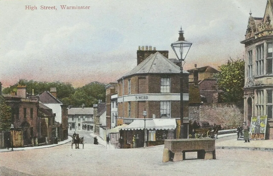
The name Warminster occurs first in the early 10th century and the Minster Church of St Denys was begun in the 11th century. The High StreetRead more
and Market Place have many fine buildings including the Athenaeum Centre, the Town Hall, St Lawrence Chapel, The Old Bell and a variety of independent shops. Several Army establishments, known collectively as the Warminster Garrison, are on the edges of the town.
Compare prices across Booking.com, Airbnb, Expedia, and more. Select your dates to see availability.
Pick your must-haves once: provider links open pre-filtered. Each filter lists which sites it applies to.
Compare before you book!
Prices can vary significantly between platforms. We recommend checking at least 2-3 sites to find the best deal for your stay in Warminster.
Discover famous landmarks, scenic roads, and more near Warminster.
Warminster offers many attractions including tourist sites, museums, parks, and local restaurants. Explore famous landmarks, scenic roads, and natural wonders on our interactive map and plan your visit.
Plan your road trip to Warminster with Plan Your Road Trips! Add Warminster as a destination, and we'll help you find the best route and discover more amazing places along the way.
Warminster is located in England, United Kingdom, Europe. The coordinates are 51.2043 latitude, -2.1787 longitude.
Warminster has a population of approximately 17,490 people, making it a town in United Kingdom.
Add to your itinerary
Start planning your road trip with Warminster as a destination. Create a custom route and discover more amazing places along the way.
Start Road TripDiscover destinations like Tinder
Swipe through stunning destinations near Warminster. Save your favourites and add them to your trip.
Essential numbers in United Kingdom
112 also works. NHS non-emergency medical advice: 111. National Highways breakdown assistance on motorways: 0300 123 5000.
Full driving guide for United Kingdom8 notable places within an hour's drive.
landmark
The oldest of Wiltshire's chalk horses, cut into the escarpment below the Iron Age hillfort of Bratton Camp.
7 km · about 15 min drive
landmark
One of the world's finest landscape gardens with a magnificent lake, classical temples and a stunning Palladian mansion in Wiltshire.
15 km · about 30 min drive
film location
The Palladian bridge and Temple of Apollo in Stourhead's landscape garden host Darcy's rain-soaked first proposal in the 2005 film.
15 km · about 30 min drive
photogenic
Steep cobbled street lined with thatched cottages, plunging past the buttressed walls of Shaftesbury Abbey with views over Blackmore Vale. Made famous by Ridley Scott's 1973 Hovis bread advert.
22 km · about 25 min drive
ancient ruins
Remarkably preserved Roman bathing complex fed by Britain's only natural hot springs, surrounded by elegant Georgian architecture.
23 km · about 25 min drive
racetrack
A 1,000-yard chalk downland hillclimb in Wiltshire with a fearsome uphill Karousel corner, run by enthusiasts since 1967 and one of the best places in Britain to watch sprint cars up close.
24 km · about 30 min drive
film location
The medieval cloisters of Lacock Abbey served as Hogwarts corridors, and its rooms as Professor Snape's Potions classroom and Professor Quirrell's Defence Against the Dark Arts room.
24 km · about 30 min drive
film location
The unspoilt National Trust village stood in for Godric's Hollow; 'Harry's parents' house' on Church Street appears in the Half-Blood Prince and Deathly Hallows.
24 km · about 25 min drive
April to October
Other places to explore near Warminster.
Create your perfect itinerary with our calendar-based planner. Add stops, discover attractions along the way, and share your trip with friends.
Start Planning