museum
Louwman Museum
World's oldest private car collection spanning from 1886 to modern day with over 275 rare and iconic automobiles.
11 km · about 20 min drive
South Holland, Netherlands · Europe
Valkenburg works well as a base: 10 minutes from Oostdorp, 13km from Scheveningen Beach.
Valkenburg is a town located in South Holland, Netherlands. With a population of 3,925, it is an important destination in Europe.
On a road trip, Valkenburg sits in Netherlands, where you drive on the right. It's in the Europe/Amsterdam time zone. Below you'll find where to stay, things to do nearby, and everything you need to add Valkenburg to your route.
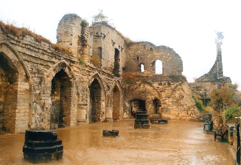
The Capture of Valkenburg of 1574, took place in early February 1574, at Valkenburg, South Holland (present-day the Netherlands), during the Eighty Years' War and the Anglo-Spanish War (1585–1604), in the context of the siege of Leiden. The fortress of Valkenburg (northwest of Leiden), garrisoned by five companies ofRead more
English volunteers commanded by Colonel Edward Chester, was of strategic importance to facilitate (or complicate) the Spanish efforts at Leiden. In early February, when the Spanish troops (sent by Maestre de Campo Don Francisco de Valdés) advanced over Valkenburg Castle, the English troops surrendered the fortress to the Spaniards and fled towards Leiden. Then, the Spanish forces entered and took possession of the fortress. For the cowardice demonstrated at Valkenburg, the English troops were rejected by the Dutch rebel army at Leiden, and finally Chester's troops surrendered to the Spanish army.
Soon after, the English forces at Alphen (now called Alphen aan den Rijn, southwest Leiden), were defeated as well, and at Gouda, another English force was surprised and defeated by a contingent of Spanish troops, with the loss of 300 men and three colours for the English.
In April 1574, Francisco de Valdés halted the siege of Leiden, to face the invading rebel army led by Louis of Nassau and Henry of Nassau-Dillenburg (brothers of Prince William of Orange), but the Spanish forces commanded by General Don Sancho d'Avila reached them first, leading to the Battle of Mookerheyde. The Dutch suffered a disastrous defeat, losing at least 3,000 men, with both Louis and Henry killed. Finally, the rebel army dispersed due to lack of pay.
Compare prices across Booking.com, Airbnb, Expedia, and more. Select your dates to see availability.
Pick your must-haves once: provider links open pre-filtered. Each filter lists which sites it applies to.
Compare before you book!
Prices can vary significantly between platforms. We recommend checking at least 2-3 sites to find the best deal for your stay in Valkenburg.
Discover famous landmarks, scenic roads, and more near Valkenburg.
Valkenburg offers many attractions including tourist sites, museums, parks, and local restaurants. Explore famous landmarks, scenic roads, and natural wonders on our interactive map and plan your visit.
Plan your road trip to Valkenburg with Plan Your Road Trips! Add Valkenburg as a destination, and we'll help you find the best route and discover more amazing places along the way.
Valkenburg is located in South Holland, Netherlands, Europe. The coordinates are 52.1800 latitude, 4.4319 longitude.
Valkenburg has a population of approximately 3,925 people, making it a town in Netherlands.
Add to your itinerary
Start planning your road trip with Valkenburg as a destination. Create a custom route and discover more amazing places along the way.
Start Road TripDiscover destinations like Tinder
Swipe through stunning destinations near Valkenburg. Save your favourites and add them to your trip.
Essential numbers in Netherlands
Watch for cyclists. They generally have priority.
Full driving guide for Netherlands8 notable places within an hour's drive.
museum
World's oldest private car collection spanning from 1886 to modern day with over 275 rare and iconic automobiles.
11 km · about 20 min drive
landmark
The world's largest flower garden, displaying roughly seven million tulips, daffodils, and hyacinths each spring.
13 km · about 25 min drive
landmark
A miniature Netherlands in 1:25 scale, with tiny canals, windmills and airports, on the edge of The Hague.
13 km · about 25 min drive
beach
The Hague's grand seaside resort with a long sandy strand, a historic pier and a Belle Epoque Kurhaus hotel.
13 km · about 25 min drive
landmark
The cobbled heart of Vermeer's Delft, framed by the New Church tower and Renaissance town hall above the famous blue pottery.
19 km · about 20 min drive
racetrack
Dutch seaside circuit with banked corners, revived for modern F1
24 km · about 30 min drive
landmark
A handsome historic square dominated by the towering St-Bavo church where Mozart once played the great organ.
26 km · about 30 min drive
landmark
Piet Blom's tilted yellow cube houses are the quirky landmark of Rotterdam's bold post-war architecture scene.
29 km · about 35 min drive
4 named roads, passes and coastal drives within 150km.
April to October
Other places to explore near Valkenburg.
Create your perfect itinerary with our calendar-based planner. Add stops, discover attractions along the way, and share your trip with friends.
Start Planning