PYRTPlan Your Road Trips
Create TripMy TripsCommunityMerchandise
PYRTPlan Your Road Trips
Create TripMy TripsCommunityMerchandise
U
Destinations
Home›Destinations›Unidad Habitacional José María Morelos y Pavón
North AmericaMexicoMorelos

Unidad Habitacional José María Morelos y Pavón

Morelos, Mexico · North America

About Unidad Habitacional José María Morelos y Pavón

Unidad Habitacional José María Morelos y Pavón is worth a stop: 10 minutes from Temixco, 28km from Malinalco.

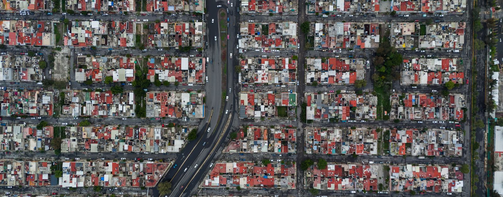
Unidad Habitacional José María Morelos y Pavón is a town located in Morelos, Mexico. With a population of 10,625, it is an important destination in North America.

On a road trip, Unidad Habitacional José María Morelos y Pavón sits in Mexico, where you drive on the right. It's in the America/Mexico City time zone. Below you'll find where to stay, things to do nearby, and everything you need to add Unidad Habitacional José María Morelos y Pavón to your route.

About Unidad Habitacional José María Morelos y Pavón

Cuernavaca International Airport (Spanish: Aeropuerto Internacional de Cuernavaca); officially Aeropuerto Internacional General Mariano Matamoros (General Mariano Matamoros International Airport) (IATA: CVJ, ICAO: MMCB) is an airport located in Temixco, Morelos, Mexico. It manages air traffic for the Metropolitan area

Read more of Cuernavaca and the entire state of Morelos. Currently, the airport does not operate scheduled passenger public services. Travelers to and from Cuernavaca commonly use Mexico City International Airport, situated approximately 60 kilometres (37 mi) to the north of Cuernavaca. Historically, the airport was a primary hub for Aerolíneas Internacionales. However, it now predominantly handles charter flights and various activities in general and executive aviation, including flight training. The airport is operated by the government-owned corporation Aeropuerto de Cuernavaca S.A. de C.V. It was named after General Mariano Matamoros, a Mexican priest who played a significant role in the country's War of Independence. In 2021, the airport reported a total of 3,627 passengers.

Read more on Wikipedia

Where to Stay in Unidad Habitacional José María Morelos y Pavón

Compare prices across Booking.com, Airbnb, Expedia, and more. Select your dates to see availability.

Filter presets

Pick your must-haves once: provider links open pre-filtered. Each filter lists which sites it applies to.

Booking.comExpediaTripAdvisorHotels.comAgodaAirbnb

Compare before you book!

Prices can vary significantly between platforms. We recommend checking at least 2-3 sites to find the best deal for your stay in Unidad Habitacional José María Morelos y Pavón.

Explore the Area

Discover famous landmarks, scenic roads, and more near Unidad Habitacional José María Morelos y Pavón.

Loading map...
Open in Google Maps

Frequently Asked Questions

What are the best things to do in Unidad Habitacional José María Morelos y Pavón?

Unidad Habitacional José María Morelos y Pavón offers many attractions including tourist sites, museums, parks, and local restaurants. Explore famous landmarks, scenic roads, and natural wonders on our interactive map and plan your visit.

How do I plan a road trip to Unidad Habitacional José María Morelos y Pavón?

Plan your road trip to Unidad Habitacional José María Morelos y Pavón with Plan Your Road Trips! Add Unidad Habitacional José María Morelos y Pavón as a destination, and we'll help you find the best route and discover more amazing places along the way.

Where is Unidad Habitacional José María Morelos y Pavón located?

Unidad Habitacional José María Morelos y Pavón is located in Morelos, Mexico, North America. The coordinates are 18.8203 latitude, -99.2622 longitude.

What is the population of Unidad Habitacional José María Morelos y Pavón?

Unidad Habitacional José María Morelos y Pavón has a population of approximately 10,625 people, making it a town in Mexico.

Plan a Road Trip

Add to your itinerary

Start planning your road trip with Unidad Habitacional José María Morelos y Pavón as a destination. Create a custom route and discover more amazing places along the way.

Start Road Trip

What's Nearby?

Discover destinations like Tinder

Swipe through stunning destinations near Unidad Habitacional José María Morelos y Pavón. Save your favourites and add them to your trip.

Explore now

Quick Information

Population
10,625
Continent
North America
Country
Mexico
Region
Morelos
Timezone
America/Mexico_City
Coordinates
18.8203, -99.2622

Emergency & Services

Essential numbers in Mexico

Police
911
Ambulance
911
Fire
911
Driving side
right

Green Angels (free tourist roadside assistance on federal highways): 078.

Full driving guide for Mexico

Tags

North AmericaMexicoMorelosTown

Worth the detour from Unidad Habitacional José María Morelos y Pavón

5 notable places within an hour's drive.

landmark

Tepoztlán

A Morelos town under sheer volcanic cliffs, with a hilltop 13th-century pyramid to the pulque god reached by a steep hour's climb, a fortress-like Dominican convent, and a market known for exotic ice creams.

25 km · about 30 min drive

ancient ruins

Malinalco

Site of the Cuauhcalli, or House of Eagles: one of the very few temples in the Americas carved directly out of solid bedrock, reached by 400 steps up the Hill of the Idols above a quiet colonial town.

28 km · about 35 min drive

landmark

Taxco

A hillside silver-mining town with winding cobblestone streets, baroque Santa Prisca church, and centuries of silversmithing tradition.

47 km · about 55 min drive

landmark

Xochimilco Floating Gardens

A network of ancient Aztec canals and artificial islands where colorful trajinera boats glide past floating gardens and mariachi bands.

51 km · about 60 min drive

landmark

Six Flags México

Mexico City's premier amusement park with world-class coasters and seasonal events in the south of the city.

53 km · about 60 min drive

Driving roads near Unidad Habitacional José María Morelos y Pavón

  • 71 kmPaso de CortésThe 3,600-m saddle between the volcanoes Popocatépetl and Iztaccíhuatl, reached by a paved mountain road from Amecameca: the route Cortés marched into the Valley of Mexico in 1519.

When to drive here

Year-round

Tropical latitude: plan around the wet season rather than temperature.

Nearby Destinations

Other places to explore near Unidad Habitacional José María Morelos y Pavón.

Temixco

🇲🇽 Mexico

5 km awayPop. 97,788

Xochicalco (Cirenio Longares)

🇲🇽 Mexico

5 km awayPop. 1,361

Xochitepec

🇲🇽 Mexico

6 km awayPop. 19,164

Tezoyuca

🇲🇽 Mexico

7 km awayPop. 4,555

Chiconcuac

🇲🇽 Mexico

7 km awayPop. 7,071

Ninguno [Centro de Readaptación Social de Atlacholoaya]

🇲🇽 Mexico

8 km awayPop. 2,487

Tres de Mayo

🇲🇽 Mexico

8 km awayPop. 17,966

El Rodeo

🇲🇽 Mexico

8 km awayPop. 1,278

Plan a trip around Unidad Habitacional José María Morelos y Pavón

North America road trip planner

Plan a Road Trip from Unidad Habitacional José María Morelos y Pavón

Create your perfect itinerary with our calendar-based planner. Add stops, discover attractions along the way, and share your trip with friends.

Start Planning
PYRT

The ultimate road trip planning platform. Discover 150,000+ destinations worldwide, plan scenic routes, and create unforgettable adventures.

Inspiration

  • Discover Trips
  • Travel Guides
  • Community

The Product

  • Calendar Planner
  • Integrations
  • How It Works
  • Collaboration Mode
  • Get the App
  • Merchandise: PYRT Supply Co.
  • Become a Creator
  • Trip Marketplace

Plan Your Trip

  • Road Trip Planner
  • Famous Routes
  • Planners by Country
  • Best Road Trip Planner App
  • Discover Road Trips
  • Events
  • Travel Guides
  • How It Works
  • My Trips
  • Community Groups

Company

  • Terms of Service
  • Privacy Policy
  • Support
  • Contact Us
  • Sign In
  • Create Account

© 2026 Plan Your Road Trips. All rights reserved.

•[email protected]
Data sources:GeoNames (CC BY 4.0)•Wikimedia Commons (CC BY-SA)•Mapbox•Photography: George Lawrence