

castle
Corvin Castle
One of the largest and most impressive Gothic-Renaissance castles in Europe, perched above a river in Hunedoara, Romania.
21 km · about 25 min drive
Hunedoara County, Romania · Europe
Turdaş is worth a stop: 5 minutes from Mărtineşti, 40km from Râpa Roșie.
Turdaş is a town located in Hunedoara County, Romania. With a population of 1,931, it is an important destination in Europe.
On a road trip, Turdaş sits in Romania, where you drive on the right. It's in the Europe/Bucharest time zone. Below you'll find where to stay, things to do nearby, and everything you need to add Turdaş to your route.
Turdaș (Hungarian: Tordos, German: Tordesch) is a commune in Hunedoara County, Transylvania, Romania. It is composed of four villages: Pricaz (Perkász), Râpaș (Répás), Spini (Pád), and Turdaș.
Turdaș lies on the left bank of the Mureș River, which surrounds the village to the north and west.
The Turdaș RiverRead more
discharges into the Mureș in the village Turdaș. To the east is the Sitiș stream, which separates the Turdaș and Pricaz villages. The commune is located in the central-east part of Hunedoara County, 6 km (3.7 mi) from Orăștie and 20 km (12 mi) from the county seat, Deva.
Turdaș has been attested to in various relics found in museums in Germany and Romania. The first is a tax collector report dated to 1334, where in the Catholic priest paid one silver mark in taxes; the Germans in the region were Catholic until the 16th century. According to the report the village had 56 "smokes" or chimneys, i.e., houses. Turdaș is located in an area of Transylvanian Saxon settlement, and the village traditionally had a strong German population.
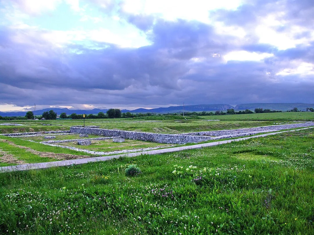
This is the location of the Turdaș archaeological site, some 7000 years old. The archaeological site was a large Neolithic/Chalcolithic settlement along the course of the river Mureș. It was first researched by Zsófia Torma. The sub-culture Vinča-Turdaș (a late, regional variation of the Vinča culture) is named after this site. Some archaeological culture layers at this site are contemporary with the site at Tărtăria.
Compare prices across Booking.com, Airbnb, Expedia, and more. Select your dates to see availability.
Pick your must-haves once: provider links open pre-filtered. Each filter lists which sites it applies to.
Compare before you book!
Prices can vary significantly between platforms. We recommend checking at least 2-3 sites to find the best deal for your stay in Turdaş.
Discover famous landmarks, scenic roads, and more near Turdaş.
Turdaş offers many attractions including tourist sites, museums, parks, and local restaurants. Explore famous landmarks, scenic roads, and natural wonders on our interactive map and plan your visit.
Plan your road trip to Turdaş with Plan Your Road Trips! Add Turdaş as a destination, and we'll help you find the best route and discover more amazing places along the way.
Turdaş is located in Hunedoara County, Romania, Europe. The coordinates are 45.8500 latitude, 23.1167 longitude.
Turdaş has a population of approximately 1,931 people, making it a town in Romania.
Add to your itinerary
Start planning your road trip with Turdaş as a destination. Create a custom route and discover more amazing places along the way.
Start Road TripDiscover destinations like Tinder
Swipe through stunning destinations near Turdaş. Save your favourites and add them to your trip.
Essential numbers in Romania
Rovinieta (road tax sticker) required for all national roads.
Full driving guide for Romania4 notable places within an hour's drive.
castle
One of the largest and most impressive Gothic-Renaissance castles in Europe, perched above a river in Hunedoara, Romania.
21 km · about 25 min drive
ancient ruins
UNESCO-listed capital of the Dacian kingdom in the Orastie mountains, with a circular stone sanctuary and paved sacred road.
29 km · about 35 min drive
natural wonder
An 800 m wall of red sandstone ravines up to 125 m high just north of Sebeș, eroded into organ-pipe pinnacles that glow crimson at sunset: Romania's 'little Grand Canyon', visible right from the approach road.
40 km · about 45 min drive
national park
Romania's oldest national park with over 80 glacial lakes, ancient forests, and some of the wildest mountain scenery in the Carpathians.
58 km · about 65 min drive
4 named roads, passes and coastal drives within 150km.
Other places to explore near Turdaş.
Create your perfect itinerary with our calendar-based planner. Add stops, discover attractions along the way, and share your trip with friends.
Start Planning