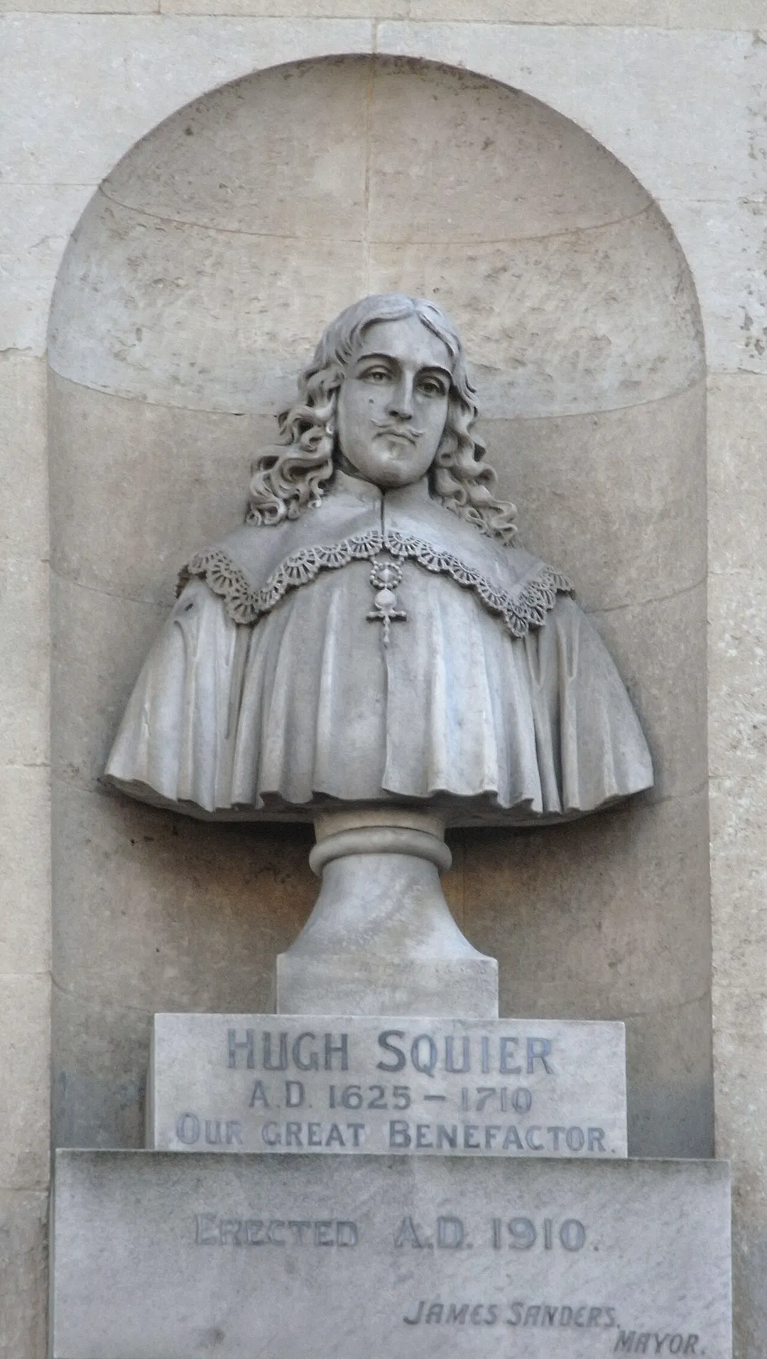
![Portrait of Hugh Squier (1625-1710), benefactor of South Molton, Devon, in the Mayor's Parlour, Guildhall, South Molton. Oil on canvas (74cm * 60cm). Painted in 1799 by a certain Mr Whitby, a copy of the miniature purchased by the Town Council in 1796. It hung formerly in Hugh Squier's School.[1]](https://prod-images.planyourroadtrips.com/img/city-images/south-molton-gb-510167--38333/1-HughSquier_GuildhallSouthMolton.JPG?w=1080&q=80&f=webp)
bridge
Tarr Steps
A 17-span prehistoric-style clapper bridge across the River Barle on Exmoor, repeatedly rebuilt after floods.
17 km · about 20 min drive
England, United Kingdom · Europe
South Molton works well as a base: 20 minutes from Chulmleigh, 23km from Watersmeet.
South Molton is a town located in England, United Kingdom. With a population of 5,108, it is an important destination in Europe.
On a road trip, South Molton sits in United Kingdom, where you drive on the left. It's in the Europe/London time zone. Below you'll find where to stay, things to do nearby, and everything you need to add South Molton to your route.
South Molton is a town and civil parish in the North Devon district, in the county of Devon, England. The town is on the River Mole. In 2021 it had a population of 6225.
South Molton is a market town trading mostly in sheep and cattle. There was a railway station on the Devon and Somerset Railway until 1966, when theRead more
branch line was closed. It is situated on the southern side of Exmoor just off the A361 North Devon link road, which in part follows the route of the railway line.
Compare prices across Booking.com, Airbnb, Expedia, and more. Select your dates to see availability.
Pick your must-haves once: provider links open pre-filtered. Each filter lists which sites it applies to.
Compare before you book!
Prices can vary significantly between platforms. We recommend checking at least 2-3 sites to find the best deal for your stay in South Molton.
Discover famous landmarks, scenic roads, and more near South Molton.
South Molton offers many attractions including tourist sites, museums, parks, and local restaurants. Explore famous landmarks, scenic roads, and natural wonders on our interactive map and plan your visit.
Plan your road trip to South Molton with Plan Your Road Trips! Add South Molton as a destination, and we'll help you find the best route and discover more amazing places along the way.
South Molton is located in England, United Kingdom, Europe. The coordinates are 51.0167 latitude, -3.8333 longitude.
South Molton has a population of approximately 5,108 people, making it a town in United Kingdom.
Add to your itinerary
Start planning your road trip with South Molton as a destination. Create a custom route and discover more amazing places along the way.
Start Road TripDiscover destinations like Tinder
Swipe through stunning destinations near South Molton. Save your favourites and add them to your trip.
Essential numbers in United Kingdom
112 also works. NHS non-emergency medical advice: 111. National Highways breakdown assistance on motorways: 0300 123 5000.
Full driving guide for United Kingdom8 notable places within an hour's drive.
bridge
A 17-span prehistoric-style clapper bridge across the River Barle on Exmoor, repeatedly rebuilt after floods.
17 km · about 20 min drive
natural wonder
A wooded gorge where Hoar Oak Water joins the East Lyn, with a National Trust tea garden in a former fishing lodge.
23 km · about 25 min drive
natural wonder
A dry U-shaped valley of rock towers above the sea near Lynton, grazed by feral goats.
24 km · about 30 min drive
landmark
A harbour village where the East and West Lyn rivers meet the sea, rebuilt after the catastrophic flood of 1952.
24 km · about 25 min drive
landmark
A water-powered funicular opened in 1890, climbing 152 m of 1-in-1.75 cliff between the two villages.
24 km · about 25 min drive
famous road
A long 1-in-4 climb on the A39 out of Lynmouth onto Exmoor, with sweeping views over the Bristol Channel.
24 km · about 30 min drive
scenic viewpoint
The highest point on Exmoor and in Somerset at 519 m, with views to the Brecon Beacons and Dartmoor on clear days.
24 km · about 25 min drive
famous road
Britain's steepest A-road, where the A39 climbs out of Porlock onto Exmoor at gradients up to 1-in-4 with two severe hairpins. A scenic Victorian toll road offers a gentler coastal alternative.
26 km · about 30 min drive
April to October
Other places to explore near South Molton.
Create your perfect itinerary with our calendar-based planner. Add stops, discover attractions along the way, and share your trip with friends.
Start Planning