castle
Poenari Citadel
Vlad the Impaler's real cliff-top fortress, reached by climbing 1,480 steps above the Transfăgărășan.
29 km · about 35 min drive
Arges, Romania · Europe
Retevoiești is worth a stop: 5 minutes from Stroești, 29km from Poenari Citadel.
Retevoiești is a town located in Arges, Romania. With a population of 1,860, it is an important destination in Europe.
On a road trip, Retevoiești sits in Romania, where you drive on the right. It's in the Europe/Bucharest time zone. Below you'll find where to stay, things to do nearby, and everything you need to add Retevoiești to your route.
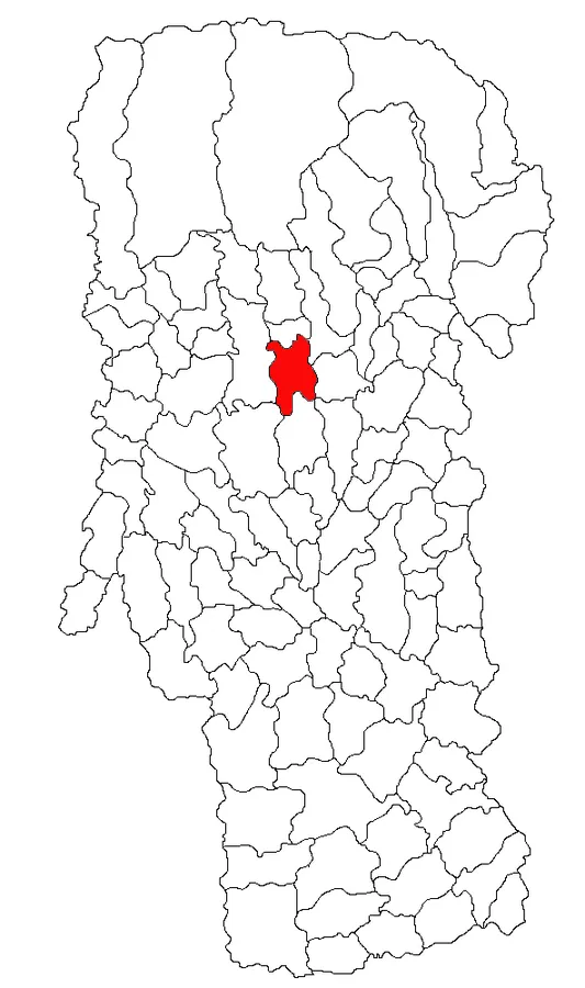
Pietroșani is a commune in Argeș County, Muntenia, Romania. It is composed of five villages: Bădești, Gănești, Pietroșani, Retevoiești, and Vărzăroaia.
The commune is situated in the southern foothills of the Făgăraș Mountains, at an altitude of 442 m (1,450 ft), on the banks of Râul Doamnei and its right tributary,Read more
Valea Ruzii. It is located in the central-north part of Argeș County, 28 km (17 mi) southwest of Câmpulung and 38 km (24 mi) north of the county seat, Pitești.
Pietroșani is crossed by county road DJ731, which connects it to the north with Domnești, Corbi, and Nucșoara, and to the south with Coșești and Dârmănești, where it ends in DN73.
Compare prices across Booking.com, Airbnb, Expedia, and more. Select your dates to see availability.
Pick your must-haves once: provider links open pre-filtered. Each filter lists which sites it applies to.
Compare before you book!
Prices can vary significantly between platforms. We recommend checking at least 2-3 sites to find the best deal for your stay in Retevoiești.
Discover famous landmarks, scenic roads, and more near Retevoiești.
Retevoiești offers many attractions including tourist sites, museums, parks, and local restaurants. Explore famous landmarks, scenic roads, and natural wonders on our interactive map and plan your visit.
Plan your road trip to Retevoiești with Plan Your Road Trips! Add Retevoiești as a destination, and we'll help you find the best route and discover more amazing places along the way.
Retevoiești is located in Arges, Romania, Europe. The coordinates are 45.1402 latitude, 24.8380 longitude.
Retevoiești has a population of approximately 1,860 people, making it a town in Romania.
Add to your itinerary
Start planning your road trip with Retevoiești as a destination. Create a custom route and discover more amazing places along the way.
Start Road TripDiscover destinations like Tinder
Swipe through stunning destinations near Retevoiești. Save your favourites and add them to your trip.
Essential numbers in Romania
Rovinieta (road tax sticker) required for all national roads.
Full driving guide for Romania8 notable places within an hour's drive.
castle
Vlad the Impaler's real cliff-top fortress, reached by climbing 1,480 steps above the Transfăgărășan.
29 km · about 35 min drive
landmark
A towering 166m arch dam at the southern foot of the Transfăgărășan, topped by the Prometheus statue.
30 km · about 35 min drive
mountain pass
Historic corridor road (DN73) between Brașov and Câmpulung, cresting at Fundata (~1,290 m) with pastoral villages, limestone ridges and views of the Bucegi and Piatra Craiului massifs.
47 km · about 55 min drive
cafe
A remote alpine cafe at the summit of Romania's Transfagarasan Highway beside Balea Lake, atop what Jeremy Clarkson called 'the best road in the world.'
54 km · about 65 min drive
scenic viewpoint
The summit of Romania's spectacular mountain highway, called 'the best road in the world' by Top Gear, with views of Balea Lake and the Fagaras range.
54 km · about 65 min drive
mountain pass
Romania's spectacular mountain road crossing the Carpathians - 'best road in the world' per Top Gear
54 km · about 60 min drive
scenic viewpoint
A glacial lake at 2,034m crowning the Transfăgărășan, reached by car in summer or cable car in winter.
54 km · about 65 min drive
tunnel
At 2,040 m the highest road tunnel in Romania, cutting through the ridge at the top of the Transfăgărășan.
54 km · about 65 min drive
Other places to explore near Retevoiești.
Create your perfect itinerary with our calendar-based planner. Add stops, discover attractions along the way, and share your trip with friends.
Start Planning