
landmark
Angel of the North
Striking 20-metre steel sculpture with a 54-metre wingspan standing on a hilltop in Gateshead, England.
18 km · about 20 min drive
England, United Kingdom · Europe
Ponteland works well as a base: 10 minutes from Dinnington, 25km from Chesters Roman Fort.
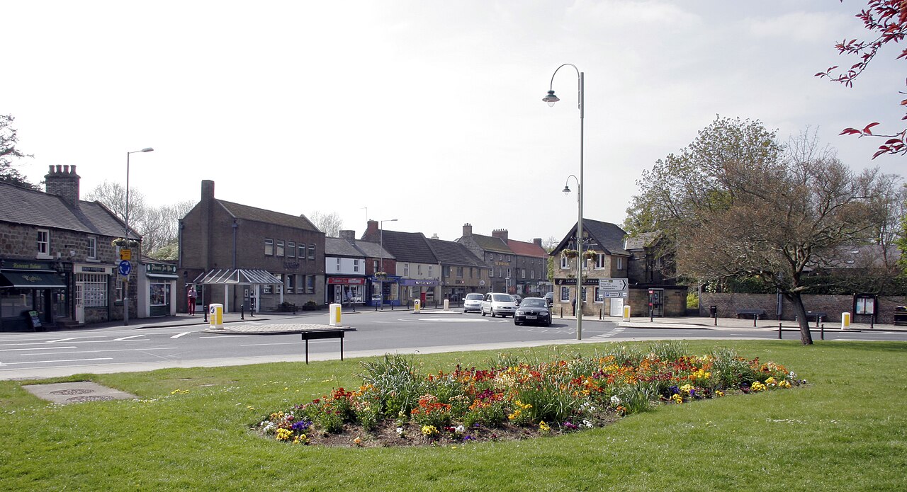
Ponteland is a town located in England, United Kingdom. With a population of 10,135, it is an important destination in Europe.
On a road trip, Ponteland sits in United Kingdom, where you drive on the left. It's in the Europe/London time zone. Below you'll find where to stay, things to do nearby, and everything you need to add Ponteland to your route.
Ponteland ( pon-TEE-lənd) is a town and civil parish in Northumberland, England. It is 8 miles (13 km) northwest of Newcastle upon Tyne.
Built on marshland near St Mary's Church and the old bridge, most marshland has now been drained to make way for housing. In the industrial era, the settlement expanded with theRead more
development of Darras Hall. Parts of Ponteland have some of North-East England's most expensive houses; being just outside Newcastle, near the airport and on the edge of rural countryside.
The civil parish includes the old village of Ponteland, the Darras Hall estate, and the villages of Kirkley, Medburn, Milbourne and Prestwick.
Compare prices across Booking.com, Airbnb, Expedia, and more. Select your dates to see availability.
Pick your must-haves once: provider links open pre-filtered. Each filter lists which sites it applies to.
Compare before you book!
Prices can vary significantly between platforms. We recommend checking at least 2-3 sites to find the best deal for your stay in Ponteland.
Discover famous landmarks, scenic roads, and more near Ponteland.
Ponteland offers many attractions including tourist sites, museums, parks, and local restaurants. Explore famous landmarks, scenic roads, and natural wonders on our interactive map and plan your visit.
Plan your road trip to Ponteland with Plan Your Road Trips! Add Ponteland as a destination, and we'll help you find the best route and discover more amazing places along the way.
Ponteland is located in England, United Kingdom, Europe. The coordinates are 55.0502 latitude, -1.7453 longitude.
Ponteland has a population of approximately 10,135 people, making it a town in United Kingdom.
Add to your itinerary
Start planning your road trip with Ponteland as a destination. Create a custom route and discover more amazing places along the way.
Start Road TripDiscover destinations like Tinder
Swipe through stunning destinations near Ponteland. Save your favourites and add them to your trip.
Essential numbers in United Kingdom
112 also works. NHS non-emergency medical advice: 111. National Highways breakdown assistance on motorways: 0300 123 5000.
Full driving guide for United Kingdom8 notable places within an hour's drive.
landmark
Striking 20-metre steel sculpture with a 54-metre wingspan standing on a hilltop in Gateshead, England.
18 km · about 20 min drive
ancient ruins
The best-preserved Roman cavalry fort in Britain, on the North Tyne, with a remarkably complete military bath house.
25 km · about 30 min drive
beach
Seven miles of near-empty sand backed by dunes and reclaimed opencast lakes now managed as nature reserves.
29 km · about 35 min drive
museum
The Victorian home of engineer Lord Armstrong, the first house in the world lit by hydroelectric power, set in a vast rock garden estate.
30 km · about 35 min drive
cathedral
UNESCO-listed Romanesque masterpiece perched above the River Wear, widely regarded as the finest Norman building in England.
33 km · about 40 min drive
film location
The Norman cathedral's cloister garth is where Harry releases Hedwig in the snow, and its chapter house was Professor McGonagall's transfiguration classroom.
33 km · about 40 min drive
castle
A striking cross-shaped keep above the River Coquet, the Percy family stronghold that appears in Shakespeare's Henry IV.
34 km · about 40 min drive
ancient ruins
The 73-mile Roman frontier fortification stretching across northern England, built in 122 AD with forts, milecastles, and turrets marking the edge of the Roman Empire.
37 km · about 45 min drive
May to September
Far northern latitude: short daylight hours outside summer make long drives harder.
Other places to explore near Ponteland.
Create your perfect itinerary with our calendar-based planner. Add stops, discover attractions along the way, and share your trip with friends.
Start Planning