
castle
Powderham Castle
The fortified manor of the Courtenay family since 1391, in a deer park beside the Exe estuary.
18 km · about 20 min drive
England, United Kingdom · Europe
Ottery St Mary works well as a base: 10 minutes from Newton Poppleford, 20km from Jurassic Coast.
Ottery St Mary is a town located in England, United Kingdom. With a population of 4,898, it is an important destination in Europe.
On a road trip, Ottery St Mary sits in United Kingdom, where you drive on the left. It's in the Europe/London time zone. Below you'll find where to stay, things to do nearby, and everything you need to add Ottery St Mary to your route.
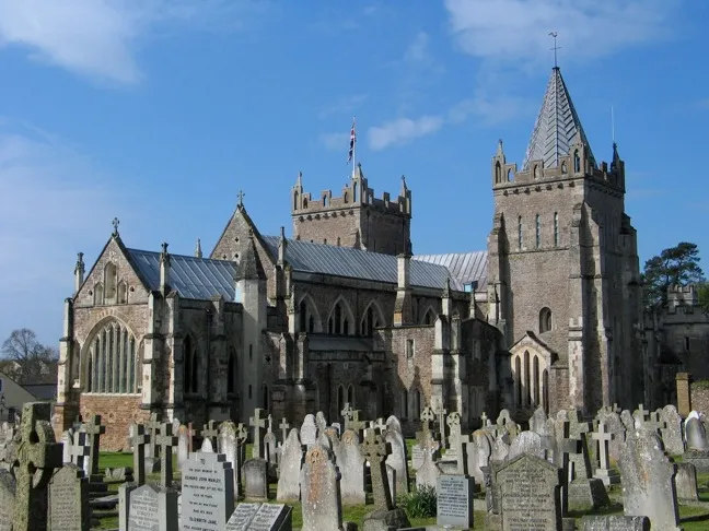
Ottery St Mary, known as "Ottery", is a town and civil parish in the East Devon district of Devon, England, on the River Otter, about 10 miles (16 km) east of Exeter on the B3174. At the 2001 census, the parish, which includes the villages of Metcombe, Fairmile, Alfington, Tipton St John, Wiggaton, and (until 2017)Read more
West Hill, had a population of 7,692. The population of the urban area alone at the 2011 census was 4,898. In 2021 the parish had a population of 7,986.
There are two electoral wards in Ottery (Rural and Town). The total population of both wards, including the adjacent civil parish of Aylesbeare, at the 2011 census was 9,022.
Ottery is home to a number of independent, local businesses which are situated on Mill Street, Silver Street and Yonder Street. An area known as 'The Square' is at the centre of the town.
Compare prices across Booking.com, Airbnb, Expedia, and more. Select your dates to see availability.
Pick your must-haves once: provider links open pre-filtered. Each filter lists which sites it applies to.
Compare before you book!
Prices can vary significantly between platforms. We recommend checking at least 2-3 sites to find the best deal for your stay in Ottery St Mary.
Discover famous landmarks, scenic roads, and more near Ottery St Mary.
Ottery St Mary offers many attractions including tourist sites, museums, parks, and local restaurants. Explore famous landmarks, scenic roads, and natural wonders on our interactive map and plan your visit.
Plan your road trip to Ottery St Mary with Plan Your Road Trips! Add Ottery St Mary as a destination, and we'll help you find the best route and discover more amazing places along the way.
Ottery St Mary is located in England, United Kingdom, Europe. The coordinates are 50.7500 latitude, -3.2667 longitude.
Ottery St Mary has a population of approximately 4,898 people, making it a town in United Kingdom.
Add to your itinerary
Start planning your road trip with Ottery St Mary as a destination. Create a custom route and discover more amazing places along the way.
Start Road TripDiscover destinations like Tinder
Swipe through stunning destinations near Ottery St Mary. Save your favourites and add them to your trip.
Essential numbers in United Kingdom
112 also works. NHS non-emergency medical advice: 111. National Highways breakdown assistance on motorways: 0300 123 5000.
Full driving guide for United Kingdom8 notable places within an hour's drive.
castle
The fortified manor of the Courtenay family since 1391, in a deer park beside the Exe estuary.
18 km · about 20 min drive
cafe
The original Bike Shed venue in Exeter's historic city centre, blending motorcycle culture with independent food and drink.
19 km · about 20 min drive
cathedral
Magnificent Gothic cathedral boasting the longest uninterrupted vaulted ceiling in England, dating back to the 12th century.
19 km · about 20 min drive
natural wonder
UNESCO World Heritage coastline stretching 95 miles from Devon to Dorset, exposing 185 million years of geological history in its dramatic cliffs.
20 km · about 25 min drive
landmark
The curving stone harbour wall at Lyme Regis, made famous by Jane Austen's Persuasion and The French Lieutenant's Woman.
23 km · about 25 min drive
scenic viewpoint
The highest point on England's south coast at 191 m, its sandstone summit glowing gold above Charmouth and Lyme Bay.
30 km · about 35 min drive
natural wonder
The most visited granite tor on Dartmoor, a pair of rounded outcrops rising above open moor with easy roadside access.
39 km · about 45 min drive
natural wonder
A weathered granite stack on Hayne Down shaped like a human head, tied to a legend of a hunter turned to stone by witches.
39 km · about 45 min drive
April to October
Other places to explore near Ottery St Mary.
Create your perfect itinerary with our calendar-based planner. Add stops, discover attractions along the way, and share your trip with friends.
Start Planning