
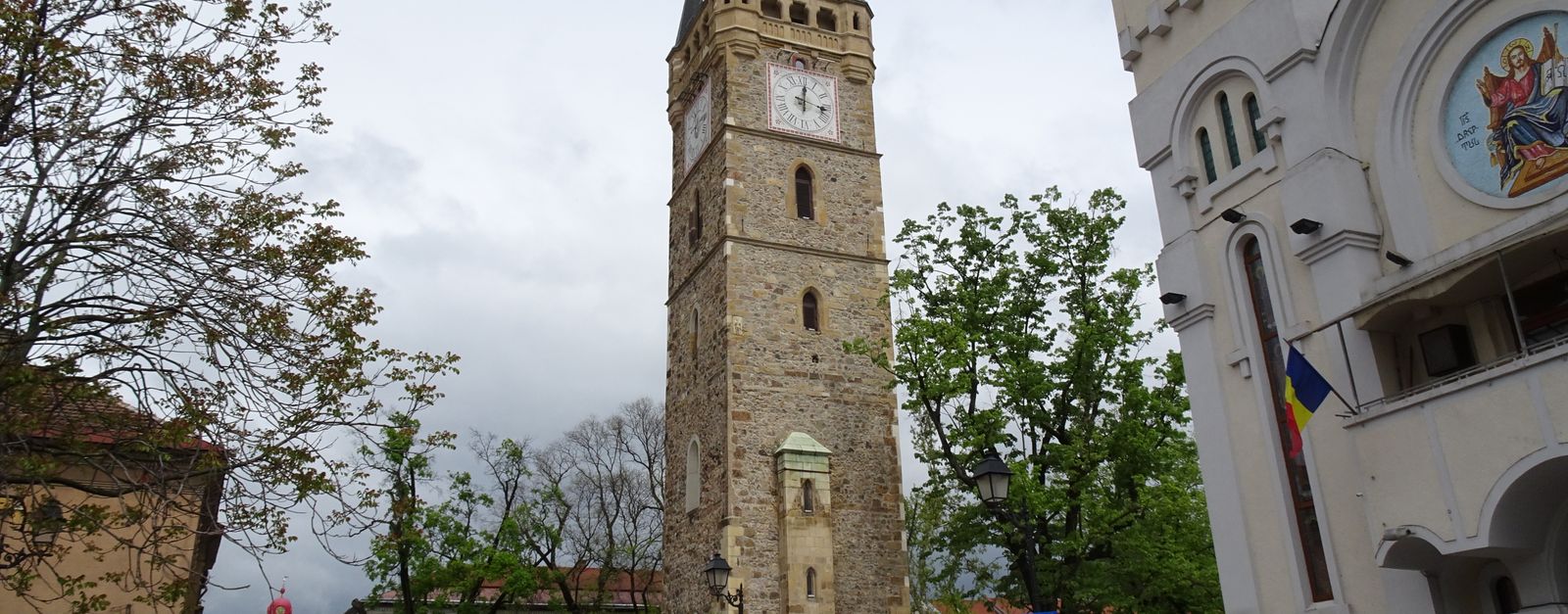

landmark
Sighișoara
A remarkably intact UNESCO-listed medieval citadel and birthplace of Vlad the Impaler, with colorful houses and a famous Clock Tower.
44 km · about 50 min drive
Mureș County, Romania · Europe
Ogra sits on the route: 10 minutes from Valea Izvoarelor, 51km from Cheile Turzii (Turda Gorge).
Ogra is a town located in Mureș County, Romania. With a population of 2,403, it is an important destination in Europe.
On a road trip, Ogra sits in Romania, where you drive on the right. It's in the Europe/Bucharest time zone. Below you'll find where to stay, things to do nearby, and everything you need to add Ogra to your route.
Ogra (Hungarian: Marosugra or colloquially Ugra, pronounced: [ˈmɒroʃuɡrɒ]) is a commune in Mureș County, Transylvania, Romania. It is composed of five villages: Dileu Vechi (Oláhdellő), Giuluș (Gyulas), Lăscud (Lackod), Ogra, and Vaideiu (Mezőújfalu).
The commune is on the Transylvanian Plateau, on the banks of theRead more
Mureș River. It is in the southwestern part of the county, 22 km (14 mi) from the county seat, Târgu Mureș. The A3 motorway connects Ogra to Brașov (Cristian), 160.1 km (99.5 mi) to the southeast and Cluj-Napoca (Gilău), 89.7 km (55.7 mi) to the northwest. The Târgu Mureș International Airport is 8.7 km (5.4 mi) to the east.
As of the 2011 census, the commune had a population of 2,387, of which 45.3% were Romanians, 29.2% Roma, and 21.3% Hungarians. At the 2021 census, Ogra had a population of 2,442; of those, 40.46% were Roma, 33.7% Romanians, and 15.85% Hungarians.
Haller Castle was originally built in the seventeenth century, although most of the current building dates from the eighteenth and nineteenth centuries, and is Post-Baroque. It was nationalized by the Communist authorities in 1949, and served for a while as a school and then town hall; since 2011 it functions as a hotel and restaurant.
The Ogra mine is a large salt mine in the commune.
Compare prices across Booking.com, Airbnb, Expedia, and more. Select your dates to see availability.
Pick your must-haves once: provider links open pre-filtered. Each filter lists which sites it applies to.
Compare before you book!
Prices can vary significantly between platforms. We recommend checking at least 2-3 sites to find the best deal for your stay in Ogra.
Discover famous landmarks, scenic roads, and more near Ogra.
Ogra offers many attractions including tourist sites, museums, parks, and local restaurants. Explore famous landmarks, scenic roads, and natural wonders on our interactive map and plan your visit.
Plan your road trip to Ogra with Plan Your Road Trips! Add Ogra as a destination, and we'll help you find the best route and discover more amazing places along the way.
Ogra is located in Mureș County, Romania, Europe. The coordinates are 46.4333 latitude, 24.3167 longitude.
Ogra has a population of approximately 2,403 people, making it a town in Romania.
Add to your itinerary
Start planning your road trip with Ogra as a destination. Create a custom route and discover more amazing places along the way.
Start Road TripDiscover destinations like Tinder
Swipe through stunning destinations near Ogra. Save your favourites and add them to your trip.
Essential numbers in Romania
Rovinieta (road tax sticker) required for all national roads.
Full driving guide for Romania4 notable places within an hour's drive.
landmark
A remarkably intact UNESCO-listed medieval citadel and birthplace of Vlad the Impaler, with colorful houses and a famous Clock Tower.
44 km · about 50 min drive
landmark
A spectacular ancient salt mine transformed into an underground theme park with a Ferris wheel, boating lake, and amphitheatre deep below the surface.
44 km · about 50 min drive
natural wonder
A limestone gorge with walls up to 300 m, walked on a path that crosses the stream on a series of bridges.
51 km · about 60 min drive
cathedral
Unique UNESCO-listed Saxon fortified churches scattered across Transylvania's rolling countryside and medieval villages.
52 km · about 60 min drive
Other places to explore near Ogra.
Create your perfect itinerary with our calendar-based planner. Add stops, discover attractions along the way, and share your trip with friends.
Start Planning