PYRTPlan Your Road Trips
Create TripCommunityMerchandise
PYRTPlan Your Road Trips
Create TripCommunityMerchandise
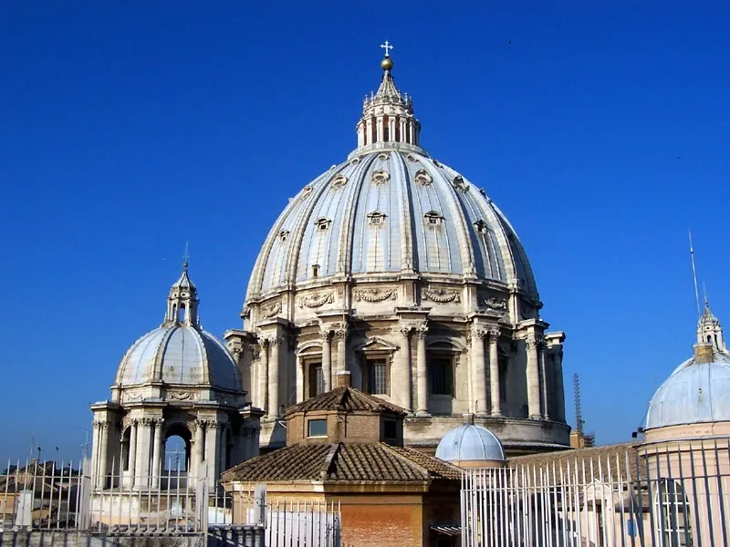
Città del Vaticano - Cupola della Basilica di S. Pietro
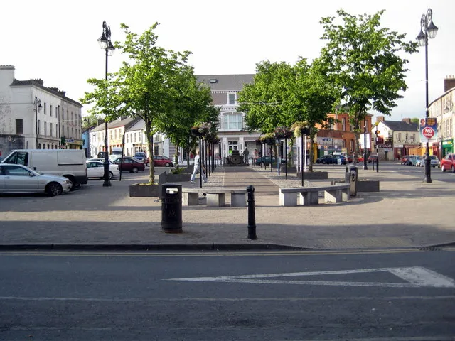
The Square, Newcastle West, Co. Limerick
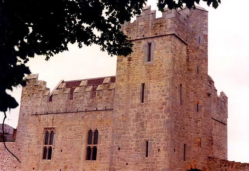
Desmond Banqueting Hall and Castle - Newcastle West's landmark feature dominates the southern of end of the Main Town Square. The banqueting hall of the Desmond Castle, seat of the Earl of Desmond, parts of which date from the 13th century, is the most notable historical feature of the town. The current Castle dates from the 15th century and during the later part of the 20th century was partly restored and is open to the public, for guided tours May to September. The guided tour is a must for locals and visitors. The area in front of the banqueting hall was the site of The Protestant Church, built in 1777.
Photo by MarkusMark
Destinations
Home›Destinations›Newcastle West
EuropeIrelandMunster

Newcastle West

Munster, Ireland · Europe

About Newcastle West

Newcastle West sits on the route: 20 minutes from Rathkeale, 57km from Bridges of Ross.

Newcastle West is a town located in Munster, Ireland. With a population of 6,619, it is an important destination in Europe.

On a road trip, Newcastle West sits in Ireland, where you drive on the left. It's in the Europe/Dublin time zone. Below you'll find where to stay, things to do nearby, and everything you need to add Newcastle West to your route.

About Newcastle West

Newcastle West (Irish: An Caisleán Nua Thiar) or simply Newcastle (An Caisleán Nua, formerly anglicised as Castlenoe) is a town in west County Limerick, Ireland. It is the largest town in the county, excluding Limerick city. It is also the county town and sits on the River Arra, which flows into the River Deel.

Read more Newcastle West is in the middle of a great bowl-shaped valley in West Limerick, known one time as the valley of the Wild Boar, apparently due to the abundance of this animal here when the area was thickly wooded. The crest of the town carries the image of a wild boar. The town is partly in the civil parish of Newcastle. Newcastle West is on the N21 road from Limerick to Tralee, between Rathkeale and Abbeyfeale. It is the second-largest urban center in the county, with a population of 7,209 in 2022.

Read more on Wikipedia

Where to Stay in Newcastle West

Compare prices across Booking.com, Airbnb, Expedia, and more. Select your dates to see availability.

Filter presets

Pick your must-haves once: provider links open pre-filtered. Each filter lists which sites it applies to.

Booking.comExpediaTripAdvisorHotels.comAgodaAirbnb

Compare before you book!

Prices can vary significantly between platforms. We recommend checking at least 2-3 sites to find the best deal for your stay in Newcastle West.

Explore the Area

Discover famous landmarks, scenic roads, and more near Newcastle West.

Loading map...
Open in Google Maps

Frequently Asked Questions

What are the best things to do in Newcastle West?

Newcastle West offers many attractions including tourist sites, museums, parks, and local restaurants. Explore famous landmarks, scenic roads, and natural wonders on our interactive map and plan your visit.

How do I plan a road trip to Newcastle West?

Plan your road trip to Newcastle West with Plan Your Road Trips! Add Newcastle West as a destination, and we'll help you find the best route and discover more amazing places along the way.

Where is Newcastle West located?

Newcastle West is located in Munster, Ireland, Europe. The coordinates are 52.4492 latitude, -9.0611 longitude.

What is the population of Newcastle West?

Newcastle West has a population of approximately 6,619 people, making it a town in Ireland.

Plan a Road Trip

Add to your itinerary

Start planning your road trip with Newcastle West as a destination. Create a custom route and discover more amazing places along the way.

Start Road Trip

What's Nearby?

Discover destinations like Tinder

Swipe through stunning destinations near Newcastle West. Save your favourites and add them to your trip.

Explore now

Quick Information

Population
6,619
Continent
Europe
Country
Ireland
Region
Munster
Timezone
Europe/Dublin
Coordinates
52.4492, -9.0611

Emergency & Services

Essential numbers in Ireland

Police
999
Ambulance
999
Fire
999
All emergencies
112
Driving side
left
Full driving guide for Ireland

Tags

EuropeIrelandMunsterTown

Worth the detour from Newcastle West

5 notable places within an hour's drive.

castle

Ross Castle

A 15th-century tower house on the shore of Lough Leane, gateway to boat trips across Killarney's lakes.

56 km · about 65 min drive

landmark

Muckross House

An elegant Victorian mansion and gardens beside Muckross Lake in Killarney National Park.

57 km · about 65 min drive

natural wonder

Bridges of Ross

A sea arch on the Loop Head peninsula — one of three originally, the others collapsed — and a renowned seabird watchpoint.

57 km · about 65 min drive

waterfall

Torc Waterfall

Beautiful 20-metre cascade in Killarney National Park, set in ancient oak woodland at the base of Torc Mountain near Muckross House.

58 km · about 65 min drive

cafe

Kate Kearney's Cottage

A historic pub and cafe at the entrance to the Gap of Dunloe in County Kerry, the traditional starting point for driving or riding through Ireland's most dramatic mountain pass.

60 km · about 70 min drive

Driving roads near Newcastle West

9 named roads, passes and coastal drives within 100km.

  • 60 kmLoop HeadWorking lighthouse on a wave-hammered peninsula tip where 60m cliffs, sea stacks and dolphins rival the Cliffs of Moher with a fraction of the crowds. The loop drive from Kilkee passes the Bridges of Ross blowholes.
  • 62 kmGap of DunloeNarrow mountain pass carved by glaciers through the MacGillycuddy's Reeks, best experienced by pony trap or on foot along its 11-kilometre length.
  • 62 kmHag's HeadThe southern end of the Cliffs of Moher, with a Napoleonic signal tower and far fewer people than the visitor centre.
  • 63 kmCliffs of Moher Coastal WalkDramatic 20km trail along the cliff edge from Hags Head to Doolin, offering ever-changing perspectives of Ireland's most famous sea cliffs.
  • 63 kmCliffs of Moher Viewing PlatformIreland's most visited natural attraction with 700-foot sea cliffs stretching for 8 miles along the Atlantic coast of County Clare.
  • 65 kmLadies ViewA celebrated panorama over the Lakes of Killarney named for Queen Victoria's ladies-in-waiting who admired it.

Driving in Ireland

Drives on
the left
Petrol
~€1.78/litre
Motorway tolls
~€2.10/100km

When to drive here

April to October

Nearby Destinations

Other places to explore near Newcastle West.

Rathkeale

🇮🇪 Ireland

12 km awayPop. 1,550

Askeaton

🇮🇪 Ireland

18 km awayPop. 1,137

Listowel

🇮🇪 Ireland

29 km awayPop. 4,820

Limerick

🇮🇪 Ireland

38 km awayPop. 94,192

Castletroy

🇮🇪 Ireland

42 km awayPop. 14,733

Ennis

🇮🇪 Ireland

44 km awayPop. 25,276

Tralee

🇮🇪 Ireland

48 km awayPop. 22,941

Killarney

🇮🇪 Ireland

53 km awayPop. 14,504

Plan a trip around Newcastle West

Ireland road trip planner

Plan a Road Trip from Newcastle West

Create your perfect itinerary with our calendar-based planner. Add stops, discover attractions along the way, and share your trip with friends.

Start Planning
PYRT

The ultimate road trip planning platform. Discover 150,000+ destinations worldwide, plan scenic routes, and create unforgettable adventures.

Inspiration

  • Discover Trips
  • Travel Guides
  • Community

The Product

  • Calendar Planner
  • Integrations
  • How It Works
  • Collaboration Mode
  • Get the App
  • Merchandise: PYRT Supply Co.
  • Become a Creator
  • Trip Marketplace

Plan Your Trip

  • Road Trip Planner
  • Famous Routes
  • Drive Times & Distances
  • Planners by Country
  • Best Road Trip Planner App
  • Discover Road Trips
  • Events
  • Travel Guides
  • How It Works
  • My Trips
  • Community Groups

Company

  • Terms of Service
  • Privacy Policy
  • Support
  • Contact Us
  • Sign In
  • Create Account

© 2026 Plan Your Road Trips. All rights reserved.

•[email protected]
Data sources:GeoNames (CC BY 4.0)•Wikimedia Commons (CC BY-SA)•Mapbox•Photography: George Lawrence