natural wonder
Valle de la Luna (La Paz)
A surreal moonscape of eroded clay spires and canyons on the outskirts of La Paz, sculpted by centuries of wind and rain.
10 km · about 20 min drive
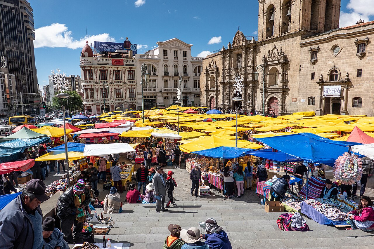
La Paz Department, Bolivia · South America
La Paz is worth a stop: 15 minutes from Achocalla, 10km from Valle de la Luna (La Paz).
La Paz is a major city located in La Paz Department, Bolivia. With a population of 2,004,652, it is one of the largest urban centers in South America.
On a road trip, La Paz sits in Bolivia. It's in the America/La Paz time zone. Below you'll find where to stay, things to do nearby, and everything you need to add La Paz to your route.
Mi Teleférico (Spanish pronunciation: [mi teleˈfeɾiko], English: My Cable Car), also known as Teleférico La Paz–El Alto (La Paz–El Alto Cable Car), is an aerial cable car urban transit system serving the La Paz–El Alto metropolitan area in Bolivia. As of October 2019, the system consists of 26 stations (36 if transferRead more
stations are counted separately per line) along ten lines: Red, Yellow, Green, Blue, Orange, White, Sky Blue, Purple, Brown, and Silver. Further lines and extensions are in planning or construction. The system is the longest aerial cable car system in the world.
Based on its master plan, the completed system, which is being built by the Doppelmayr Garaventa Group, is intended to reach a length of 33.8 km (21.0 mi) with 11 lines and 30 stations. While other urban transit cable cars like Medellín's Metrocable complement existing rapid transit systems, Mi Teleférico is the first system to use cable cars as the backbone of the urban transit network. In 2018, Mi Teleférico won a Latam Smart City Award in the category of "Sustainable urban development and mobility".
Mi Teleférico was planned in order to address a number of problems, including a precarious public transit system that could not cope with growing user demands, the high cost in time and money of traveling between La Paz and El Alto, chaotic traffic with its subsequent environmental and noise pollution, and a growing demand for gasoline and diesel fuel, which are subsidized by the state. The Red, Yellow, and Purple lines connect the neighboring cities of La Paz and El Alto, which are separated by a steep slope about 400 m (1,300 ft) tall, and which were previously only connected by winding, congested roads.
Compare prices across Booking.com, Airbnb, Expedia, and more. Select your dates to see availability.
Pick your must-haves once: provider links open pre-filtered. Each filter lists which sites it applies to.
Compare before you book!
Prices can vary significantly between platforms. We recommend checking at least 2-3 sites to find the best deal for your stay in La Paz.
Discover famous landmarks, scenic roads, and more near La Paz.
La Paz offers many attractions including tourist sites, museums, parks, and local restaurants. Explore famous landmarks, scenic roads, and natural wonders on our interactive map and plan your visit.
Plan your road trip to La Paz with Plan Your Road Trips! Add La Paz as a destination, and we'll help you find the best route and discover more amazing places along the way.
La Paz is located in La Paz Department, Bolivia, South America. The coordinates are -16.5000 latitude, -68.1500 longitude.
La Paz has a population of approximately 2,004,652 people, making it a major city in Bolivia.
Add to your itinerary
Start planning your road trip with La Paz as a destination. Create a custom route and discover more amazing places along the way.
Start Road TripDiscover destinations like Tinder
Swipe through stunning destinations near La Paz. Save your favourites and add them to your trip.
5 notable places within an hour's drive.
natural wonder
A surreal moonscape of eroded clay spires and canyons on the outskirts of La Paz, sculpted by centuries of wind and rain.
10 km · about 20 min drive
scenic viewpoint
A 6,088-meter peak near La Paz that is one of the world's most accessible 6,000-meter summits, offering glacier climbing for beginners.
26 km · about 30 min drive
famous road
Bolivia's infamous former highway drops 3,600 meters from La Paz to Coroico along narrow cliffside ledges with no guardrails.
40 km · about 45 min drive
ancient ruins
The spiritual and political center of the Tiwanaku civilization near Lake Titicaca, featuring the iconic Sun Gate, semi-subterranean temple, and precision-cut stone architecture.
56 km · about 65 min drive
scenic viewpoint
A subtropical Yungas town on a ridge at 1,700 m, the traditional finish of the Death Road descent, surrounded by coffee and coca terraces plunging into cloud-forest valleys.
57 km · about 65 min drive
Year-round
Tropical latitude: plan around the wet season rather than temperature.
Other places to explore near La Paz.
Create your perfect itinerary with our calendar-based planner. Add stops, discover attractions along the way, and share your trip with friends.
Start Planning