landmark
Caterham Cars
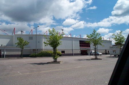
Home of the legendary Caterham Seven where visitors can see lightweight sports cars assembled and even build their own.
2 km · about 5 min drive
England, United Kingdom · Europe
Crawley works well as a base: 10 minutes from Copthorne, 22km from Hever Castle.
Crawley is a city located in England, United Kingdom. With a population of 124,008, it is an important destination in Europe.
On a road trip, Crawley sits in United Kingdom, where you drive on the left. It's in the Europe/London time zone. Below you'll find where to stay, things to do nearby, and everything you need to add Crawley to your route.
Crawley ( KRAW-lee) is a town and borough in West Sussex, England. It is 28 miles (45 km) south of London, 18 miles (29 km) north of Brighton and Hove, and 32 miles (51 km) north-east of the county town of Chichester. Crawley covers an area of 17.36 square miles (44.96 km2) and had a population of 118,493 at the timeRead more
of the 2021 Census. Southern parts of the borough lie immediately next to the High Weald National Landscape.
The area has been inhabited since the Stone Age, and was a centre of ironworking in the Iron Age and Roman times. The area was probably used by the kings of Sussex for hunting. Initially a clearing in the vast forest of the Weald, Crawley began as a settlement on the boundary of two of the sub-regions particular to Sussex, known as Rapes, the Rape of Bramber and the Rape of Lewes. Becoming a market town in 1202, Crawley developed slowly, serving the surrounding villages in the Weald. In the medieval period, its location on the main road from London to the port of Shoreham helped the town to grow; and when Brighton became a fashionable seaside town in the 18th century, the passing trade encouraged the development of coaching inns. A rail link to London and Brighton opened in 1841, encouraging further development.
After World War II, the British Government planned to move large numbers of people and jobs out of London and into new towns around South East England. The New Towns Act 1946 (9 & 10 Geo. 6. c. 68) designated Crawley as the site of one of these. A master plan was developed for the establishment of new residential, commercial, industrial and civic areas, and rapid development greatly increased the size and population of the town over a few decades. The town expanded further in 1974 to include Gatwick Airport, Britain's second busiest international airport and, in 2024, the tenth busiest in Europe.
The town contains 14 residential neighbourhoods radiating out from the core of the old market town, and separated by main roads and railway lines. The nearby communities of Ifield, Pound Hill and Three Bridges were absorbed into the new town at various stages in its development. Established in 2019, the south-western suburb of Kilnwood Vale lies outside of the borough boundary in the neighbouring district of Horsham. Economically, the town has developed into the main centre of industry and employment between London and Brighton. Its large industrial area supports manufacturing and service companies, many of them connected with the airport. The commercial and retail sectors continue to expand. In the late 20th century and early 21st century, the town has attracted a diverse and multicultural population. It is home to about two-thirds of the UK's population of Chagossians.
Compare prices across Booking.com, Airbnb, Expedia, and more. Select your dates to see availability.
Pick your must-haves once: provider links open pre-filtered. Each filter lists which sites it applies to.
Compare before you book!
Prices can vary significantly between platforms. We recommend checking at least 2-3 sites to find the best deal for your stay in Crawley.
Discover famous landmarks, scenic roads, and more near Crawley.
Crawley offers many attractions including tourist sites, museums, parks, and local restaurants. Explore famous landmarks, scenic roads, and natural wonders on our interactive map and plan your visit.
Plan your road trip to Crawley with Plan Your Road Trips! Add Crawley as a destination, and we'll help you find the best route and discover more amazing places along the way.
Crawley is located in England, United Kingdom, Europe. The coordinates are 51.1130 latitude, -0.1831 longitude.
Crawley has a population of approximately 124,008 people, making it a city in United Kingdom.
Add to your itinerary
Start planning your road trip with Crawley as a destination. Create a custom route and discover more amazing places along the way.
Start Road TripDiscover destinations like Tinder
Swipe through stunning destinations near Crawley. Save your favourites and add them to your trip.
Essential numbers in United Kingdom
112 also works. NHS non-emergency medical advice: 111. National Highways breakdown assistance on motorways: 0300 123 5000.
Full driving guide for United Kingdom8 notable places within an hour's drive.
landmark
Home of the legendary Caterham Seven where visitors can see lightweight sports cars assembled and even build their own.
2 km · about 5 min drive
scenic viewpoint
The highest point in south-east England at 294 m, its 18th-century tower taking visitors just above the 1,000-foot mark.
15 km · about 30 min drive
cafe
The hilltop cafe at the summit of Box Hill offering sweeping views across the Surrey Hills, a classic destination for drivers and cyclists alike.
18 km · about 20 min drive
scenic viewpoint
A steep chalk escarpment above the Mole valley, the Zig Zag Road on its flank made famous by the 2012 Olympic road race.
18 km · about 20 min drive
cafe
Iconic biker and cyclist cafe at the foot of Box Hill in Surrey, a must-stop gathering point on one of England's most famous riding roads.
19 km · about 20 min drive
cafe
A popular roadside cafe at the base of the Box Hill zig-zag road, serving as the unofficial meeting point for the Surrey biker community.
19 km · about 20 min drive
castle
Romantic 13th-century double-moated castle that was the childhood home of Anne Boleyn, set within award-winning gardens and a 38-acre lake.
22 km · about 25 min drive
landmark
The famous airfield test track used by BBC Top Gear for its power laps and celebrity challenges.
24 km · about 30 min drive
April to October
Other places to explore near Crawley.
Create your perfect itinerary with our calendar-based planner. Add stops, discover attractions along the way, and share your trip with friends.
Start Planning