PYRTPlan Your Road Trips
Create TripMy TripsCommunityMerchandise
PYRTPlan Your Road Trips
Create TripMy TripsCommunityMerchandise
C
Destinations
Home›Destinations›Chalampé
EuropeFranceGrand Est

Chalampé

Grand Est, France · Europe

About Chalampé

Chalampé works well as a base: 5 minutes from Rumersheim-le-Haut, 30km from Freiburg Minster.

Chalampé is a town located in Grand Est, France. With a population of 1,018, it is an important destination in Europe.

On a road trip, Chalampé sits in France, where you drive on the right. It's in the Europe/Paris time zone. Below you'll find where to stay, things to do nearby, and everything you need to add Chalampé to your route.

About Chalampé

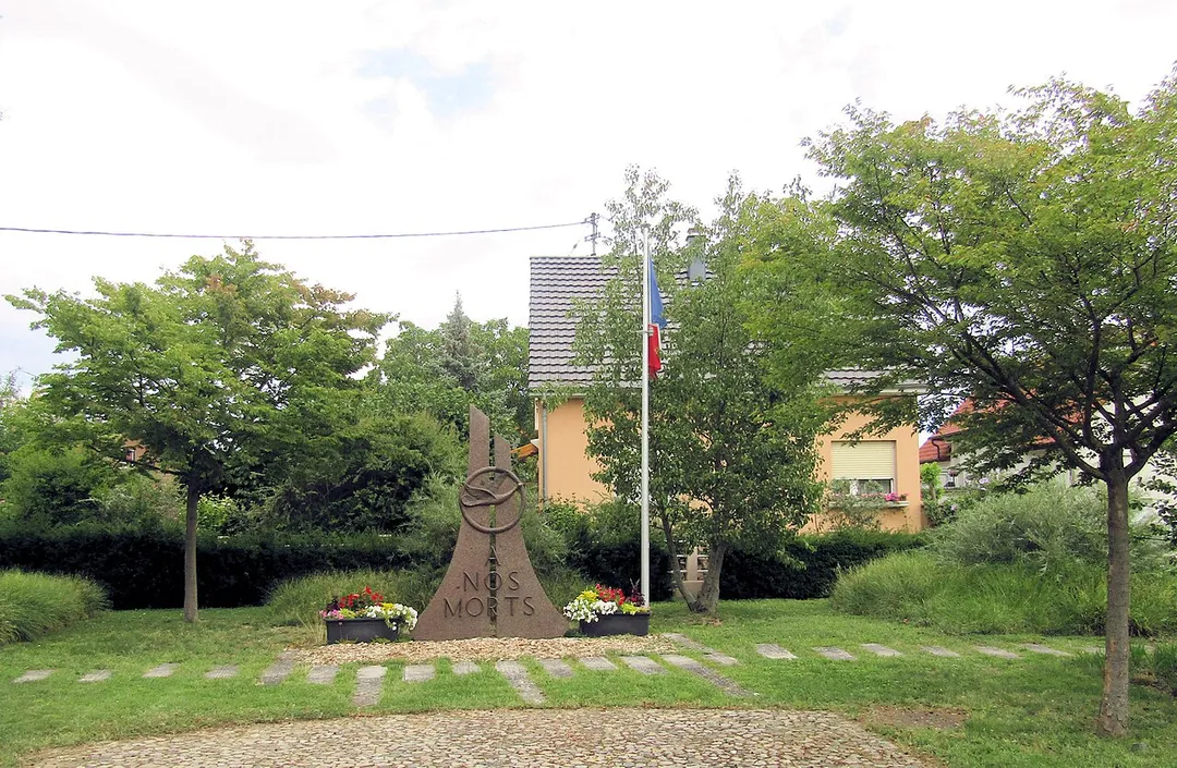
Chalampé (French pronunciation: [ʃalɑ̃pe] ; German: Eichwald) is a commune in the Haut-Rhin department in Alsace in north-eastern France, just across the river Rhine from Neuenburg, Germany. The town was founded by soldiers of Marshal Dubourg who in 1709 had beaten the Austrians under Count Claude Florimond de Mercy

Read more in the War of the Spanish Succession. It is located in an area called Eichwald (oak forest) by the otherwise German-speaking population of the Alsace and bears its French name since 1735. Before Johann Gottfried Tulla and others straightened the Rhine in the 19th century, the river had changed its course several times, moving the border. Thus, the village was sometimes considered to be part of Germany.

Read more on Wikipedia

Where to Stay in Chalampé

Compare prices across Booking.com, Airbnb, Expedia, and more. Select your dates to see availability.

Filter presets

Pick your must-haves once: provider links open pre-filtered. Each filter lists which sites it applies to.

Booking.comExpediaTripAdvisorHotels.comAgodaAirbnb

Compare before you book!

Prices can vary significantly between platforms. We recommend checking at least 2-3 sites to find the best deal for your stay in Chalampé.

Explore the Area

Discover famous landmarks, scenic roads, and more near Chalampé.

Loading map...
Open in Google Maps

Frequently Asked Questions

What are the best things to do in Chalampé?

Chalampé offers many attractions including tourist sites, museums, parks, and local restaurants. Explore famous landmarks, scenic roads, and natural wonders on our interactive map and plan your visit.

How do I plan a road trip to Chalampé?

Plan your road trip to Chalampé with Plan Your Road Trips! Add Chalampé as a destination, and we'll help you find the best route and discover more amazing places along the way.

Where is Chalampé located?

Chalampé is located in Grand Est, France, Europe. The coordinates are 47.8202 latitude, 7.5411 longitude.

What is the population of Chalampé?

Chalampé has a population of approximately 1,018 people, making it a town in France.

Plan a Road Trip

Add to your itinerary

Start planning your road trip with Chalampé as a destination. Create a custom route and discover more amazing places along the way.

Start Road Trip

What's Nearby?

Discover destinations like Tinder

Swipe through stunning destinations near Chalampé. Save your favourites and add them to your trip.

Explore now

Quick Information

Population
1,018
Continent
Europe
Country
France
Region
Grand Est
Timezone
Europe/Paris
Coordinates
47.8202, 7.5411

Emergency & Services

Essential numbers in France

Police
17
Ambulance
15
Fire
18
All emergencies
112
Driving side
right

Carrying a warning triangle and hi-vis vest in your vehicle is mandatory. Motorway emergency phones connect to official breakdown services only.

Full driving guide for France

Tags

EuropeFranceGrand EstTown

Worth the detour from Chalampé

8 notable places within an hour's drive.

museum

Cité de l'Automobile - Musée National (Collection Schlumpf)

The former Schlumpf brothers' secret collection in Mulhouse, the largest car museum in the world, with over 100 Bugattis including two Royales, hidden from the public until a factory occupation revealed it in 1977.

17 km · about 20 min drive

landmark

Basel

A cultural powerhouse at the meeting point of three countries, home to over 40 museums, a vibrant Rhine riverfront, and Art Basel.

29 km · about 35 min drive

landmark

Hartmannswillerkopf

A WWI mountain battlefield of trenches and a vast crypt overlooking the Alsace plain.

29 km · about 35 min drive

landmark

Freiburg im Breisgau

The sunny gateway to the Black Forest, with a Gothic minster, Bächle waterways in the old town, and a vibrant university atmosphere.

30 km · about 35 min drive

landmark

Basel Zoo

Switzerland's oldest and most visited zoo, affectionately known as 'Zolli', with a strong conservation focus.

30 km · about 35 min drive

landmark

Eguisheim

A concentric wine village of cobbled lanes spiralling around its castle, voted favourite village of France.

30 km · about 35 min drive

cathedral

Freiburg Minster

A red-sandstone Gothic masterpiece whose lacy openwork spire towers over a market square at the edge of the Black Forest.

30 km · about 35 min drive

landmark

Colmar Old Town

A fairy-tale Alsatian town with brilliantly colored half-timbered houses along the canals of its 'Little Venice' quarter.

32 km · about 35 min drive
Driving roads near Chalampé

  • 34 kmGrand BallonThe highest summit of the Vosges at 1424 m, crowning the Route des Crêtes with all-round Alsace views.
  • 35 kmFeldbergThe Black Forest's highest summit at 1,493 m offers Alps-to-Vosges panoramas and a chairlift up to the windswept ridge.
  • 40 kmRoute des Vins d'AlsaceA 170 km wine road threading flower-decked villages and vine-clad hills below the Vosges mountains.
  • 43 kmAlsace Wine RouteA 170-kilometer scenic wine road winding through vine-covered hills and storybook villages from Marlenheim to Thann.
  • 52 kmBallon d'Alsace SummitGrassy 1,247 m summit at the meeting point of Alsace, Lorraine and Franche-Comte, reached by a classic hairpinned climb first raced in the 1905 Tour de France; views stretch to Mont Blanc on clear days.
  • 69 kmMont Sainte-OdileClifftop abbey at 764 m on a Vosges spur, Alsace's holiest site, with terrace views across the Rhine plain and the mysterious 10-km 'Pagan Wall' megalithic enclosure in the woods below.

Driving in France

Drives on
the right
Petrol
~€1.85/litre
Motorway tolls
~€10.00/100km

When to drive here

April to October

Nearby Destinations

Other places to explore near Chalampé.

Neuenburg am Rhein

🇩🇪 Germany

2 km awayPop. 11,682

Bantzenheim

🇫🇷 France

2 km awayPop. 1,649

Rumersheim-le-Haut

🇫🇷 France

4 km awayPop. 1,050

Ottmarsheim

🇫🇷 France

4 km awayPop. 2,018

Auggen

🇩🇪 Germany

6 km awayPop. 2,404

Müllheim

🇩🇪 Germany

7 km awayPop. 18,097

Blodelsheim

🇫🇷 France

7 km awayPop. 1,468

Schliengen

🇩🇪 Germany

8 km awayPop. 5,208

Plan a trip around Chalampé

France road trip planner

Plan a Road Trip from Chalampé

Create your perfect itinerary with our calendar-based planner. Add stops, discover attractions along the way, and share your trip with friends.

Start Planning
PYRT

The ultimate road trip planning platform. Discover 150,000+ destinations worldwide, plan scenic routes, and create unforgettable adventures.

Inspiration

  • Discover Trips
  • Travel Guides
  • Community

The Product

  • Calendar Planner
  • Integrations
  • How It Works
  • Collaboration Mode
  • Get the App
  • Merchandise: PYRT Supply Co.
  • Become a Creator
  • Trip Marketplace

Plan Your Trip

  • Road Trip Planner
  • Famous Routes
  • Planners by Country
  • Best Road Trip Planner App
  • Discover Road Trips
  • Events
  • Travel Guides
  • How It Works
  • My Trips
  • Community Groups

Company

  • Terms of Service
  • Privacy Policy
  • Support
  • Contact Us
  • Sign In
  • Create Account

© 2026 Plan Your Road Trips. All rights reserved.

•[email protected]
Data sources:GeoNames (CC BY 4.0)•Wikimedia Commons (CC BY-SA)•Mapbox•Photography: George Lawrence