
landmark
Kinderdijk Windmills
UNESCO World Heritage site featuring 19 iconic 18th-century windmills in a quintessential Dutch polder landscape.
10 km · about 20 min drive
South Holland, Netherlands · Europe
Bleskensgraaf works well as a base: 10 minutes from Bergstoep, 14km from Biesbosch National Park.
Bleskensgraaf is a town located in South Holland, Netherlands. With a population of 2,800, it is an important destination in Europe.
On a road trip, Bleskensgraaf sits in Netherlands, where you drive on the right. It's in the Europe/Amsterdam time zone. Below you'll find where to stay, things to do nearby, and everything you need to add Bleskensgraaf to your route.
Bleskensgraaf is a town in the Dutch province of South Holland. It is a part of the municipality of Molenlanden, and lies about 10 km northeast of Dordrecht. It has an area of 1272 hectares. On 1 January 2009 Bleskensgraaf and Hofwegen had 2797 inhabitants in 936 residences.
Until 1855, Bleskensgraaf was a separateRead more
municipality. In 1855 the heerlijkheid or seigniory Bleskensgraaf and the heerlijkheid or seigniory 'Hofwegen' merged into one municipality named 'Bleskensgraaf and Hofwegen'. In 1986 it became the new municipality Graafstroom together with 6 adjacent towns. The town hall of Graafstroom was located in Bleskensgraaf. From 2013 Graafstroom was part of Molenwaard, till 2019 when it merged into Molenlanden.
The town got its name because of the landlord (count) "Willem van Blassekijn". Over the years the name Blassekijnsgraeve changed into Bleskensgraaf.
On letters it often says "Bleskensgraaf CA". CA stands for the Latin phrase 'cum annexis' which means 'with surroundings'.
The centre of Bleskensgraaf is made up out of new buildings. The old centre was bombarded during the Second World War at 06:25 on 12 May 1940. Seven people died and forty houses were destroyed. The town hall was leveled and the church sustained irreparable damage. The reconstruction was fast and took a couple of years. In September 1948 the new church officially opened and the new town hall opened on 12 May 1955.
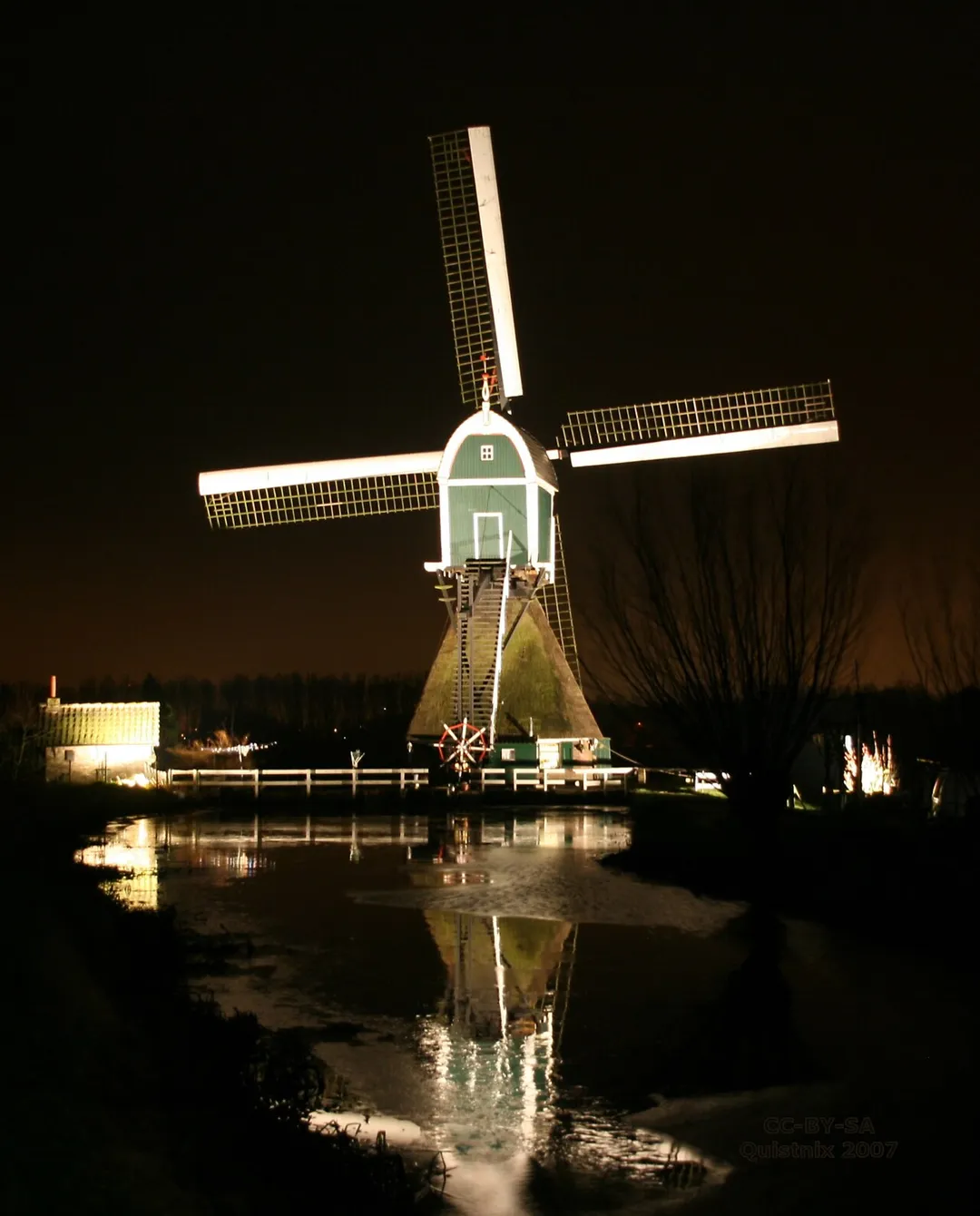
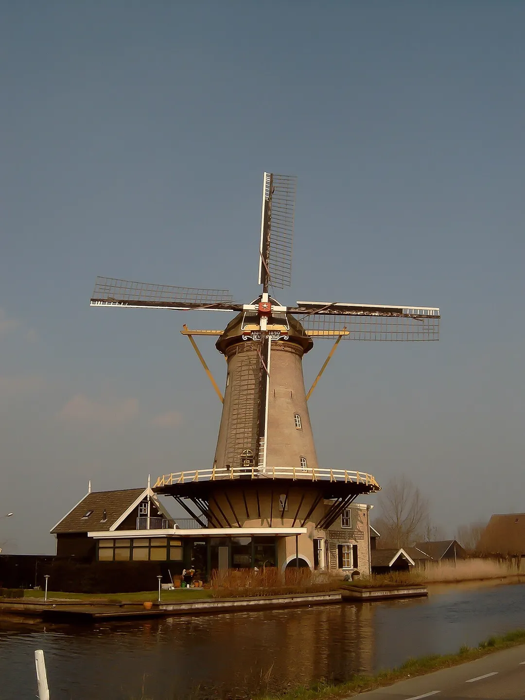
Old buildings that remain are a couple of windmills: the flour mill 'Molen de Vriendschap' (Friendship Mill) built in 1890 and two Hollow post mills, named the 'Hofwegense Molen' and the 'Wingerdse Molen' built in 1513, and many old farmhouses.
Compare prices across Booking.com, Airbnb, Expedia, and more. Select your dates to see availability.
Pick your must-haves once: provider links open pre-filtered. Each filter lists which sites it applies to.
Compare before you book!
Prices can vary significantly between platforms. We recommend checking at least 2-3 sites to find the best deal for your stay in Bleskensgraaf.
Discover famous landmarks, scenic roads, and more near Bleskensgraaf.
Bleskensgraaf offers many attractions including tourist sites, museums, parks, and local restaurants. Explore famous landmarks, scenic roads, and natural wonders on our interactive map and plan your visit.
Plan your road trip to Bleskensgraaf with Plan Your Road Trips! Add Bleskensgraaf as a destination, and we'll help you find the best route and discover more amazing places along the way.
Bleskensgraaf is located in South Holland, Netherlands, Europe. The coordinates are 51.8725 latitude, 4.7833 longitude.
Bleskensgraaf has a population of approximately 2,800 people, making it a town in Netherlands.
Add to your itinerary
Start planning your road trip with Bleskensgraaf as a destination. Create a custom route and discover more amazing places along the way.
Start Road TripDiscover destinations like Tinder
Swipe through stunning destinations near Bleskensgraaf. Save your favourites and add them to your trip.
Essential numbers in Netherlands
Watch for cyclists. They generally have priority.
Full driving guide for Netherlands8 notable places within an hour's drive.
landmark
UNESCO World Heritage site featuring 19 iconic 18th-century windmills in a quintessential Dutch polder landscape.
10 km · about 20 min drive
national park
Freshwater tidal wetland of creeks and willow forest between Dordrecht and Werkendam, with visitor centres and car parks.
14 km · about 25 min drive
landmark
Piet Blom's tilted yellow cube houses are the quirky landmark of Rotterdam's bold post-war architecture scene.
21 km · about 25 min drive
bridge
Rotterdam's swan-necked cable-stayed bridge soars over the Maas, a striking modern icon glowing over the river at night.
21 km · about 25 min drive
landmark
Enchanting Dutch fairy-tale theme park with immersive storytelling, dark rides, and world-class roller coasters.
31 km · about 35 min drive
castle
The Netherlands' largest castle, a turreted neo-Gothic fairytale with moats and formal gardens near Utrecht.
31 km · about 35 min drive
landmark
The cobbled heart of Vermeer's Delft, framed by the New Church tower and Renaissance town hall above the famous blue pottery.
33 km · about 40 min drive
cathedral
The Netherlands' tallest church tower at 112 metres, standing detached from its cathedral in central Utrecht.
34 km · about 40 min drive
4 named roads, passes and coastal drives within 150km.
April to October
Other places to explore near Bleskensgraaf.
Create your perfect itinerary with our calendar-based planner. Add stops, discover attractions along the way, and share your trip with friends.
Start Planning