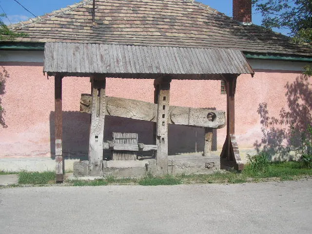
Bakonycsernye sits on the route: 10 minutes from Súr, 31km from Bory Castle.
Bakonycsernye is a town located in Fejér, Hungary. With a population of 3,177, it is an important destination in Europe.
On a road trip, Bakonycsernye sits in Hungary, where you drive on the right. It's in the Europe/Budapest time zone. Below you'll find where to stay, things to do nearby, and everything you need to add Bakonycsernye to your route.
About Bakonycsernye
Bakonycsernye (Slovak: Čerňa) is a village in Fejér County, Hungary.
Bakonycsernye is located in the valley of the Gaja stream, at the northeastern edge of the Transdanubian range of mountains. The settlement stretches some five kilometres into the valley forming the present village, with a population of around 3300.Read more Historians and linguists etymologically derive the name of the settlement from the Slavic word of ’cserny’, meaning ’black’. The anterior constituent, the word ’Bakony’ was added to the settlement's name in 1913, when administrative changes were introduced all over the country. Formerly the settlement had been registered as Csernye, by which it is still colloquially known. It was part of Veszprém County until April 1, 1956, the time, when the village was annexed to the Mór District of Fejér County.
Archeological finds from the area indicate that it has been inhabited since as early as the New Stone and the Iron Ages, also indications it was a settlement of significance in the period of the Romans as well. The medieval Csernye was first mentioned in 1341. During the period of Ottoman Conquest of Hungary, Csernye underwent a period of depopulation and its development was halted. Resettlement took place in several stages from 1724 to 1726. The new settlers were Slovaks from the counties of Nyitra and Zólyom of the Old Upper Hungary, who in addition to their mother tongue, the Slovak language, also brought with them new skills and occupations including the basics of forestry and viniculture. The local gentry in this period were the members of the Zichy family, who granted the inhabitants the free practice of their Lutheran religion and built a church and a school for the inhabitants of the village. The settlement prospered during this period and in 1730 the number of inhabitants numbered 300. The first stone church of the settlement was built in 1785.
It was in 1862 that part of the village was destroyed by a great fire. The pews in the Lutheran church, still in use today, were acquired when the church was rebuilt after the fire. The second half of the 19th century saw due to bad weather conditions crop failure and many inhabitants of the village had to switch to crafts. Weaving, spinning and basketry gained importance and the baskets made in Csernye became well known all over the Transdanubian. In 1920 coal mining began in the area of Bakonycsernye and a narrow-gauge railway line was constructed in the vicinity for coal transport. Consequently, Bakonycsernye turned into a mining village. Electricity was introduced, a village pharmacy, a doctor's surgery opened at Bakonycsernye and in the Gaja valley several water mills were constructed; another coal mine at Balinka opened in 1950 and many inhabitants of Bakonycsernye took up job opportunities in this mine.
Today a cultural centre, a library and a music school serve the educational and cultural needs of the inhabitants. In addition to two kindergartens the village also boasts a school building. The sports hall of the village school covers an area of 800 square metres and it can be used all the year round. During the local elections of 1994 the local government of the Slovak minority was elected. It is their task to cherish the Slovak language and traditions. In order to keep the old cultural traditions alive they built a Slovak Cultural Centre in the village.
The ruins of the 15th century Csikling castle can be found approx 4 kilometres from Bakonycsernye. Other important sights in the village include the Lutheran and the Catholic churches, both built in Baroque style. The village also boast several early 19th century porched cottages. Infrastructurally Bakonycsernye can offer favourable conditions. Its houses are equipped with electricity, gas, running water as well as modern telecommunication network systems area also built into the village. The local government inaugurated the settlement's coat of arms and flag in 1997. The inhabitants of the village do a lot in order to create and improve the local conditions for village tourism at Bakonycsernye. The number of houses offering accommodation has lately been on the increase. Visitors and tourists to the area can enjoy the picturesque woodlands of the Bakony region, the clean air of the forests and the well-marked local tour paths.
Bakonycsernye offers many attractions including tourist sites, museums, parks, and local restaurants. Explore famous landmarks, scenic roads, and natural wonders on our interactive map and plan your visit.
How do I plan a road trip to Bakonycsernye?
Plan your road trip to Bakonycsernye with Plan Your Road Trips! Add Bakonycsernye as a destination, and we'll help you find the best route and discover more amazing places along the way.
Where is Bakonycsernye located?
Bakonycsernye is located in Fejér, Hungary, Europe. The coordinates are 47.3240 latitude, 18.0751 longitude.
What is the population of Bakonycsernye?
Bakonycsernye has a population of approximately 3,177 people, making it a town in Hungary.
Plan a Road Trip
Add to your itinerary
Start planning your road trip with Bakonycsernye as a destination. Create a custom route and discover more amazing places along the way.
A romantic castle in Székesfehérvár built almost single-handedly over 40 summers by sculptor-architect Jenő Bory as a monument to his wife: towers, courtyards and studios crammed with the couple's paintings and statues.
31 km · about 35 min drive
landmark
Pannonhalma Archabbey
A 1,000-year-old Benedictine monastery on a hill with a Gothic basilica and ancient library, near Gyor.
35 km · about 40 min drive
scenic viewpoint
Tihany Peninsula, Lake Balaton
A lavender-scented peninsula with an abbey perched over Central Europe's largest lake, ringed by a scenic drive.
48 km · about 55 min drive
photogenic
Hegyestű Geological Visitor Site
A quarried-open basalt volcano near Monoszló above Lake Balaton: a 50 m wall of vertical polygonal columns showing the inside of an 8-million-year-old eruption, with Káli Basin views from the rim.
58 km · about 65 min drive
Driving roads near Bakonycsernye
48 kmTihany Peninsula, Lake BalatonA lavender-scented peninsula with an abbey perched over Central Europe's largest lake, ringed by a scenic drive.
74 kmBalaton North Shore Drive (Route 71)Route 71 hugs Lake Balaton's northern shore beneath volcanic hills and vineyards, linking Balatonfured, Tihany and Badacsony in one of Central Europe's finest lakeside drives.
75 kmFisherman's BastionA fairy-tale neo-Romanesque terrace on Castle Hill offering the most iconic panoramic views over Budapest and the Danube.