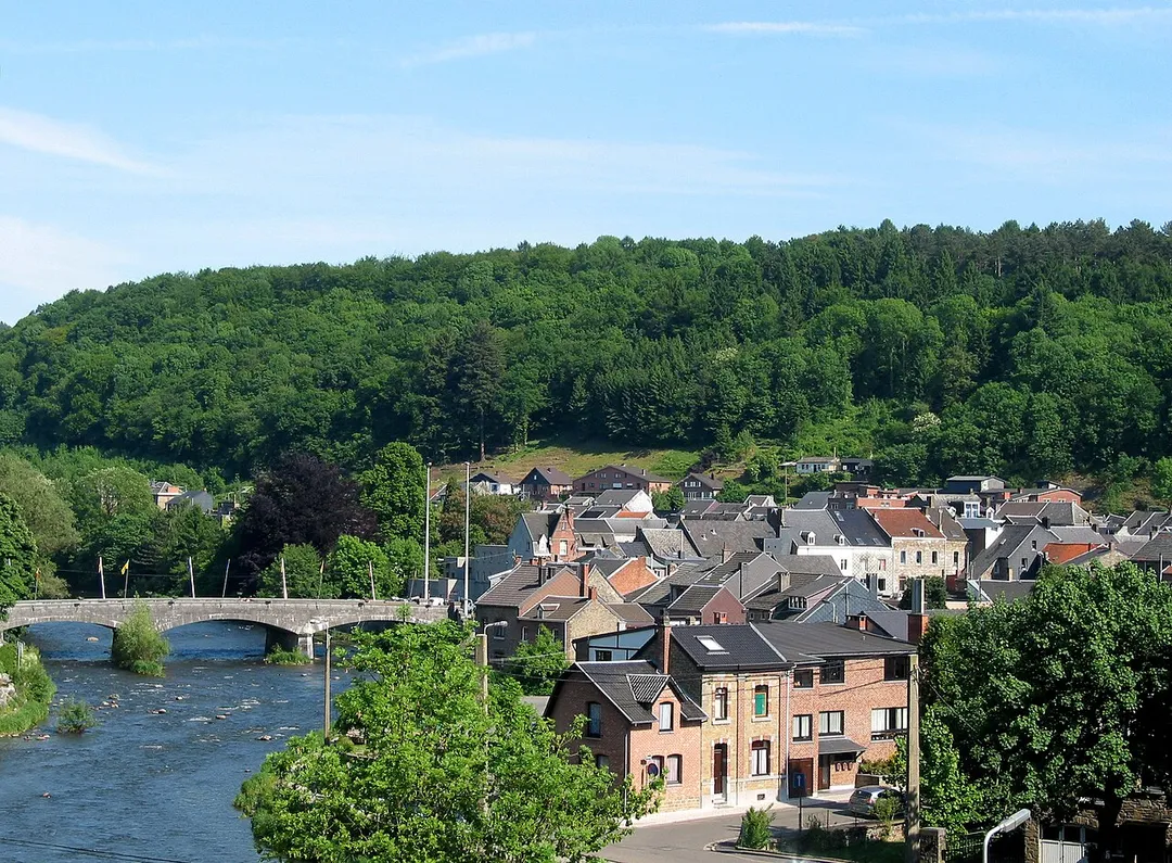
Aywaille works well as a base: 5 minutes from Harzé, 5km from Ninglinspo Valley.
Aywaille is a town located in Wallonia, Belgium. With a population of 10,636, it is an important destination in Europe.
On a road trip, Aywaille sits in Belgium, where you drive on the right. It's in the Europe/Brussels time zone. Below you'll find where to stay, things to do nearby, and everything you need to add Aywaille to your route.
About Aywaille
Aywaille (French pronunciation: [ɛwaj]; Walloon: Aiwêye) is a municipality of Wallonia located in the province of Liège, Belgium.
On 1 January 2012, Aywaille had a total population of 11,697. The total area is 80.04 km2 which gives a population density of 146 inhabitants per km2. Its area consists of 45.7% of woodedRead more and wild country, 29.9% of agricultural areas and 24.4% of built-up areas.
The inhabitants of Aywaille are called the "Aqualiens", from the Latin version of Aywaille "Aqualia loca", which means "area full of water" or "muddy land".
The municipality consists of the following districts: Aywaille, Ernonheid, Harzé, and Sougné-Remouchamps. They include many villages as Aywaille, Awan, Chambralles, Deigné, Ernonheid, Paradis, Houssonloge, Pouhon, Harzé, Havelange, Kin, Stoqueu, Martinrive, Nonceveux, Playe, Quarreux, Sedoz, Septroux, Sougné, Remouchamps, Ville-au-Bois.
Aywaille offers many attractions including tourist sites, museums, parks, and local restaurants. Explore famous landmarks, scenic roads, and natural wonders on our interactive map and plan your visit.
How do I plan a road trip to Aywaille?
Plan your road trip to Aywaille with Plan Your Road Trips! Add Aywaille as a destination, and we'll help you find the best route and discover more amazing places along the way.
Where is Aywaille located?
Aywaille is located in Wallonia, Belgium, Europe. The coordinates are 50.4741 latitude, 5.6768 longitude.
What is the population of Aywaille?
Aywaille has a population of approximately 10,636 people, making it a town in Belgium.
Plan a Road Trip
Add to your itinerary
Start planning your road trip with Aywaille as a destination. Create a custom route and discover more amazing places along the way.
Belgium's only true mountain stream, tumbling through the Aywaille woods in a chain of red-rock cascades and natural bathing pools with names like 'Bain de Diane'; the trail starts directly at the Sedoz roadside parking.
5 km · about 10 min drive
museum
Stavelot Abbey
A 1,000-year-old abbey minutes from Spa-Francorchamps housing the circuit's official racing museum, with historic F1 and endurance cars in its vaulted cellars.
20 km · about 25 min drive
racetrack
Circuit de Spa-Francorchamps
Home of the Belgian Grand Prix, featuring the legendary Eau Rouge corner
21 km · about 25 min drive
landmark
Durbuy
Billed as the smallest town in the world, a cluster of grey-stone houses and a castle in a green Ardennes valley.
21 km · about 25 min drive
scenic viewpoint
Gileppe Dam
A 19th-century dam near Spa crowned by a 13-ton stone lion, with a 78 m panorama tower and forested Ardennes reservoir views a short detour off the Verviers road.
24 km · about 30 min drive
mountain pass
Baraque de Fraiture
Belgium's second-highest point at 652 m, a windswept Ardennes plateau crossroads on the N89 with a small ski station and sweeping high-fen scenery.
25 km · about 30 min drive
national park
Hautes Fagnes
Belgium's highest, wildest plateau of peat bog and boardwalk trails, often the snowiest corner of the country.
29 km · about 35 min drive
scenic viewpoint
Signal de Botrange
At 694m this is the highest point in Belgium, marked by a stone tower on the Hautes Fagnes plateau.
29 km · about 35 min drive
Driving roads near Aywaille
5 named roads, passes and coastal drives within 150km.
24 kmGileppe DamA 19th-century dam near Spa crowned by a 13-ton stone lion, with a 78 m panorama tower and forested Ardennes reservoir views a short detour off the Verviers road.
25 kmBaraque de FraitureBelgium's second-highest point at 652 m, a windswept Ardennes plateau crossroads on the N89 with a small ski station and sweeping high-fen scenery.
29 kmSignal de BotrangeAt 694m this is the highest point in Belgium, marked by a stone tower on the Hautes Fagnes plateau.
39 kmVaalserberg DrielandenpuntThe Netherlands' highest mainland point at 322.4 metres, where the Dutch, Belgian and German borders meet near Vaals.