landmark
Golden Roof (Goldenes Dachl)
Innsbruck's most famous landmark, a late-Gothic oriel window with 2,657 fire-gilded copper tiles built for Emperor Maximilian I.
3 km · about 5 min drive
Tyrol, Austria · Europe
Arzl works well as a base: 5 minutes from Innsbruck, 28km from Achensee.
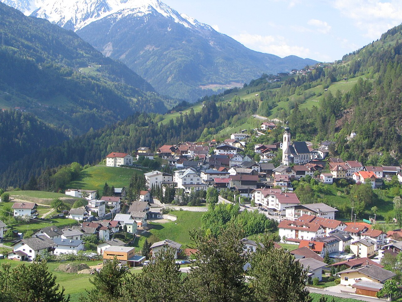
Arzl is a town located in Tyrol, Austria. With a population of 11,082, it is an important destination in Europe.
On a road trip, Arzl sits in Austria, where you drive on the right. It's in the Europe/Vienna time zone. Below you'll find where to stay, things to do nearby, and everything you need to add Arzl to your route.
The Sill is a 43-kilometre-long (27 mi) river in Tyrol, Austria. It is one of the larger tributaries of the Inn, joining it from the right bank in Tyrol. It flows north through the Wipptal to Innsbruck. Its source lies east of the Brenner Pass. At the Sillzwickel - the name of the point where it meets the Inn atRead more
Innsbruck - there is a recreation area with cycling trails.
The Viggarbach merges with it in Schönberg im Stubaital.
The natural river basin is 853 km2 (329 sq mi); 31.6 km2 (12.2 sq mi) are covered by glacier ice.
The water power generated by the river flow is used for three power plants.
Waterfalls on the river include the Sill Fall, which has a height of about 4 metres (13 ft), and from where water is taken out for urban use. In the fall basin, fishes such as trouts can be found. The Bretterkeller waterfall is located at the bottom of the Paschberg in Innsbruck.
The Sill features prominently in the stories Amras and Der Wetterfleck by the Austrian writer Thomas Bernhard.
Compare prices across Booking.com, Airbnb, Expedia, and more. Select your dates to see availability.
Pick your must-haves once: provider links open pre-filtered. Each filter lists which sites it applies to.
Compare before you book!
Prices can vary significantly between platforms. We recommend checking at least 2-3 sites to find the best deal for your stay in Arzl.
Discover famous landmarks, scenic roads, and more near Arzl.
Arzl offers many attractions including tourist sites, museums, parks, and local restaurants. Explore famous landmarks, scenic roads, and natural wonders on our interactive map and plan your visit.
Plan your road trip to Arzl with Plan Your Road Trips! Add Arzl as a destination, and we'll help you find the best route and discover more amazing places along the way.
Arzl is located in Tyrol, Austria, Europe. The coordinates are 47.2833 latitude, 11.4333 longitude.
Arzl has a population of approximately 11,082 people, making it a town in Austria.
Add to your itinerary
Start planning your road trip with Arzl as a destination. Create a custom route and discover more amazing places along the way.
Start Road TripDiscover destinations like Tinder
Swipe through stunning destinations near Arzl. Save your favourites and add them to your trip.
Essential numbers in Austria
Motorway vignette required. ÖAMTC roadside assistance: 120.
Full driving guide for Austria8 notable places within an hour's drive.
landmark
Innsbruck's most famous landmark, a late-Gothic oriel window with 2,657 fire-gilded copper tiles built for Emperor Maximilian I.
3 km · about 5 min drive
landmark
Alpine capital of Tyrol surrounded by dramatic peaks, with the Golden Roof, imperial palace, and Olympic ski jumps.
4 km · about 5 min drive
scenic viewpoint
A futuristic Zaha Hadid-designed ski jump tower above Innsbruck with a panoramic café offering views over the city and surrounding Alps.
5 km · about 10 min drive
landmark
Ten minutes from Innsbruck yet skipped by nearly everyone, Hall preserves North Tyrol's largest intact medieval old town and the mint at Hasegg Castle that struck the world's first thaler coins.
6 km · about 10 min drive
scenic viewpoint
A dramatic 2,334-metre Alpine ridge accessible by cable car directly from Innsbruck's city centre, offering world-class views of the Inn Valley.
7 km · about 10 min drive
bridge
The 190 m high, 815 m long motorway bridge carrying the Brenner Autobahn over the Sill gorge south of Innsbruck, for decades Europe's highest bridge and still an icon of Alpine engineering.
9 km · about 20 min drive
museum
A surreal crystal art park and museum near Innsbruck, fronted by a glittering water-spouting giant.
13 km · about 25 min drive
natural wonder
Tyrol's largest lake, a pristine fjord-like alpine jewel between the Karwendel and Rofan mountain ranges, perfect for sailing and diving.
28 km · about 30 min drive
14 named roads, passes and coastal drives within 60km.
April to October
Other places to explore near Arzl.
Create your perfect itinerary with our calendar-based planner. Add stops, discover attractions along the way, and share your trip with friends.
Start Planning