PYRTPlan Your Road Trips
Create TripMy TripsCommunityMerchandise
PYRTPlan Your Road Trips
Create TripMy TripsCommunityMerchandise
A
Destinations
Home›Destinations›Annahilt
EuropeUnited KingdomNorthern Ireland

Annahilt

Northern Ireland, United Kingdom · Europe

About Annahilt

Annahilt works well as a base: 10 minutes from Hillsborough, 24km from Tollymore Forest Park.

Annahilt is a town located in Northern Ireland, United Kingdom. With a population of 1,170, it is an important destination in Europe.

On a road trip, Annahilt sits in United Kingdom, where you drive on the left. It's in the Europe/London time zone. Below you'll find where to stay, things to do nearby, and everything you need to add Annahilt to your route.

About Annahilt

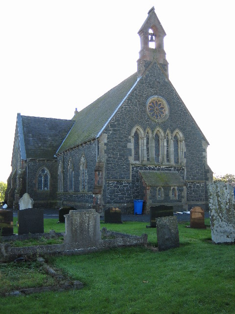
Annahilt / Anahilt (from Irish Eanach Eilte) is a village and civil parish in north County Down, Northern Ireland. It is 7.5 miles (12 kilometres) south of Lisburn, and about 14 miles south-west of Belfast, on the main road between Ballynahinch and Hillsborough. In the 2021 census, the village had a population of

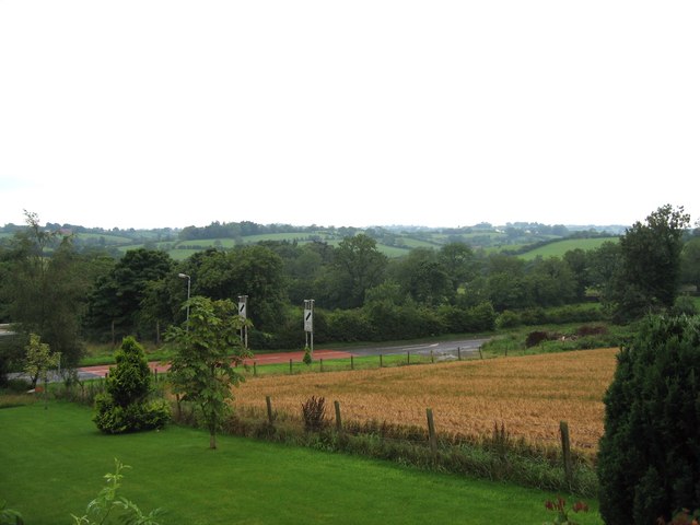
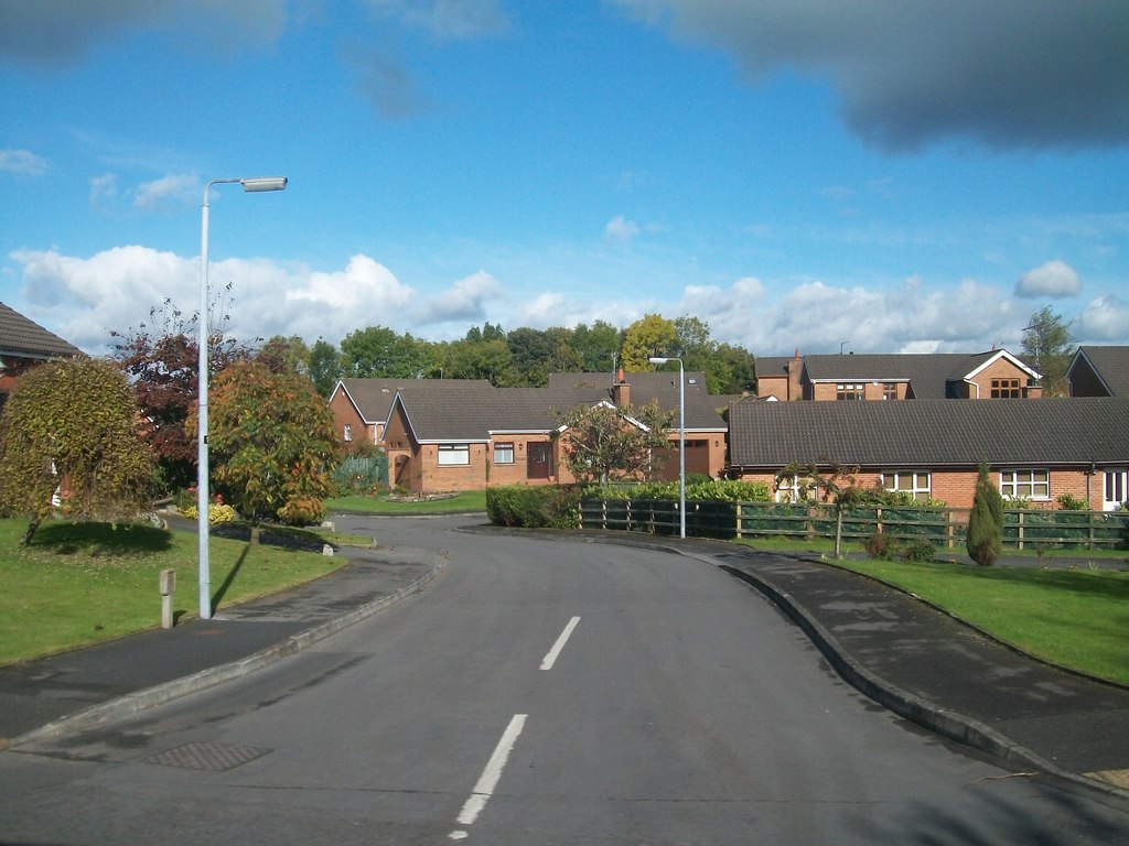
Read more 1,034. Annahilt has a distinctive drumlin setting, with a small wooded estate on a ridge to the west. Annahilt has a primary school, hair dressers, Scout Hall, an Orange Hall and a play park. There is also a business park to the north, on the Glebe Road. Annahilt also has a caravan site, known as the 'Lakeside View Caravan Park', on the Magheraconluce Road.

Read more on Wikipedia

Where to Stay in Annahilt

Compare prices across Booking.com, Airbnb, Expedia, and more. Select your dates to see availability.

Filter presets

Pick your must-haves once: provider links open pre-filtered. Each filter lists which sites it applies to.

Booking.comExpediaTripAdvisorHotels.comAgodaAirbnb

Compare before you book!

Prices can vary significantly between platforms. We recommend checking at least 2-3 sites to find the best deal for your stay in Annahilt.

Explore the Area

Discover famous landmarks, scenic roads, and more near Annahilt.

Loading map...
Open in Google Maps

Frequently Asked Questions

What are the best things to do in Annahilt?

Annahilt offers many attractions including tourist sites, museums, parks, and local restaurants. Explore famous landmarks, scenic roads, and natural wonders on our interactive map and plan your visit.

How do I plan a road trip to Annahilt?

Plan your road trip to Annahilt with Plan Your Road Trips! Add Annahilt as a destination, and we'll help you find the best route and discover more amazing places along the way.

Where is Annahilt located?

Annahilt is located in Northern Ireland, United Kingdom, Europe. The coordinates are 54.4333 latitude, -6.0000 longitude.

What is the population of Annahilt?

Annahilt has a population of approximately 1,170 people, making it a town in United Kingdom.

Plan a Road Trip

Add to your itinerary

Start planning your road trip with Annahilt as a destination. Create a custom route and discover more amazing places along the way.

Start Road Trip

What's Nearby?

Discover destinations like Tinder

Swipe through stunning destinations near Annahilt. Save your favourites and add them to your trip.

Explore now

Quick Information

Population
1,170
Continent
Europe
Country
United Kingdom
Region
Northern Ireland
Timezone
Europe/London
Coordinates
54.4333, -6.0000

Emergency & Services

Essential numbers in United Kingdom

Police
999
Ambulance
999
Fire
999
Non-emergency police
101
Driving side
left

112 also works. NHS non-emergency medical advice: 111. National Highways breakdown assistance on motorways: 0300 123 5000.

Full driving guide for United Kingdom

Tags

EuropeUnited KingdomNorthern IrelandTown

Worth the detour from Annahilt

8 notable places within an hour's drive.

historic highway

Dundrod Circuit

A 11.9km loop of Northern Irish country lanes still used for the Ulster Grand Prix motorcycle races, with jumps, stone walls and hedges inches from the racing line. Open public roads the rest of the year.

17 km · about 20 min drive

museum

Titanic Belfast

World-leading visitor attraction in a striking angular building on the exact spot where RMS Titanic was designed, built and launched in 1912.

20 km · about 25 min drive

national park

Tollymore Forest Park

Northern Ireland's first state forest park at the foot of the Mourne Mountains, with Gothic arches, ancient trees and Game of Thrones filming locations.

24 km · about 30 min drive

historic highway

Craigantlet Hillclimb

A hillclimb on public roads in the hills above Belfast, running since 1946 and closed to traffic only on event days. The narrow climb gives long views over Belfast Lough.

24 km · about 30 min drive

museum

Ulster Transport Museum

Major transport museum at Cultra near Belfast, home to a gull-winged DeLorean DMC-12 built just miles away, Irish-built cars, locomotives and a renowned Titanic exhibition.

28 km · about 30 min drive

scenic viewpoint

Mourne Mountains

Granite mountain range that inspired C.S. Lewis's Narnia, with the Mourne Wall traversing 15 peaks and sweeping views to the Irish Sea.

32 km · about 35 min drive

castle

Carrickfergus Castle

One of the best-preserved Norman castles in Ireland, guarding Belfast Lough for over 800 years from its commanding waterfront position.

34 km · about 40 min drive

scenic viewpoint

The Gobbins

A dramatic Edwardian cliff-path of bridges and tunnels clinging to the basalt cliffs of Islandmagee.

42 km · about 50 min drive

Driving roads near Annahilt

  • 17 kmDundrod CircuitA 11.9km loop of Northern Irish country lanes still used for the Ulster Grand Prix motorcycle races, with jumps, stone walls and hedges inches from the racing line. Open public roads the rest of the year.
  • 24 kmCraigantlet HillclimbA hillclimb on public roads in the hills above Belfast, running since 1946 and closed to traffic only on event days. The narrow climb gives long views over Belfast Lough.
  • 32 kmMourne MountainsGranite mountain range that inspired C.S. Lewis's Narnia, with the Mourne Wall traversing 15 peaks and sweeping views to the Irish Sea.
  • 42 kmThe GobbinsA dramatic Edwardian cliff-path of bridges and tunnels clinging to the basalt cliffs of Islandmagee.
  • 71 kmAntrim Coast RoadA breathtaking coastal drive hugging cliffs and beaches from Larne past the Glens of Antrim toward the Causeway.

Driving in United Kingdom

Drives on
the left
Petrol
~€1.73/litre
Motorway tolls
None

When to drive here

April to October

Nearby Destinations

Other places to explore near Annahilt.

Hillsborough

🇬🇧 United Kingdom

6 km awayPop. 3,872

Ballynahinch

🇬🇧 United Kingdom

7 km awayPop. 5,701

Lisburn

🇬🇧 United Kingdom

10 km awayPop. 77,506

Saintfield

🇬🇧 United Kingdom

11 km awayPop. 3,327

Carryduff

🇬🇧 United Kingdom

12 km awayPop. 7,798

Ballygowan

🇬🇧 United Kingdom

15 km awayPop. 2,832

Moira

🇬🇧 United Kingdom

16 km awayPop. 4,098

Crossgar

🇬🇧 United Kingdom

16 km awayPop. 1,667

Plan a trip around Annahilt

United Kingdom road trip planner

Plan a Road Trip from Annahilt

Create your perfect itinerary with our calendar-based planner. Add stops, discover attractions along the way, and share your trip with friends.

Start Planning
PYRT

The ultimate road trip planning platform. Discover 150,000+ destinations worldwide, plan scenic routes, and create unforgettable adventures.

Inspiration

  • Discover Trips
  • Travel Guides
  • Community

The Product

  • Calendar Planner
  • Integrations
  • How It Works
  • Collaboration Mode
  • Get the App
  • Merchandise: PYRT Supply Co.
  • Become a Creator
  • Trip Marketplace

Plan Your Trip

  • Road Trip Planner
  • Famous Routes
  • Planners by Country
  • Best Road Trip Planner App
  • Discover Road Trips
  • Events
  • Travel Guides
  • How It Works
  • My Trips
  • Community Groups

Company

  • Terms of Service
  • Privacy Policy
  • Support
  • Contact Us
  • Sign In
  • Create Account

© 2026 Plan Your Road Trips. All rights reserved.

•[email protected]
Data sources:GeoNames (CC BY 4.0)•Wikimedia Commons (CC BY-SA)•Mapbox•Photography: George Lawrence