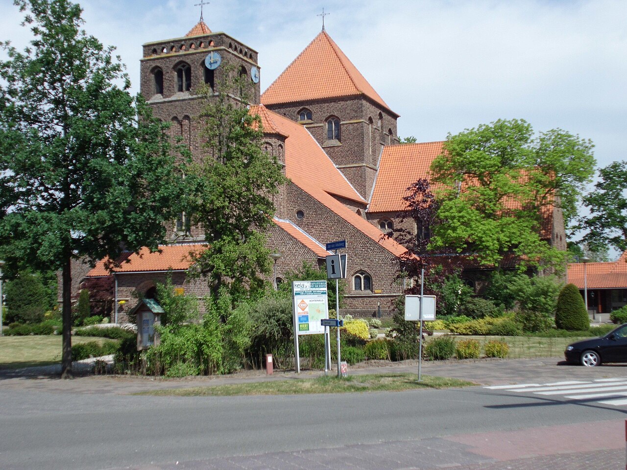
Achterveld works well as a base: 5 minutes from Terschuur, 26km from Hoge Veluwe National Park.
Achterveld is a town located in Utrecht, Netherlands. With a population of 2,652, it is an important destination in Europe.
On a road trip, Achterveld sits in Netherlands, where you drive on the right. It's in the Europe/Amsterdam time zone. Below you'll find where to stay, things to do nearby, and everything you need to add Achterveld to your route.
About Achterveld
Achterveld is a village in the central Netherlands. It is a part of the municipality of Leusden, Utrecht and is located about 8 km east of Amersfoort. A small part of the village is located in Barneveld.
The village is a Catholic enclave in a Protestant region. It has a neo-romanesque church.
In 2001, the village ofRead more Achterveld had 1616 inhabitants. The built-up area of the village was 0.50 km2, and contained 651 residences.
The statistical area "Achterveld", which also can include the peripheral parts of the village, as well as the surrounding countryside, has a population of around 2570.
On 28 to 30 April 1945, Achterveld was the scene of high-ranking talks now known as 'The Achterveld Conference' between the Allied command (among others, General Foulkes of Canada, and General Bedell Smith of the United States), Sir Francis de Guingand of the United Kingdom, Prince Bernhard of the Netherlands, Ivan Susloparov of the Soviet Union and the occupying German government of the Netherlands, headed by 'Reichskomissar' Arthur Seyss-Inquart, and his aides. They discussed urgent food-help for the starving cities in the west of Holland, which Seyss-Inquart allowed, and which started the day after, 29 April, by plane from England, code-named Operation Manna.
The Allies tried to start negotiations about an unconditional German surrender. Seyss-Inquart did not want to comply there and then, although a general cease-fire was convened. The Germans ceased their resistance only on 5 May following, in Wageningen.
In June 2017 was Achterveld in international News, then 14 year-old girl Romy Nieuwburg (born 11 April 2003 in Hoevelaken) was found dead in an ditch in Achterveld, she was raped and killed. The perpetrator was then 14 year-old boy Brian Nijhof (born December 2002 in Arnhem) from Lunteren.
Achterveld offers many attractions including tourist sites, museums, parks, and local restaurants. Explore famous landmarks, scenic roads, and natural wonders on our interactive map and plan your visit.
How do I plan a road trip to Achterveld?
Plan your road trip to Achterveld with Plan Your Road Trips! Add Achterveld as a destination, and we'll help you find the best route and discover more amazing places along the way.
Where is Achterveld located?
Achterveld is located in Utrecht, Netherlands, Europe. The coordinates are 52.1358 latitude, 5.4972 longitude.
What is the population of Achterveld?
Achterveld has a population of approximately 2,652 people, making it a town in Netherlands.
Plan a Road Trip
Add to your itinerary
Start planning your road trip with Achterveld as a destination. Create a custom route and discover more amazing places along the way.
Museum deep inside Hoge Veluwe National Park holding the world's second-largest Van Gogh collection plus a 25-hectare sculpture garden with Rodin, Moore and Dubuffet; free white bicycles carry you there through the park.
22 km · about 25 min drive
museum
Rietveld Schröder House
Gerrit Rietveld's radical 1924 Utrecht house, the purest built statement of De Stijl with its sliding walls and Mondrian palette: UNESCO-listed and visitable on pre-booked tours.
25 km · about 30 min drive
national park
Hoge Veluwe National Park
Cycle free white bikes across heath, dune and forest to the Kröller-Müller museum's Van Goghs in this vast wild park.
26 km · about 30 min drive
cathedral
Dom Tower of Utrecht
The Netherlands' tallest church tower at 112 metres, standing detached from its cathedral in central Utrecht.
26 km · about 30 min drive
landmark
Naarden-Vesting
The best-preserved star fortification town in Europe, a double-moated six-pointed star of 17th-century ramparts enclosing a grid of gabled streets, 25 minutes from Amsterdam yet ignored by most itineraries.
29 km · about 35 min drive
castle
Kasteel de Haar
The Netherlands' largest castle, a turreted neo-Gothic fairytale with moats and formal gardens near Utrecht.
35 km · about 40 min drive
castle
Muiderslot
A moated red-brick medieval fortress at the mouth of the Vecht, one of the best-preserved castles in the Netherlands.
36 km · about 40 min drive
landmark
Walibi Holland
Dutch thrill park near Amsterdam known for intense roller coasters and a fun Halloween Fright Nights event.
38 km · about 45 min drive
Driving roads near Achterveld
3 named roads, passes and coastal drives within 150km.
56 kmHoutribdijkA 26 km dike road (N302) running straight across the water between Enkhuizen and Lelystad, splitting the IJsselmeer from the Markermeer with sea views on both sides.
74 kmErasmusbrugRotterdam's swan-necked cable-stayed bridge soars over the Maas, a striking modern icon glowing over the river at night.