England, United Kingdom · Europe
14,000
Population
Europe
Continent
London
Timezone
GB
Country Code
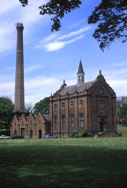
Ryhope ( RY-əp) is a coastal village along the southern boundary of the City of Sunderland, in Tyne and Wear, England. With a population of approximately 14,000, measured at 10.484 in the 2011 census, Ryhope is 2.9 miles to the centre of Sunderland, 2.8 miles to the centre of Seaham, and 1.2 miles from the main A19. The older village section is centred on a triangular 'green', which contains a war monument. The newer 'Colliery' area of Ryhope flanks the Ryhope Street/Tunstall Bank Road, which le...
Coordinates
54.8714°, -1.3700°
Region/State
England
District
Sunderland
Compare prices across top booking platforms
Compare before you book!
Prices can vary significantly between platforms. We recommend checking at least 2-3 sites to find the best deal for your stay in Ryhope.
Add to your itinerary
Start planning your road trip with Ryhope as a destination. Create a custom route and discover more amazing places along the way.
Start Road TripAdd to your favorites
Save Ryhope to your favorites and easily find it later when planning your trips.
Free to get started
No credit card required
Country
United Kingdom
Region
England
Timezone
Europe/London
Population
Create your free account and start planning an unforgettable road trip. Discover hidden gems, save your favorite spots, and share your adventures.
14,000